|
In 1901 a group of Dutch businessmen received a concession from the Kingdom of Siam to construct a railway connecting Bangkok to the busy Chinese trading port of Tachin. Originally named the Tachin Railway, the meter gauge track ended at the east bank of the Tha Chin River 33 kilometers west of Bangkok. In 1904 an additional 34 kilometers of track was laid from the west side of the Tha Chin River to the Mae Klong River in Samut Songkhram Province.
The two separate railway lines connecting Bangkok to Samut Songkhram became the Maeklong Railway. Having never been joined, passengers traveling from Bangkok’s Wongwain Yai station must disembark at Mahachai station and cross the river by ferry boat. Travelers then board a train at Ban Laem station for the remainder of the journey. Originally constructed to carry goods into Bangkok, the railway is an important means of transportation for the residents of western Thailand. It has also become a popular tourist attraction; one of the highlights of the trip is the passing through and later visiting the Maeklong Railway Market. 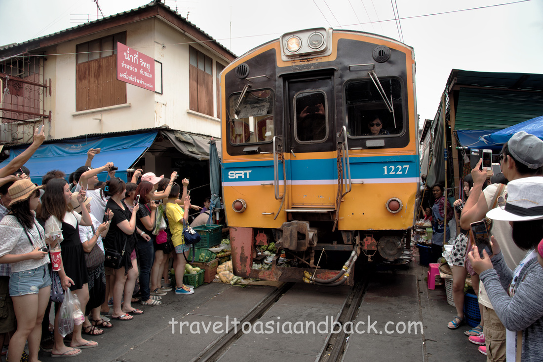
A train passes through the Maeklong Railway market, Samut Songkhram Province Thailand
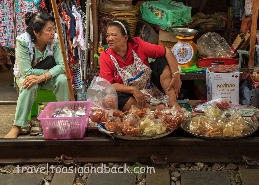
Between Bang Krabun station and Maeklong, the end of the line, is an enormous local wet market. The term wet market is often used throughout Southeast Asia to describe markets where fruit, vegetables, seafood, meat and poultry are sold in abundance. Water and ice are used in great quantities to keep fish alive, prawns and squid properly chilled and wash mountains of pans, bowls, spoons and chopsticks.
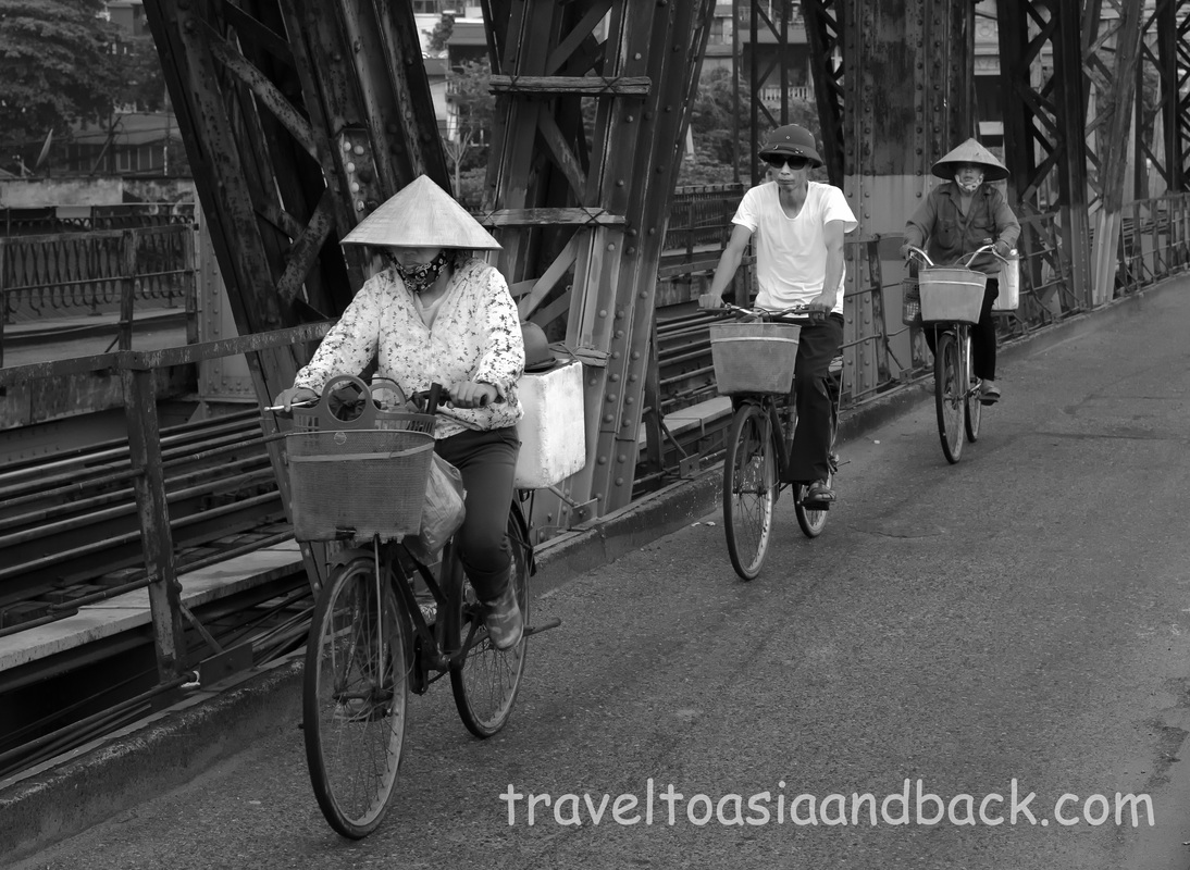
Known locally as the Umbrella Market, the Maeklong railway market is special and extremely popular with visitors because the train tracks pass directly through its center. More accurately, vendors sell their wares along the railway bed and on the tracks leaving the railway sleepers free and clear for shoppers to use as a path through the stalls. Tarps are suspended on bamboo poles extending out over the tracks to keep both produce and people shaded from Thailand’s scorching sun, hence the name Umbrella Market. About ten minutes before a train passes (they arrive and depart Maeklong station four times a day) the station bell sounds and vendors quickly move their goods away from the tracks and pull back the tarps. 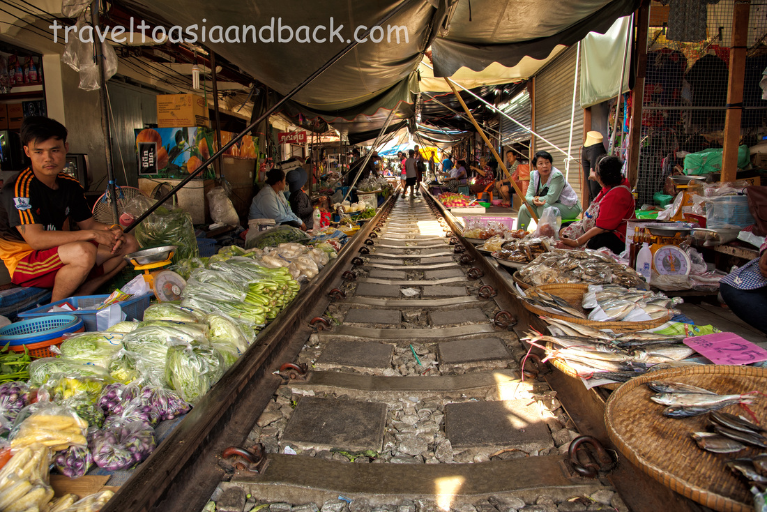
traveltoasiaandback.com - Maeklong Railway Market, Samut Songkhram Province, Thailand
As the train creeps at a snail’s pace through the market, excited visitors crowed together at the very edge of the tracks to take photos. Many people, including myself, stand dangerously close to the passing trains as there is simply very little space between the stalls and the tracks. A much safer and less crowded option is to view a train after it departs Maeklong and has passed through the most congested part of the market.
traveltoasiaandback.com - Maeklong Railway Market, Samut Songkhram Province, Thailand
To reach Maeklong Market, railway enthusiasts will probably enjoy completing the 64-kilometer trip on Thailand’s slowest trains. A faster and more comfortable option is to book a one-day bus tour which may also include a visit to the famous Amphawa Floating Market located approximately 8 kilometers to the north. These tours can be booked through travel and tour operators in Bangkok for around $60 USD. Budget travelers can easily take a mini-bus (van), from Victory Monument directly to Maeklong for 70 Thai baht ($2 USD). Transit time is approximately one hour and twenty minutes. 18/12/16 - Note - Mini-buses no longer run from Victory Monument to Maeklong or any of the popular destinations such as Hua Hin or Pattaya. These mini-buses have all been moved to Bangkok's Southern bus terminal known as Sai Tai Mai. Sai Tai Mai can be reached very inexpensively from Victory Monument by taking the (yellow) number 28 bus.
Mike Pollock
The streets of Hanoi’s Old Quarter, the city's tourism center, are dark and virtually deserted at 05:00 AM. The peaceful predawn darkness is a good time to get out and get some exercise, because by 09:00 the summer sun will be scorching the soon-to-be crowded and chaotic streets.
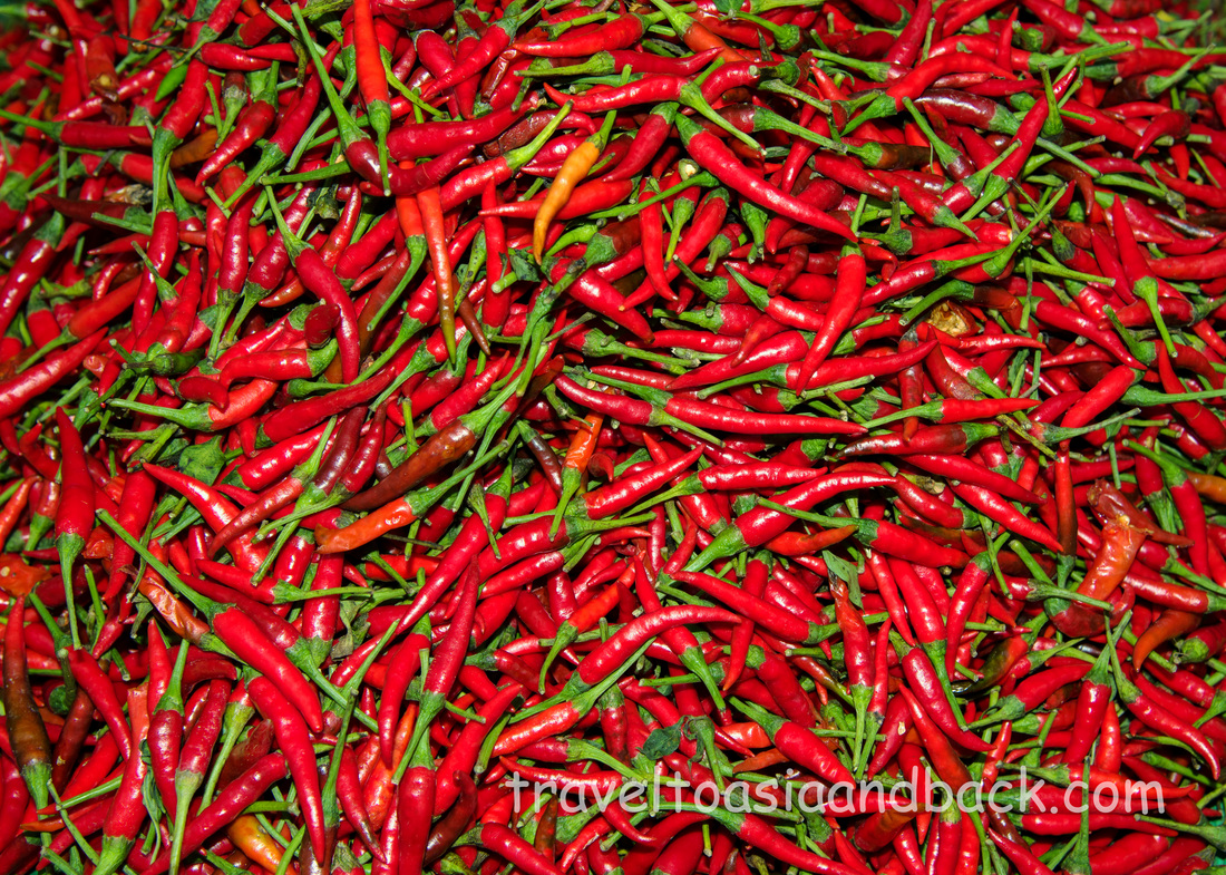
Capsicum Annuum, Bird's Eye Chili Peppers
I am on my way to the Long Biên market, a huge wholesale “wet market” that specializes in fruit, vegetables, seafood and much more. This is one of Hanoi’s largest markets; most visitors dinning in this city will surely have eaten food that passed through here. It is not a tourist destination per se, but on most mornings I encounter a handful of travelers with cameras wondering through the busy maze of stalls. The market is fantastic place to take pictures, meet the locals and see how they start their days.
My goal is to arrive at the market just before the sun starts rising and set up a shot overlooking the market from the Long Biên Railway Bridge. Completed by the French in 1902, the cantilever bridge was built to connect Hanoi with the port city of Haiphong. At just over one mile in length it was once the longest steel bridge in Asia. During the war with America it was bombed at least twice, once in 1967 and then again in 1972. The 1972 attack did significant damage to the antique bridge and put it out of commission for over year. However, the citizens of Hanoi were largely unfazed by the destruction and simply utilized boats to move people and cargo across the Red River.
Morning traffic on Long Biên Railway Bridge, Hanoi Vietnam
Since my introduction to the market shot by Colm Pierce, a photojournalist and co- owner of Vietnam in Focus, I have become somewhat obsessed with it. This is an interesting and challenging place to practice photography and I find this particular shot to be difficult, not only because of the low light and the movement in the market but because the bridge itself vibrates considerably as trains and pedestrians cross over it. I can’t quite achieve the results that I’m looking for, so I keep coming back to the bridge, the market and the near by Long Biên Railway Station, all of which are really great places to take pictures.
By 07:30 or 08:00 I’m thinking about cà phê sữa đá, a blend rich dark Vietnamese coffee sweetened with thick condensed milk. Cafes are extremely popular in Vietnam and in a populous city like Hanoi can be found on every street. I’ll stop and have a couple on my way back to the hotel where I crawl back to into bed; I’m really not a morning person. Mike Pollock 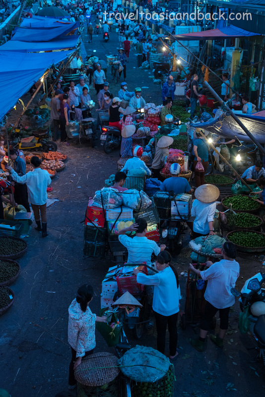
Long Biên Market, Hanoi Vietnam
Sharing a common border with China, mountainous Hà Giang province is well known for its spectacular scenery and remoteness. It is home to over 20 different groups of minority ethnic people, who happen to be among the country’s poorest inhabitants. These subsistence farmers follow a way of life that has changed little in hundreds of years. Cultivating crops on steep rock-covered hillsides is backbreaking work which produces little in the way of reward.
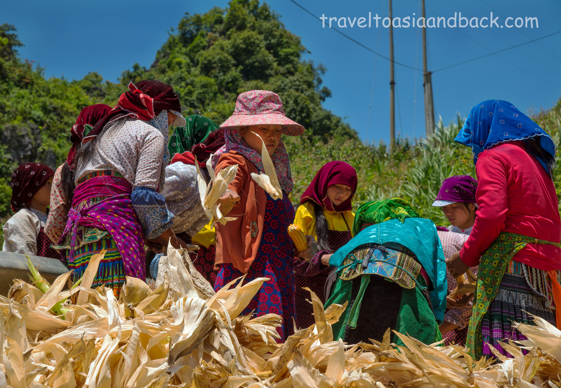
Shucking corn, near Dong Van, Hà Giang Province, Vietnam
Mass tourism has not reached Hà Giang province, perhaps because of the lack of tourism infrastructure and poor roads. In most parts of the province very few local people speak English; hotels and restaurants cater to Vietnamese and souvenir stands are few and far between. The majority of Westerns who come here are adventure seekers who tour the area on motorcycle completing a route known as the Hà Giang loop.
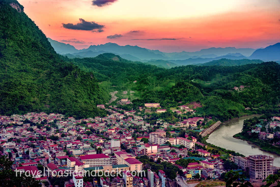
Hà Giang City, Hà Giang Province, Vietnam
Getting to Hà Giang City, the provincial capital is easy as busses depart Hà Nội’s My Dinh bus station every morning and afternoon. Tickets can be purchased just before departure at counter number 16 for 200,000 VND. The bus I took was a sleeper-style bus, which I detest and had sworn to never travel on again, but I was informed that all busses traveling to Hà Giang are sleeper buses. In Vietnam, perhaps other countries as well, these particular types of busses do not have regular seats. Passengers lie, or try to lie, in a very small kayak-like pod, which is about two feet too short for the average Westerner. The key to surviving the journey, especially if you are tall, is to take a pod-free seat in the bottom row at the very back of the bus.
Six and a half hours later we arrived safe and sound at a bus station two kilometers south of Hà Giang City, the gateway to Vietnam’s northern frontier. Most travelers only spend one night here, just enough time to organize the rental of a motorcycle and to purchase the mandatory travel permit required to visit the frontier area near the Chinese border. 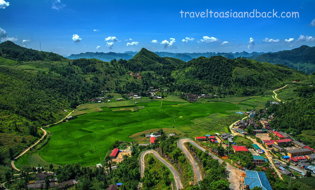
The view from Lung Cu flag tower, Lung Cu, Hà Giang Province, Vietnam
Ninety three miles (150 km) from Hà Giang City is Đồng Văn which is without a doubt the tourism capital of the province. It is considered to have the best trekking in the region and makes a terrific base for exploring the most northern reaches of Vietnam. Many travelers will head directly to Đồng Văn, which makes sense, particularly if you are short on time. Here you will find some English-speaking locals working in hotels and restaurants which provide menus in English, having become accustomed to serving foreign travelers.
Since I was in no particular hurry, I slowly worked my way north by bus, stopping overnight in several small cities; breaking the six-hour trip to Đồng Văn in three segments. The narrow roads here are essentially carved from mountainsides. They are not too steep but are winding with many sharp blind curves. Traveling here is slow. It does not matter whether it’s by motorcycle, car or bus, you can count on doing about 15 MPH. Mike Pollock 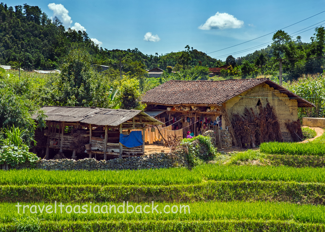
Traditional clay house, Lung Cu, Hà Giang Province, Vietnam
It turns out that the 9 a.m. van from Sapa to Điện Biên Phủ departs at 8 a.m. I was running late and as the last person to be picked up, there was no room for my duffel behind the last seat with the rest of the baggage. My bag stayed in the aisle for the duration of the eight-hour trip and was routinely sat upon, kicked and stepped on. Had I not been a packing expert, my toiletries never would have survived the journey. The owner of my hotel in Sapa booked my seat on the sixteen passenger mini-bus for 250,000 VND ($10 USD), but, clearly marked on a place card above my seat was a price of 185,000 VND. All legitimate buses and vans in Vietnam have a similar set of cards with the contact details and license number of the owner and the fare. The van departed with a full load of 16 passengers and no air conditioning. It felt like there were far more people on board than the regulations allowed, but no, I did a head count; 16 souls plus the driver. The only other transportation option would have been to take a night bus, which I’m not fond of, or to take a bus to Lao Cai city and transfer to a full-sized bus, which would add at least two more hours to the journey. Fortunately, I would not be leaving Điện Biên Phủ by bus as I had purchased a plane ticket on Vietnam Airlines back to Hanoi instead of doing another long road trip. Once we cleared town and got out on the highway the scenery was so stunning that I forgot about the heat, my crushed bag and the guy sleeping with his head on my shoulder. The two-lane highways in this part of the country are essentially carved out of the sides of hills and mountains which tower above the road, while deep plunging valleys lie on the opposite side. This is the rainy season in Southeast Asia and as a result the landscape of this region is green and lush. As the van moved northward towards our first stop, dozens of farming families could be seen tending to the rice that they planted in May. Two hours into our journey we arrived in Lai Chau to drop off a couple of travelers, the only westerners on the bus besides myself, and to take a bathroom break. I believe that this was the first time my bag was stepped on. I’m sure that the departing backpacker put the full weight of his six foot frame on it. However, as we continued on our way, more people got off and the air conditioning miraculously began working. Bus travel in Vietnam is often regarded as unsafe and avoided by many travelers, but I found our driver to be very cautious and competent. To say that these roads are winding is an understatement and the driver must remain alert at all times as a mistake could result in a vehicle tumbling off the mountain. The other legitimate reason to be concerned about road travel here is the possibility that dirt, rocks and boulders can rain down on the vehicle. It is very common, particularly after heavy rains, to see crews removing debris from partially closed roads. We arrived at the bus station in Điện Biên Phủat at 4 p.m, right on schedule. Taxi drivers swarmed the bus looking for fares, but after sitting for the better part of eight hours, I needed some exercise and opted to walk to my hotel. Mike Pollock 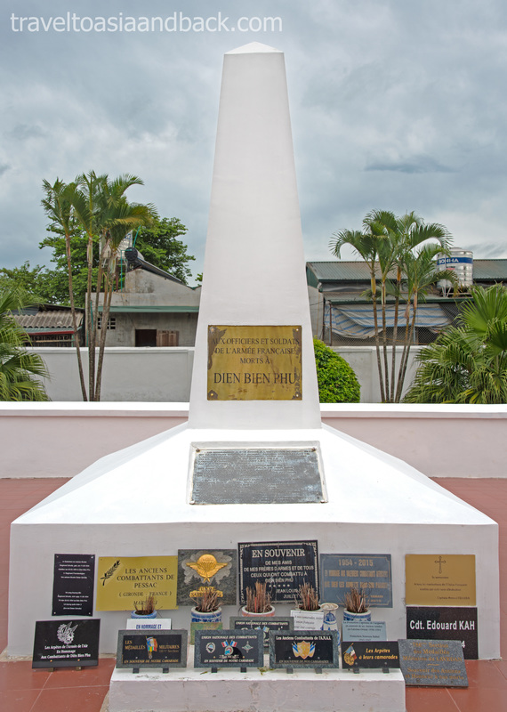 French War Memorial, Điện Biên Phủ Vietnam
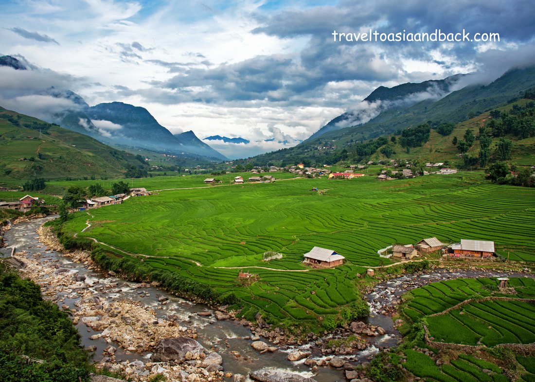
There is little doubt that the majority of Western travelers who journey to Vietnam’s mountainous north do so specifically to enjoy the region’s breath-taking scenery. Although it’s possible to view the lush green rice terraced hills and valleys from the comfort of a tour bus, trekking gives one an opportunity to get off the main road and really experience this beautiful country and meet its charming inhabitants. Trekking in Sapa is also great exercise and, if only for a little while, reduces our carbon footprints.
The undisputed tourism and trekking capital of Northern Vietnam is the tiny town of Sapa, in the district of the same name, located in Lao Cai Province 196 miles (316 km) from Hanoi. This small, but bustling, market town lies in the shadow of Indochina’s tallest mountain, Fansipan, and has been a retreat and vacation destination since the early 1900’s when the French Colonial administration sent their soldiers to “Chapa” for rest and convalescence. 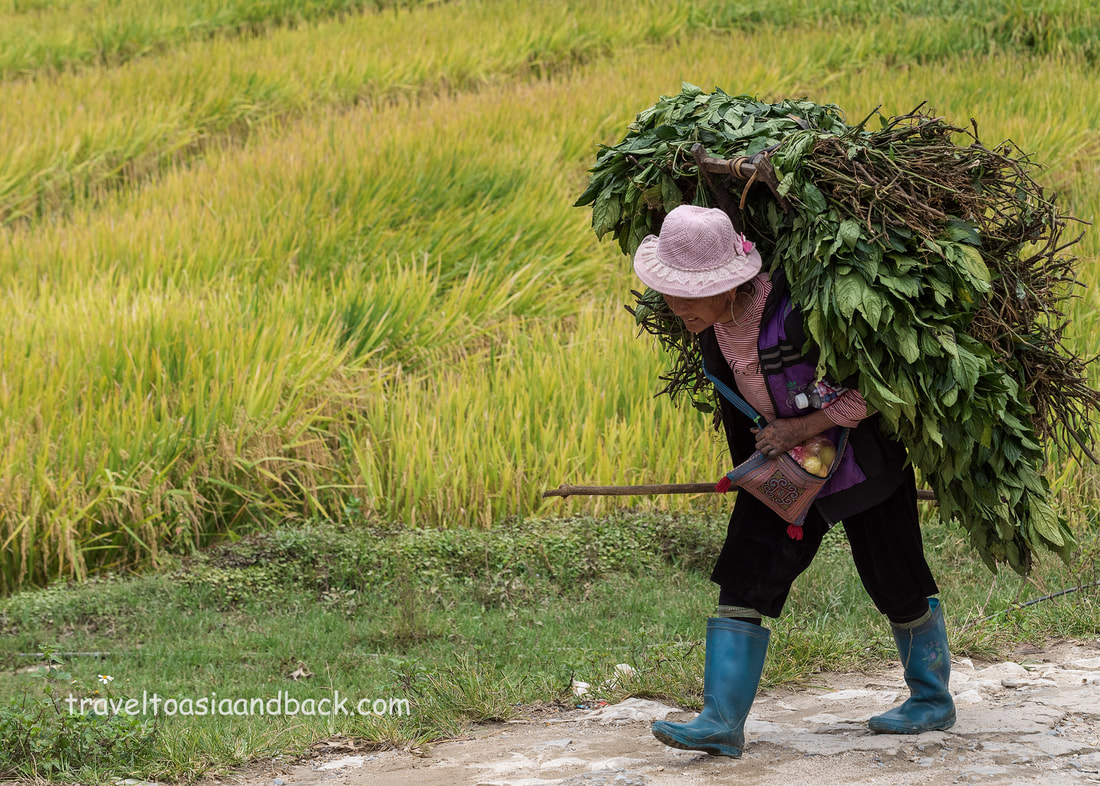
traveltoasiaandback.com - A full load of indigo, Lao Chai, Sapa, Lao Cai Province, Vietnam
Sapa town lies among the hills at the top of the magnificent Muong Hoa Valley. Running in a roughly north to south direction, the valley is divided by the Muong Hoa River which is fed by the area’s many spectacular waterfalls. Dozens of tiny villages are nestled within the region, inhabited by at least a half dozen different minority ethnic groups including the Black Hmong, Giáy, Red Dao, Tày and Kihn. Primarily subsistence farmers, these warm and friendly people have managed to cultivate crops from this rugged landscape. The entire valley is dotted by beautiful rice terraces, carved from the hill sides, utilizing century-old farming methods.
traveltoasiaandback.com - The Muong Hoa River Valley, Sapa, Lao Cai Province, Vietnam
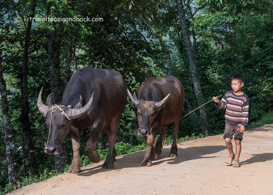
Trekking in Sapa generally begin with an easy walk out of town along Mường Hoa Road. One of the district's principle roads, it winds through the hills and mountains, providing trekkers with spectacular views of the valley below. It is not uncommon to share the main road with herds of water buffalo on their way to plow rice terraces. A few kilometers from town, trekkers leave the main highway behind and travel on narrow concrete secondary roads leading up into the hills or down to the valley. Walking on the paved roads is easy but at some point the trek will continue on the narrow dirt paths that connect the villages. Passing between farmer’s crops and livestock grazing grounds, these rugged dirt paths are often steep and can be quite slippery. Trekkers should wear good hiking boots or some other type of solid, closed-toed foot wear. As the weather is unpredictable and often very wet, it’s recommended to carry a light rain jacket, or better yet, an umbrella like the locals do.
traveltoasiaandback.com - On the road to Y Linh Ho Village, Sapa, Lao Cai Province, Vietnam
A common question asked by travelers planning a journey to this region is whether a trekking guide is needed or not; my answer is yes and no. Most of the villages can be reached from paved roads, allowing access by car and motorcycle. Navigating from the main paved roads is easy, particularly with a good paper map and Google Maps on a smart phone. However, finding the correct dirt trekking paths which connect the villages can be difficult or impossible for first-time visitors. For example, I followed a fairly well maintained path down towards the valley for 25 minutes before it dead ended at a small cluster of houses. I had no choice but to turn around, go back up the hill, and look for an alternate route.
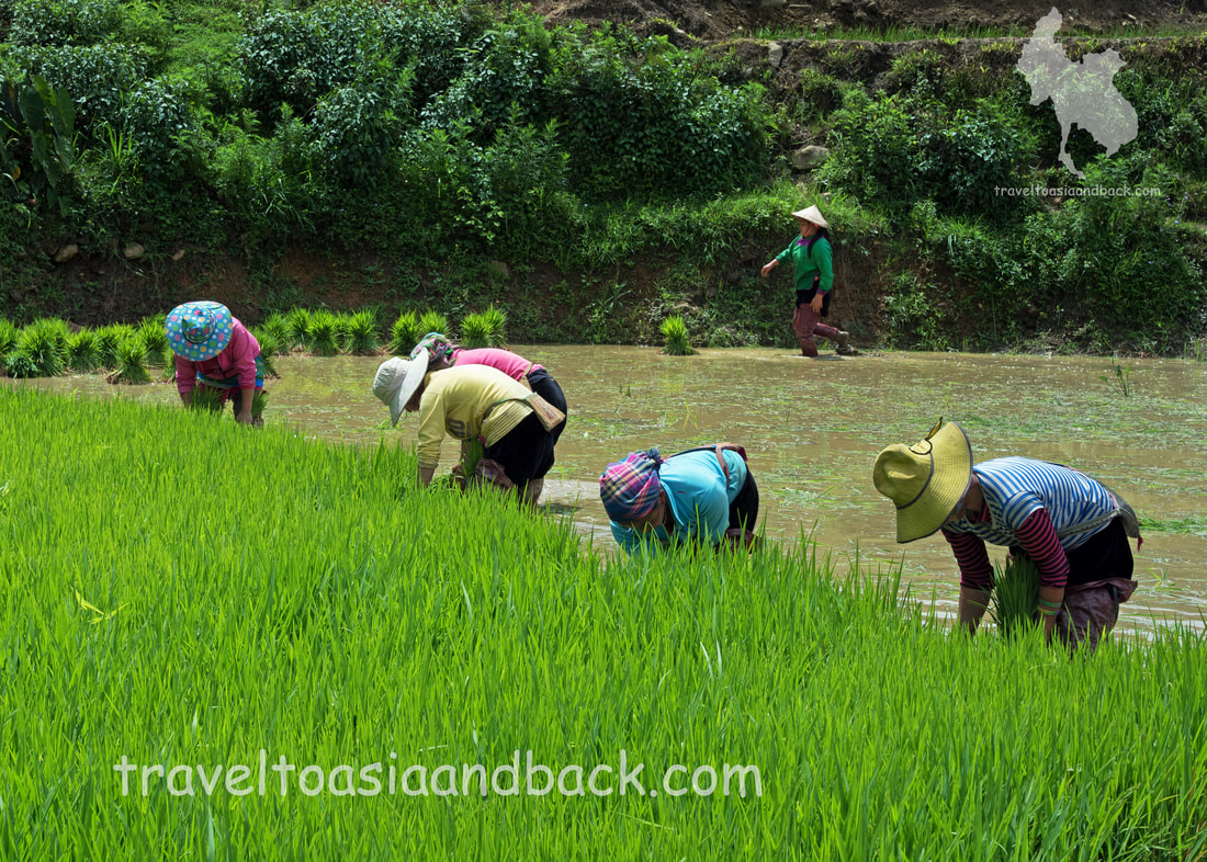
traveltoasiaandback.com - Planting rice, Cat Cat Village, Sapa, Vietnam
The majority of visitors who go trekking in Sapa go on guided treks which can be a half or full day or multiple days with overnight stays in the villages. Many travelers book tours well before arriving in Sapa as this can easily be done on-line through agencies such as Sapa O'Chau or Sapa Sisters. Although I have not personally trekked with either of these tour organizers, they are well regarded and receive a great deal of praise on internet travel forums. Trekking tours can also be organized after arriving in town through hotels, hostels and travel agencies. Another option is to trek with the Hmong and Dao women who sell handicrafts in the town center. These ladies are more than happy to guide you to their home villages and are very flexible in terms of departure times and length of the trek. I really enjoy trekking with these ladies and feel good knowing that, at the end of the day, the cash goes directly into their pockets.
Mike Pollock Whenever I visit Bangkok, one of my favorite cities, I try to utilize public transportation as much as possible. I particularly enjoy traveling on Bangkok’s elevated rail system known as the Skytrain or BTS. These modern electric cars whisk passengers through the business district's maze of skyscrapers several stories above Bangkok’s chaotic streets. Not only is it much less expensive then relying on taxis, it’s faster and much more interesting than being stuck in traffic. A single trip on the BTS can be had for as little as 43 cents, but for tourists, a day pass of unlimited rides is a fantastic bargain at $4 USD. Purchasing a pass is easy as each station has several ticket kiosks which are staffed by friendly, helpful English-speaking Thais. The Skytrain system is composed of two lines named Sukhumvit and Silom after key neighborhoods in downtown Bangkok. They join together at Siam Station, the location of one of Bangkok’s largest shopping malls. In fact, if shopping is your pleasure, many of the city’s most popular malls, markets and districts, such as Siam Paragon Mall, Chatuchak Weekend Market, Patpong Night Market and Ratchaprasong Road can all be reached by the BTS. To see Bangkok’s most iconic tourist sites such as Wat Pho and The Grand Palace, take the Silom line to Saphan Taksin station and connect to the Chao Phraya Express boat. Wat Pho is about a five-minute walk from Pier Number Eight, while The Grand Palace can be reached from Pier Number Nine. Visitors utilizing the Skytrain can also connect to Bangkok’s underground metro system known as the MRT. Also convenient and inexpensive, the MRT can be used to reach Hua Lamphong Railway Station, China Town and must-see sites such as the Golden Buddha at Wat Traimit. Mike Pollock 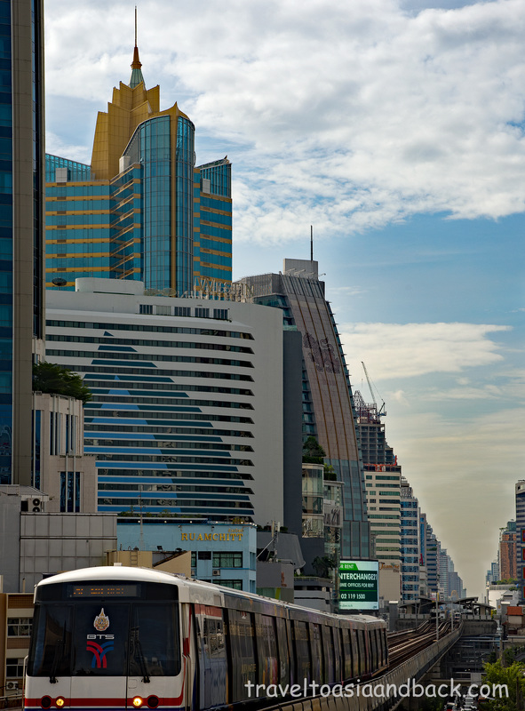 I really dragged my feet traveling though southern Vietnam, so my time in the north was limited to six days. Taking the train from Huế to Hanoi wasted a half day and was my least enjoyable train ride. Not only was the trip very long, 14 hours, but unlike the trains south of Huế there was virtually nothing to eat or drink on board. The other trains I had been on always had attendants pushing carts of food and drinks down the aisles and were constantly trying to sell me something. On the Hanoi leg there was one or two barren carts with a couple of bottles of water, and the attendants basically ignored me. I suggest that anyone planning on making this journey bring plenty of drinks and snacks. In the future I will probably fly from Danang to Hanoi and skip this leg all together. Hanoi is a really interesting city which has become a very popular travelers’ destination. The main tourism hub is the “Old Quarter” area; a busy neighborhood composed mostly of buildings left over from the French period. This is a good place to find budget hotels, hostels, bars and restaurants. The area is conveniently located close to Hanoi’s most visited sites including the Ho Chi Minh Mausoleum, Ho Chi Minh Museum and the Presidential Palace. I only spent one day touring Hanoi before heading north to the town of Sa Pa in Lao Cai Province. Located roughly 23 miles (37 km) from the Chinese border, this small town sits at the base of Vietnam’s largest mountain which is known (in English) as Mt. Fansipan. Lao Cai Province has become a bit of a tourism hotspot with Sa Pa as its epicenter. The area is a breathtaking mixture of mountains, hills, valleys, rivers and waterfalls; a nature lover’s paradise. Living among this beautiful landscape are at least a half dozen different minority ethnic groups. These charming people are essentially subsistence farmers who subsidize their meager income by producing and selling a variety of handicrafts. They also act as trekking guides for the many visitors who come to this area specifically to hike to the remote ethnic villages scattered around Lao Cai Province. There is no airport in Lao Cai Province; most travelers journeying from Hanoi will take either a bus or train to Lao Cai station and then connect to a local bus for the remaining one-hour trip into Sa Pa. A faster and better, but more expensive, option is to book a seat on the Sa Pa Express bus. This is a “luxury” motor coach which features large reclining airline style seats and makes the 196 mile (316 km) trip from the Old City in Hanoi to Sa Pa in five and a half hours. Tickets can be booked online on their website, or purchased from one of the many travel agents in Hanoi. Sa Pa is an extraordinarily beautiful place inhabited by warm, friendly and welcoming people. However, travelers should keep in mind that the weather there can be quite intense. When I arrived on Thursday afternoon the town was engulfed in a thick fog, mariners call it black fog. It was cold and wet and I joked about it with the taxi driver on my way to the hotel. That afternoon I hiked to the west of town along Dien Bien Phu road and as worked my way up the hill above the valley the fog gave way to sunny blue skies. As I returned to Sa Pa town after the eight-kilometer trek, the fog began to clear and it started raining. A couple of hours later it was absolutely pouring rain which continued until around eleven the next morning when the clouds parted and the sun came out in all its glory. They say that Sa Pa has four seasons, sometimes all in the same day. The point is that travelers to Lao Cai Province should be prepared to deal with some cool soggy weather. In the two and a half days I was in Sa Pa I managed to trek over 30 miles (50 km), see a number of minority villages and meet many friendly local people. Sa Pa was the highlight of my trip through Vietnam. It impressed me and I wished that I had more time to spend in the area. Mike Pollock 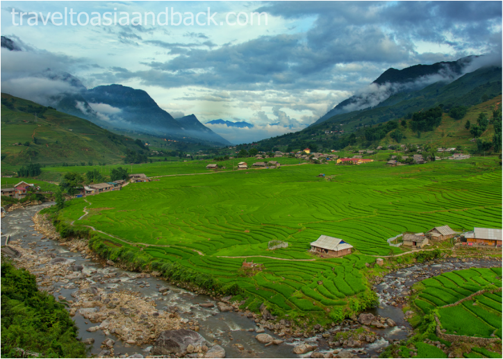 The view over Lao Chai Village, Lao Cai Province Vietnam The historic city of Huế is a must-see destination and is usually included on most travelers’ itineraries. This small city is located on the Perfume River, 64 miles (102 km) north of Đà Nẵng, where it can be reached by train in roughly two and a half hours. In 1802 the feudal lord Nguyễn Phúc Ánh consolidated power and unified Vietnam. Phúc Ánh, who would later take the title Emperor Gia Long, made Huế Vietnam’s capital. Known as the “Imperial City”, Huế would remain Vietnam’s center of politics, religion and culture until 1945. Under the direction of Emperor Gia Long, thousands of workers began constructing the famous citadel of Huế in 1804. The term citadel refers to the six miles (10km) of high walls, ramparts and moats built as a fortress to protect the palaces within. At the center of the citadel is another series of walls surrounding an area known as the Forbidden Purple City. Like the Forbidden City in Beijing, this area would have been home to the Emperor, family and staff and strictly off limits to the common people. Because of its proximity to the 17th parallel, the dividing line between North and South Vietnam, Huế was of great strategic importance to the North Vietnamese and their allies. On January 30, 1968 the North Vietnamese Army and Vietcong launched the military operation which would be known as the Tet Offensive. Tet, the Vietnamese lunar New Year, had traditionally been a time when both sides put down their weapons and returned home to be with their families. For the South Vietnamese troops Tet 1968 was not an exception and most soldiers left the cities to return to the villages. The North Vietnamese seized this opportunity and simultaneously attacked major cities and bases throughout South Vietnam. Huế’s defenders were initially caught off guard, and the North Vietnamese easily overran the city. It would take over a month for U.S. and South Vietnamese forces to turn the tide and secure Huế, marking this as one the most deadly battles of the War. Today the citadel, the remains of the royal palaces, temples, tombs and various associated structures make up the UNESCO World Heritage Site known as “The Complex of Huế Monuments”. Much of the site has been badly damaged and some parts are in ruins as a mostly as a result of war. Much of the fighting during the battle of Huế was fought in and around the citadel. However, restoration work has been completed on the major monuments so there is still plenty to see. Mike Pollock 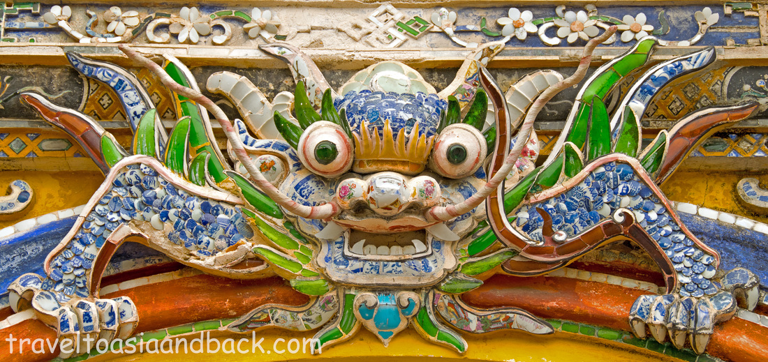 The dragon gate, Hue Vietnam From Quảng Ngãi I continued heading north to another popular seaside city; Danang. With a travel time of only two and a half hours this was an easy and inexpensive leg; the ticket was purchased at the train station the day before for around $6 USD. I had read on some travel forums that buying tickets at stations could be difficult as the sales people do not speak English. I didn’t find this to be true at all; first of all the railway staff certainly speak English well enough to complete a simple ticket sale. Secondly, there is usually an enormous sign next to the ticket window with the train schedule in Vietnamese and English; simply point at the train number on the sign. Compared to Sri Lanka train travel in Vietnam is a breeze! Danang is well known for its beautiful beaches and boasts several popular sites such as Marble Mountain and the Museum of Cham Sculpture. However, Danang is probably mostly visited by travelers because of its close proximity to the city of Hội An. Situated on the Thu Bồn River, 18 miles (29 km) south of Danang, Hội An is an extremely popular destination for Vietnamese as well as foreign visitors. The “Old Town” portion of the city has been designated a UNESCO World Heritage site due to its long history as a trading port. This charming area, which consists of a mixture of Chinese shop houses and buildings from the French colonial period, has changed very little in the last 200 years. Although the Old Town area is very touristy, it is adjacent to a very authentic market area which caters more to locals than travelers. The people of Hội An are extremely friendly and more than happy to pose for photographs providing, in the case of street vendors, that you make a purchase. The town provides perfect backgrounds to create wonderful pictures and it is very common to see photographers working with their models along the river front. In addition to the Old Town, there are a number of popular attractions in the surrounding area. Mỹ Sơn is the ruins of a number of temple complexes built by the Cham people between the fourth century B.C. and fourteenth century A.D. The Cham arrived in central Vietnam from Indonesia sometime in the third to fourth century B.C. The kingdom of Champa would eventually cover a large portion of present day Vietnam. They were contemporaries and rivals of the Khmer until 1203 when they were defeated in battle by King Jayavarman VII. The Kingdom of Champa was essentially annexed by the Khmer for the next 17 years. This UNESCO World Heritage site, is located 23 miles (37 km) from Hội An and can be reached by taxi or private car in about one hour. A number of operators run bus tours to Mỹ Sơn, and although I am not a fan of organized tourism, the price is just too good to pass up. A round-trip tour bus ticket to the site can be purchased for 150,000 VND, less than $7 USD Until next time, Mike Pollock 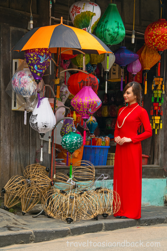 áo dài, traditional clothing, Hoi An Vietnam I started my Vietnamese train journey from the popular seaside city of Nah Trang. The destination was the city of Quảng Ngãi, 240 miles (386 km) to the north. It takes roughly 7 hours to do this particular leg, which I thought would be a good introduction to the country’s rail system. I purchased a “soft seat” ticket through one of the city’s many travel agencies. I forget the exact price but I do remember that the service charge was $3 USD. I could have taken a taxi to the railway station and purchased the ticket on my own; but after paying for the taxi, I probably would have only saved a dollar. “Soft seats” are exactly what the name implies, padded reclining seats in an air-conditioned car, which would be the equivalent of first class in other countries. On the other hand, “hard seats” are wooden benches in a car that is definitely third class. The journey was quite pleasant; the cars are modern and well maintained and I was very impressed that trains in Vietnam arrive and depart on time. There was plenty of food and beverages on board; the train’s staff sold drinks, snacks and light meals. Quảng Ngãi is the only city I visited in Vietnam that was not filled with tourists. In fact, I very well may have been the only foreigner spending the night there. The hotel I stayed in catered to Vietnamese business people and the two restaurants located near the hotel only had menus in Vietnamese; ordering was accomplished by pointing at the food. This is not a town noted for handicrafts or a night market filled with souvenirs, and is certainly not on the main tourist path. Besides breaking up the trip, I had chosen to stop in Quảng Ngãi to visit the Sơn Mỹ Memorial, located approximately nine miles (15 km) from the center of the city. Sơn Mỹ was the name of a village that had been subdivided into a number of hamlets; the most well-known are Mỹ Lai and Mỹ Khe. On March 16, 1968 soldiers from the U.S. Army killed 347 to 504 unarmed civilians which included women, children and the elderly. This incident would become known in America as the Mỹ Lai massacre while the Vietnamese refer to it as the Sơn Mỹ massacre. The army attempted to cover up the incident, but when it was leaked to the press in 1969 the American public was outraged. The memorial consists of the original foundations from the victim’s homes, some graves and a museum. The impressions of combat boots and tiny feet can be seen in the concrete pathway between the relics of the former homes and the crude bomb shelters the villagers once cowered in. Sơn Mỹ is a depressing place to say the least. My hotel had organized a taxi for the 20 minute trip to Sơn Mỹ. The driver waited for me as I toured the memorial, then we headed to the train station where I purchased a ticket for the following day. Following the train station I visited the Quảng Ngãi History Museum where I was the only visitor. After a quick stop for coffee, I had the driver drop me off in the center of town to have a look around. I had used the taxi all morning, perhaps four or five hours; the total fare was $8 USD. Until next time, Mike Pollock 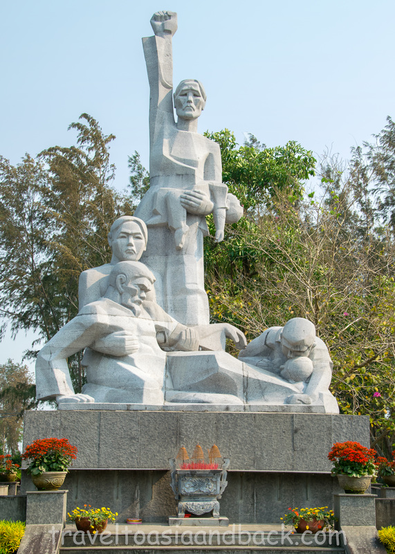 Sơn Mỹ memorial, Sơn Mỹ Vietnam |
 RSS Feed
