Travel Sapa
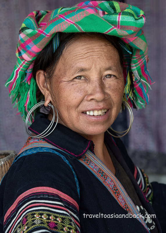
Located 22 miles (35 km) from Lao Cai City, Sapa district sits at the base of Vietnam’s largest mountain, known (in English) as Mt. Fansipan. With its breathtaking scenery and proximity to a number of rural ethnic villages, Sapa has become the epicenter of Lao Cai tourism. The area’s terrain includes a mixture of mountains, hills, valleys, rivers and waterfalls; a nature lover’s paradise. Living among this beautiful landscape are at least eight different minority ethnic groups, some of whom have managed to capitalize on the tourist trade very well. They are warm and friendly people who will often overwhelm visitors with attempts to sell their locally made handicrafts. Many are more than willing to act as trekking guides and escort visitors from the town center to their villages. On our recent visits to Sapa we have made many enjoyable treks with Hmong people we met while wandering around town.
Sapa is an extraordinary place inhabited by extremely welcoming people. However, travelers should keep in mind that the weather can be quite intense. They say that this area has four seasons, sometimes all in the same day. Periods of heavy rain and fog are common; travelers to Lao Cai Province should be prepared to deal with some cool soggy weather. It can become quite cold at nights; many hotels do not have air-conditioning as it is not needed but do provide electric blankets. Fortunately there are many stores in Sapa that sell rain-gear, sweaters, jackets and umbrellas.
Sapa is an extraordinary place inhabited by extremely welcoming people. However, travelers should keep in mind that the weather can be quite intense. They say that this area has four seasons, sometimes all in the same day. Periods of heavy rain and fog are common; travelers to Lao Cai Province should be prepared to deal with some cool soggy weather. It can become quite cold at nights; many hotels do not have air-conditioning as it is not needed but do provide electric blankets. Fortunately there are many stores in Sapa that sell rain-gear, sweaters, jackets and umbrellas.
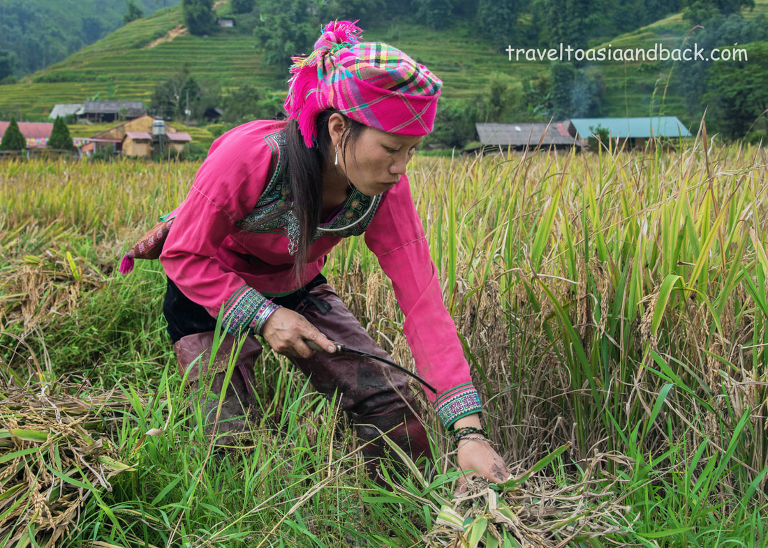
traveltoasiaandback.com - A Hmong woman harvests rice in Lao Chai Village, Sa Pa, Lao Cai Province, Vietnam
The highway system which connects Sapa to Lao Cai and Hanoi is relatively new. For many years the only way to reach the area was by train. As highways were constructed and rural roads improved, more and more bus lines started operating on this route. Improved infrastructure has directly led to a tourism boom in and around Sapa town. Construction sites abound and it appears that every vacant lot is being transformed into a multi story building, most of which will be hotels and guest houses. Many visitors already complain that the town is too touristy and refer to it as a “tourist trap”. It is certainly true that the town center has developed and grown around the tourism industry much in the same way as the Old Quarter in Hanoi. Be forewarned that on weekends and Vietnamese holidays, particularly during the height of tourist seasons, (March-May, September-November) hotels fill up quickly and rates can increase dramatically.
The upside of the tourism boom is that there are a multitude of budget hotels, guest houses and hostels to choose from. Good and inexpensive restaurants serving both Vietnamese and Western cuisine line the streets along side convince stores and shops selling trekking gear. Many of the friendly locals speak English and are more than willing to help foreign tourists.
Take a walk one kilometer to the east of Sapa town, where the new market and bus station are located and you will leave most of the tourists behind. Straddling the junction of highway four, this area resembles a typical Vietnamese trading town. There are a number of budget hotels here wedged in between traditional shophouses.
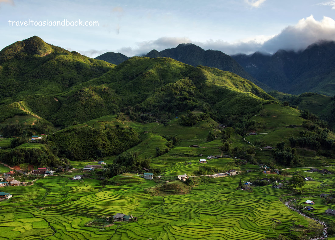
traveltoasiaandback.com - The Muong Hoa River Valley, Sa Pa, Lao Cai Province, Vietnam
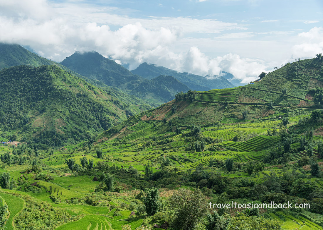
The Muong Hoa Valley
Fansipan is just one mountain in a towering range named Hoang Lien Son. Flanking the range is the stunning Muong Hoa Valley which is best known for its lush terraced rice fields and ethnic minority people. Running in a southeasterly direction for approximately 30 kilometers, the valley is home to the Black Hmong, Red Dao, Giay, Tay and Xa Pho people. There are at least ten principle villages down in the valley itself and half dozen more in the hills and mountains that rise above its north side.
The valley is one of Sapa’s primary attractions and although it’s possible to view the lush terraced hills from the comfort of a tour bus, trekking is by far the area’s most popular activity. Trekking gives one an opportunity to get off the main road and really experience this beautiful country and meet its charming inhabitants. Trekking is also great exercise and, if only for a little while, reduces our carbon footprints.
Overlooking the valley, Sapa Town is the gateway to the area via sealed roads that are suitable for automobiles and a seemingly endless network of paths and trails that connect the villages and farmer’s fields. Many trekking tours start from Sapa Town itself and utilize a combination of main roads (asphalt), secondary roads (concrete) and dirt paths. While walking on paved roads is easy, many of the dirt paths are steep and can be quite muddy and slippery. Trekkers should wear good hiking boots or some other type of solid, closed-toed footwear.
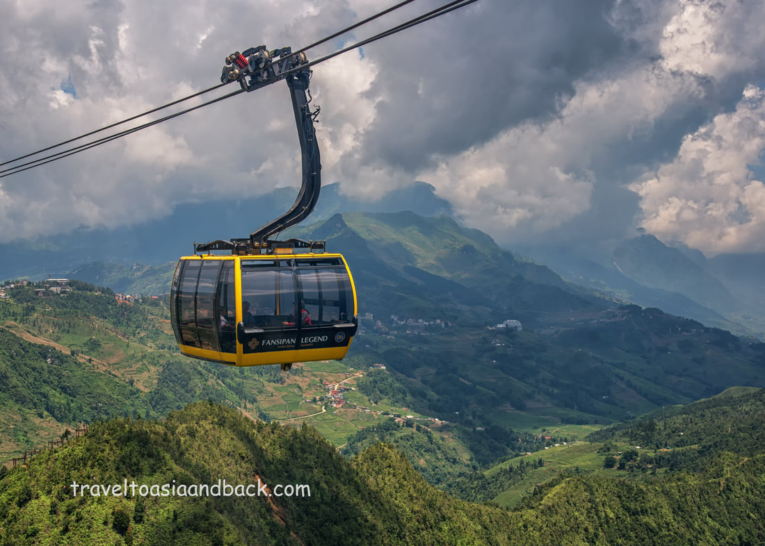
traveltoasiaandback.com - A cable car travels up to Mt. Fansipan, Sa Pa, Lao Cai Province, Vietnam
Fansipan
Towering 3,143 meters (10,312 ft) nine km from Sapa town, Fansipan is the tallest mountain in Vietnam and one of the highest peaks in mainland Southeast Asia. Known as Phan Xi Păng in Vietnamese, the peak referred to as "the Roof of Indochina" is a popular destination not only for Vietnamese tourists but for visitors from all over the world.
Ascending Fansipan is not a technical climb; it is simply a grueling version of Sapa low land trekking. The trail most commonly utilized from Tram Ton Pass is often wet, muddy and very slippery. Some rain is to be expected particularly during the rainy season when it will often rain virtually nonstop for days at a time. At higher altitudes climbers will often find themselves completed engulfed by dense fog or banks of clouds. Trekkers in reasonable physical condition can usually reach the peak in less than 10 hours. The most popular guided trek is conducted over a two-day period; the first day’s journey taking roughly 8 hours. The final ascent to the peak is made the following morning, with the goal of arriving just after sunrise.
Ascending Fansipan is not a technical climb; it is simply a grueling version of Sapa low land trekking. The trail most commonly utilized from Tram Ton Pass is often wet, muddy and very slippery. Some rain is to be expected particularly during the rainy season when it will often rain virtually nonstop for days at a time. At higher altitudes climbers will often find themselves completed engulfed by dense fog or banks of clouds. Trekkers in reasonable physical condition can usually reach the peak in less than 10 hours. The most popular guided trek is conducted over a two-day period; the first day’s journey taking roughly 8 hours. The final ascent to the peak is made the following morning, with the goal of arriving just after sunrise.
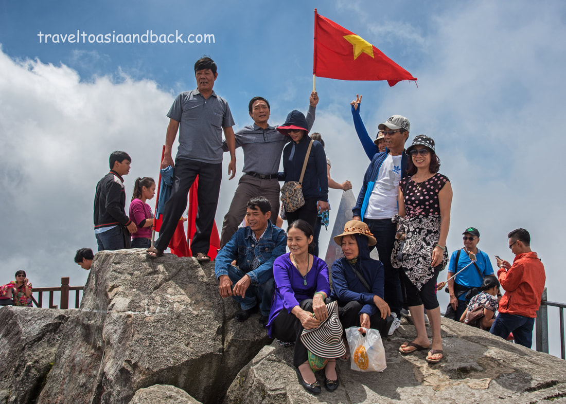
traveltoasiaandback.com - Vietnamese Tourists on the peak of Fansipan, Sa Pa, Lao Cai Province, Vietnam
These days the vast majority of visitors to Fansipan avoid hours of arduous trekking by simply taking the modern and comfortable cable cars operated by Fansipan Legend. Completed in February 2016 at a cost of $196.4 million US dollars, the system holds two Guinness World Records. Spanning a distance of 6,282 meters (20610 ft), it is the world’s longest three-rope cable car route and also boasts the greatest height difference between departure and arrival points. The 33-passenger cars cover this record setting distance in less than 20 minutes. Departing from the Sapa terminal, the view from the car as it passes high above the rice terraced village of Sin Chai is absolutely spectacular. As the ascent continues, the valley is left behind as the car travels over the densely forested mountain and up into the clouds.
Upon arrival at the Fansipan terminal the weather is noticeably colder and wetter than in Sapa town. Now is a good time to enjoy a coffee before breaking out a jacket and ascending the final 500 steps to the summit. 500 steps might not seem very daunting, but at an altitude of 3,000 meters air contains less oxygen than at sea level and most people will feel the effects. Signs posted along the route to the peak remind visitors to proceed slowly and take rest breaks. Emergency oxygen bottles are staged at rest stops and personnel are available to treat visitors who require medical attention.
Upon arrival at the Fansipan terminal the weather is noticeably colder and wetter than in Sapa town. Now is a good time to enjoy a coffee before breaking out a jacket and ascending the final 500 steps to the summit. 500 steps might not seem very daunting, but at an altitude of 3,000 meters air contains less oxygen than at sea level and most people will feel the effects. Signs posted along the route to the peak remind visitors to proceed slowly and take rest breaks. Emergency oxygen bottles are staged at rest stops and personnel are available to treat visitors who require medical attention.
At the mountain’s peak are an observation deck and two small monuments which confirm to visitors that they have indeed reached "The Roof of Indochina". Vietnamese flags are available, free of charge, for enthusiastic waving during picture taking. Unfortunately, when I arrived at the summit, clouds moved in and smothered the rocky peak. The visibility could not have been much more than a few hundred feet, so much for spectacular photos. Fortunately, located at the terminal, 500 steps below the summit is a very nice restaurant. How could anyone pass up an opportunity to eat lunch on Vietnam’s highest mountain?

traveltoasiaandback.com - O Quy Ho pass, aka Hoang Lien Son Pass, Ô Quy Hồ, Lai Chau Province, Vietnam
Tram Ton Pass, Heaven’s Gate, O Que Ho, Hoang Lien Son Pass
Crossing spectacular, rugged mountain passes, National Road QL-4D is a narrow, steep, winding stretch of sealed road that connects Sapa with neighboring Lai Chau Province. Passing just to the north of Mt. Fansipan and the Hoang Lien Son Mountain range, the scenery here can be simply breathtaking, that is when the weather chooses to cooperate.
At an approximate altitude of 2000 meters, the road is often socked in by thick fog, low clouds, drizzle, and rain. Interestingly enough, its often very difficult to predict the weather in the high mountains, even from nearby Sapa Town. It can be sunny and clear in town and yet when we drive into the pass, clouds roll up from the valley, blanketing the area and reducing visibility to 50-100 meters.
The most impressive part of this journey is a two-mile (3.2km) section that crosses both Tram Ton (Trạm Tôn) and O Quy Ho (Ô Quy Hồ) passes. Situated one-mile (2 km) from the 100-meter Silver Waterfall (Thac Bac), Tram Ton Pass begins roughly 9 miles (15 km) northwest of Sapa Town and at an altitude of 1900 meters, is Vietnam’s highest pass. As QL-4D winds its way towards Lai Chau, the next scenic stretch is known as Heaven’s Gate or O Que Ho. There are a number of scenic viewing points situated alongside the road which offer visitors the opportunity to view and photograph O Que Ho mountain pass, also known as Hoang Lien Son Pass.
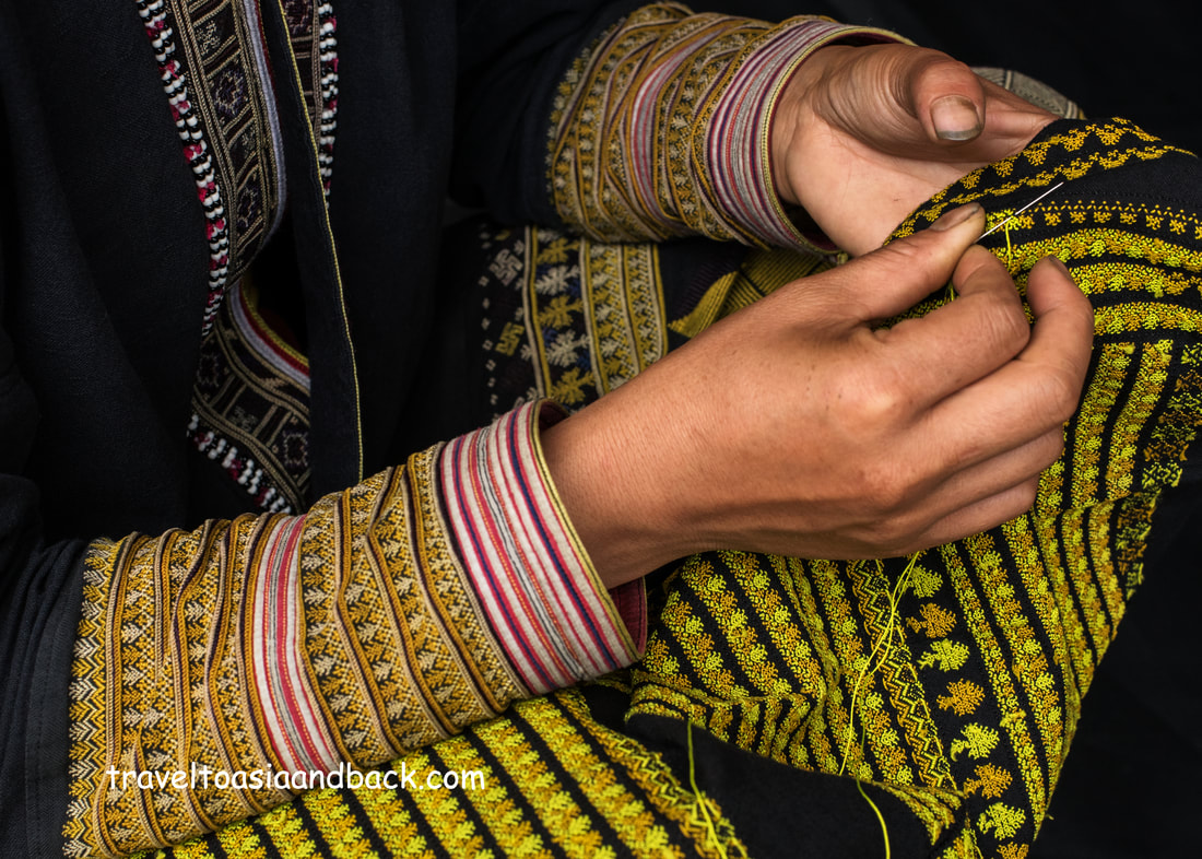
traveltoasiaandback.com - Red Dao embroidery work. Ta Phin, Sa Pa District, Lao Cai Province, Vietnam
Ta Phin
Ta Phin (Tả Phìn) Commune, just to the north of Sapa town, is another rice terraced valley that is often visited by tourists. Although the area is inhabited by a number of friendly minority groups, it is primarily known as the home of the Red Dao People. In many ways, the Dao still live like their ancestors who migrated from China centuries ago. Their villages, small clusters of traditional wooden homes, are scattered in the valley and far up in the green hills towering above. These particular Dao are famous for their fantastic red headdress the intricate embroidery work, using (mostly) fine yellow silk thread.
The area is extremely easy to visit as wide roads, clearly displayed on Google Maps, loop around and through the valley, connecting it with highway QL-4D. Ta Phin village can be reached by car, motorcycle or on foot.
The area has many homestays, which range in style from small guest houses to beds in traditional Dao homes.
traveltoasiaandback.com - Ban Khoang, Sa Pa District, Lao Cai Province, Vietnam
Ban Khoang
Situated just to the north of Ta Phin, and west of provincial road DT-155, a narrow, winding two-lane country road, Ban Khoang (Bản Khoang) commune is a very remote rural area that sees relatively few tourists. Although a handful of local Black Hmong and Red Dao families offer homestay, there is no other tourism infrastructure in the area. At least one well-known tour operator offers multi-day trekking tours that combine both Ta Phin and Ban Khoang. They call their tours, which visit the villages of Phin Ho, Lu Khau, Suoi Thau, Gia Thau and, Kim Ngan “Off the Beaten Track” which we believe is an accurate description of all points north of Ta Phin Village.
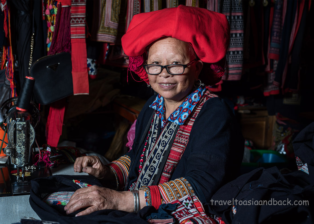
traveltoasiaandback.com - A woman from the Red Dao ethnic group. Sapa market, Lao Cai Province, Vietnam.
Sapa Market
This is the “new” market, which replaced the original market on Cầu Mây Street, a few hundred meters from the town center. The old market, was in operation for many decades, was finally demolished last year in 2019. Situated between the “old” and “new” bus stations, the market can be quite busy first thing in the morning when the locals operate a morning market on the opposite side of the street. However, it is generally pretty quiet Monday through Friday. Saturday mornings are somewhat busy, but Sunday morning is the big market day when the Black Hmong people from the furthest reaches of the district come to trade.
Here you will encounter Hmong folks, both men and women, in their finest traditional costume, selling plants, honey, clothing, hemp cloth, and hand-crafted knives. I find these out-of-towners interesting as they often do not speak English and have no interest in us, tourists.
Another easily recognizable ethnic group at the market are the Giáy people. Their modern costume includes black pants, colorful scarves, and handmade shirts that are also popular with their Black Hmong neighbors. In addition to the shirts, many Giáy ladies sell sticky-rice carefully packed in bamboo tubes, a rice cigar of sorts.
The building itself is a rather uninspiring two-story concrete affair that is unlikely to win any awards for architectural achievement. Vendors on the ground floor sell the same souvenirs and knock-off clothing (The North Face) that can be purchased all over northern Vietnam. Shoppers are advised to determine the fair price of items, before making a purchase. I promise you that negotiating (haggling) over prices is perfectly acceptable in this market.
At the east end of the ground floor, there is a “food court”, of sorts, that caters primarily to local minority people. Few Westerners dare to eat here which is a shame as it offers a truly authentic and unique dining experience.
On the street, adjacent to the food court, is a traditional wet-market that on busy days often expands to include the entire backside of the building.
The market’s second story is mostly occupied by clothing vendors who sell the same sorts of things that be found on the ground floor. This part of the market could easily be skipped if it weren’t for the Black Hmong and Red Dao gals who have set up workshops in the building’s east end, above the food court. The women work on simple Chinese made sewing machines that are surrounded by mountains of handicrafts, new and second-hand traditional clothing, silver jewelry and accessories. Dig through the piles of trinkets and you will surely find some hidden gems, but do not settle on the first price, as everything is highly negotiable.
Another reason this market interesting is that it is an important trading hub not only for the residents of Sa Pa District but also for minority people from neighboring Lai Chau and Yen Bai Provinces. Many Flower Hmong from Yen Bai regularly come here to sell their beautiful hand-made clothing and I have been very fortunate to meet Black Dao, Tai Lu and Hmong people from Lai Chau.
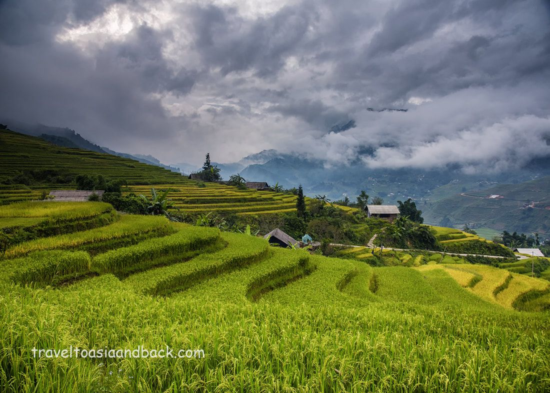
traveltoasiaandback.com - Rice terraces, Ta Van Village, Sa Pa, Lao Cai Province, Vietnam
Travel to Sapa
Reaching Sapa from Hanoi is relatively easy but can be time-consuming. By car from Hanoi, the 197-mile (317 km) journey should around five hours. That is assuming the driver utilizes the Lao Cai Express and there are no delays on the smaller country road QL-4D between the expressway and Sapa Town.
Motorcycle enthusiasts often add Sapa as a stop on various routes between Lao Cai, Ha Giang, Yen Bai, and Lai Chau Provinces.
Train travel is possible via Lao Cai Railway Station and a 1-hour drive by taxi, car and driver or bus.
The town can be easily reached by bus from the cities of Hanoi and Lao Cai, and the provinces of Yen Bai, Ha Giang, Lai Chau, Son La, and Dien Bien Phu.
traveltoasiaandback.com - Black Hmong Style, Lao Chai Village, Sapa, Lao Cai Province, Vietnam
Hanoi to Lao Cai City by Train
Many travelers journeying to Sapa from Hanoi will opt to take a train to Lao Cai station and then connect to a local bus or van for the remaining one-hour trip into Sapa town. Some people feel that traveling by train is safer than riding by bus or car over the area’s steep and narrow mountain roads. The reality is the only section of mountain road that travelers will cross is the 18.5-mile (30 km) section of road QL-4D between Lao Cai City and Sapa town. No matter how visitors arrive in Lao Cai City, the last hour of the journey will be completed by road.
Once upon a time, before the Lao Cai Expressway was completed, the journey was really slow and the train from Hanoi to Lao Cai city was a practical option. With the construction of the modern highway, train travel is now the most time consuming, expensive and complicated way to reach Lao Cai City and on to Bac Ha.
However, for train junkies and those travelers who want to travel at night and save precious daylight hours; everything you need to know can be found here: on the seat61 website.

traveltoasiaandback.com - Black Hmong costume, indigo blue hands. Ta Van, Lao Cai Province, Vietnam
Hanoi to Sapa by Bus
Like all the northern Provincial Capitals, Sapa is well connected to Hanoi by vans, mini-buses and full-sized motor coaches. Both daytime and night buses can be found at Hanoi's My Dinh bus station (Bến xe Mỹ Đình).
It should be noted that vans can either be quite ordinary or “Limo /VIP / Express” type. Converting ordinary vans in “luxury” vehicles is all the rage in Vietnam and we can expect to see more routes opening up. The Hason Hai van bus company operates a number of buses and vans on the Lao Cai City / Sapa route.
The Vexere bus booking website is an excellent resource for finding Vietnamese buses, but we suspect many buses, particularly mini-buses don’t make the list. One can also filter for bus type, price etc.
A faster and better (in our opinion), but a bit more expensive option is to book a seat on one of the many limousine buses that run directly between Hanoi’s Old Quarter tourism hub and the center Sapa town. The Sapa Express is one of several companies that operate “luxury” motor coaches which feature large reclining airline-style seats and makes the 196 mile (316 km) trip from Hanoi to Sapa in five and a half hours. Tickets can be booked online on their website, or purchased from one of the many travel agents in Hanoi.
