|
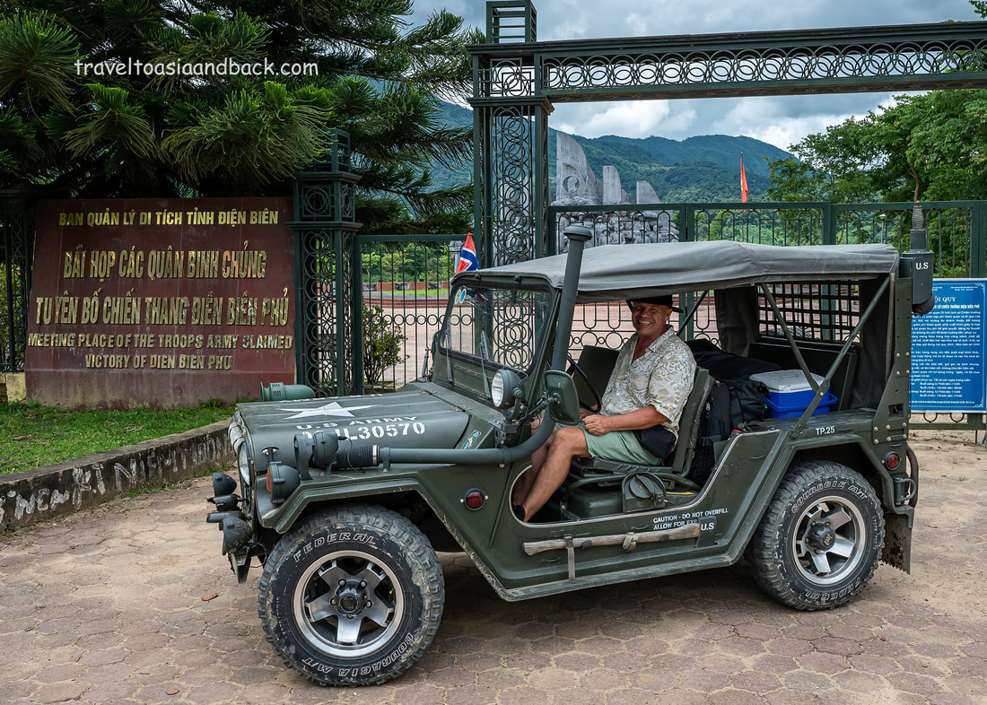
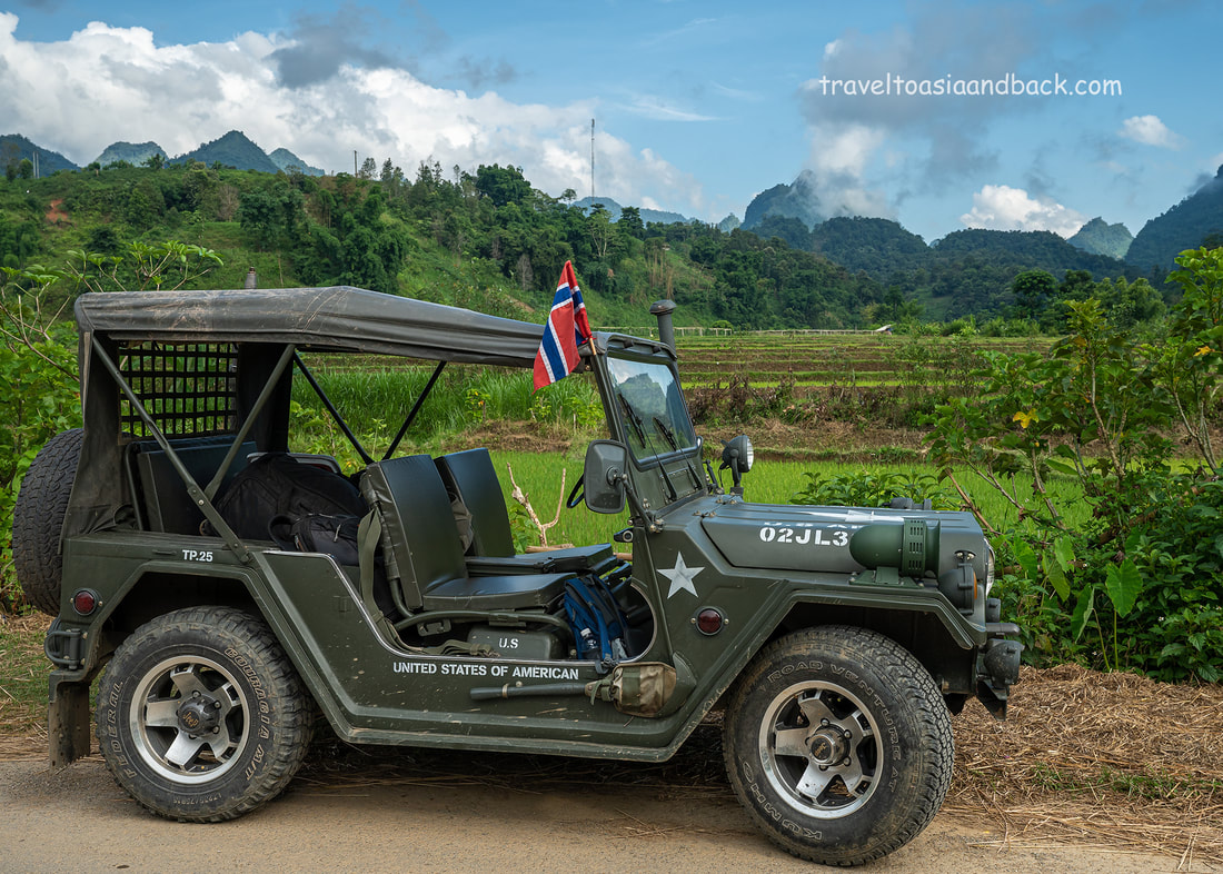
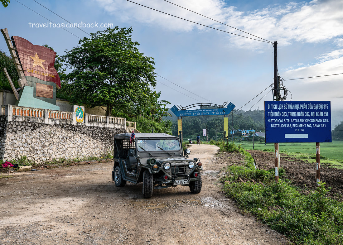
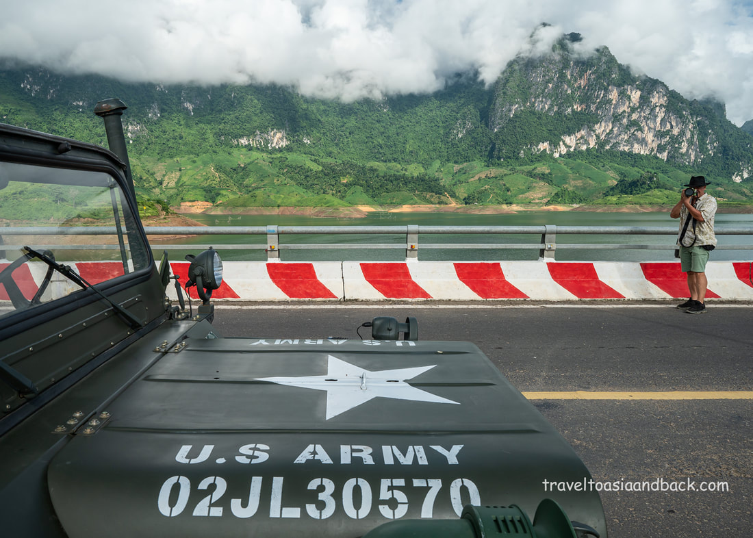
In July of 2022, I was invited by JP Klovstad, a tour leader & photographer based in Ho Chi Minh City, to make a road trip in a vintage American-War era Jeep. Starting and ending in Hanoi, the route would loop around northwestern Vietnam and include some of my favorite destinations. The trip's main objective was to check the road conditions and driving times for a longer tour JP was to conduct the following week. I also had a prior commitment, another road trip in Ha Giang Province, so I opted to part ways with JP in Mu Cang Chai, only participating in the first five days or roughly 800 kilometers.
The primary purpose of this article is to discuss the pros and cons of traveling in these old refurbished US Army Jeeps and to compare them to common methods of transportation such as small motorbikes, cars, trucks, and vans. The secondary objective will be an overview of road conditions on what I consider the most interesting legs. Having just completed my eighth significant road trip in mainland SEA in less than one year, I am in a good position to discuss road travel in the region.
It is important to note that the route shown on the Google Map above is an approximation of the journey as we made far too many stops and detours to include all of them.
The basic route was: *Hanoi’s Noi Bai airport to Sapa via the expressway, and DT-152. *Sapa to Dien Bien Phu via Sin Ho, QL-4D to DT-128 to QL-12 *Dien Bien Phu to Tuan Giao via QL-279 and AH-13 *Tuan Giao to Mu Cang Chai via QL-279 to QL-32
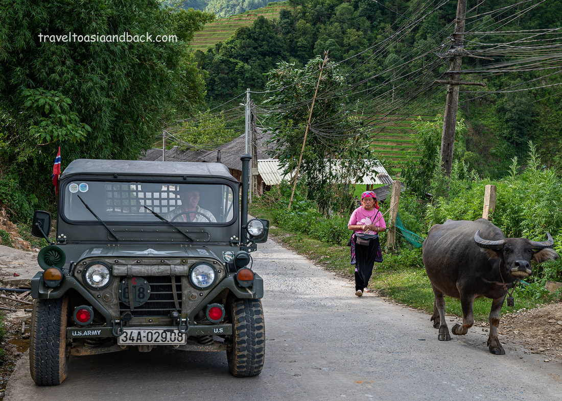
The Pros of Jeep travel; are pretty obvious, these old refurbished classics are cool! Everyone seems to agree with me, and everywhere you go the locals will want to have a look, a chat, take a few selfies, and put the children in the front seat for family photos. So, a Jeep is a great way to meet and interact with the locals.
They are also excellent platforms for photography; like the off-road vehicles used on African safaris, no doors or side windows means that you are always ready to spring into action and make the next photograph or video clip.
Although the seats in the Jeep were surprisingly comfortable, far better than riding on a small motorcycle, driving up the expressway wasn’t the most pleasant experience. It was hot and dusty and the exhaust fumes from the vehicles overtaking us were very noticeable. It was also incredibly noisy, so noisy that it is virtually impossible to have a conversation without screaming your head off.
However, as we depart Hanoi’s Noi Bai Airport and head north up the Lao Cai Expressway (CT-105), the cons of Jeep travel become apparent in short order. Completed in 2014, the 245-kilometer expressway cut the road travel time between Hanoi and Lao Cai City in half. This modern highway has a maximum speed of 100 km/h and the Jeep is the slowest vehicle on the road. How slow? Impossible to say as the speedometer doesn’t work. JP estimates we are doing 70 km/h, never mind at least the fuel gauge works.
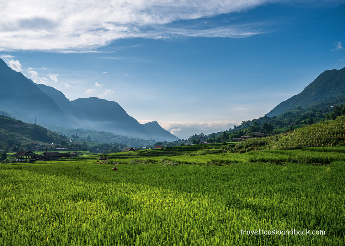
Once we left the expressway behind us in Pho Lu, Bao Thang District, and got out into the countryside, the journey became much more pleasant. I was particularly interested in traveling to the Muong Hoa (Sapa) Valley via DT-152 as I had never done this drive before and really can’t recall many people talking about it.
As we started driving the uphill DT-152 leg it became apparent that the fuel gauge really only works when the fuel tank is nearly full and on level ground. This particular Jeep had an auxiliary electric fuel pump fuel which was required when traveling up steep inclines. At this point, we learned to keep the vehicle’s fuel tank and auxiliary jerrycan topped up at all times. The district roads (DT-xxx) are often in poor condition. They don’t appear to do any maintenance on these smaller country roads, often waiting until the road is virtually unusable before they resurface the straightest, easiest sections. Curves, switchbacks, and other tight bends or curves are often completely ignored. In this case, DT-152 which connects to the valley at Thanh Phu, Nam Sai Commune is in surprisingly good condition and is an excellent choice for folks who have their own transportation and want to travel off the usual well-traveled route. By utilizing DT-152 to the valley it is possible to bypass touristy Sa Pa town and take a much more scenic route.
We spent Sunday night and Monday in the Muong Hoa (Sa Pa) Valley. I stayed at Tavan Heaven Homestay while JP stayed at another property, a possible choice for his upcoming tour. The next morning, I got up early to shoot in the rice terraces while JP continued his research by checking out potential trekking route.
In the afternoon we took the Jeep up the road toward Seo My Ty, Vietnam’s highest freshwater lake/ reservoir. In the not-so-recent past the 12-kilometer drive up to Seo My Ty was a brutal journey up what appeared to be an old riverbed. However, the locals have built a proper concrete road that now connects Ta Van village to the lake, and although it’s a little steep, it’s now easy to reach by car, motorcycle, or on foot.
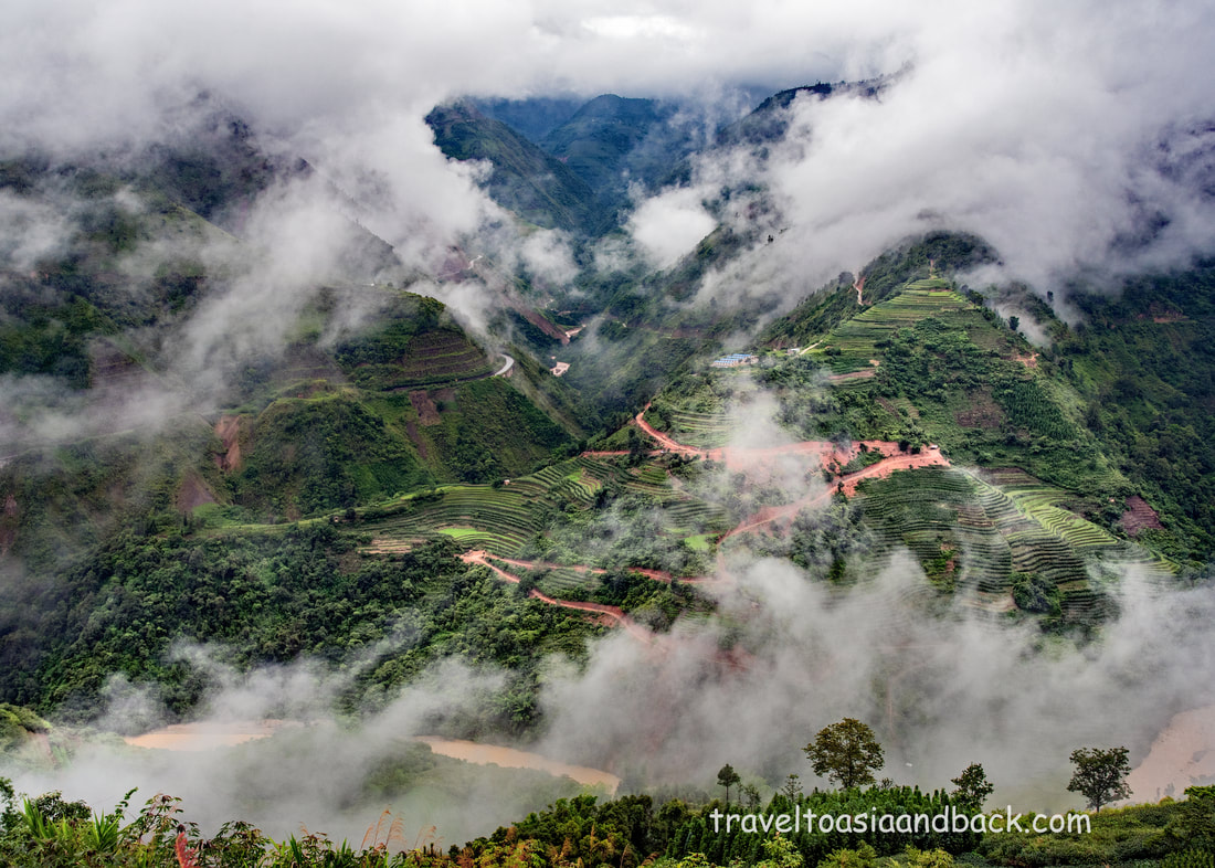
On Tuesday we departed Sa Pa for Dien Bien Phu via Sin Ho in Lai Chau Province. In Sa Pa town, at the “new” market, we take road QL-4D, one of Vietnam’s most spectacular drives through O Que Ho Pass. Also known as Heaven’s Gate or Tran Tom Pass, this is Vietnam’s highest mountain pass and is well known by Vietnamese photographers who often shoot here in the late afternoon or at sunset.
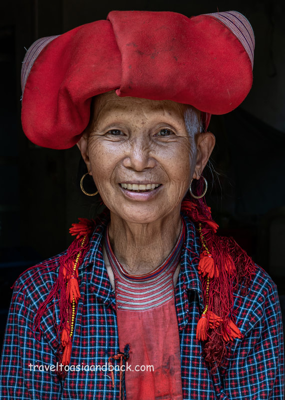
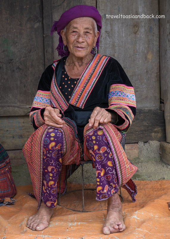
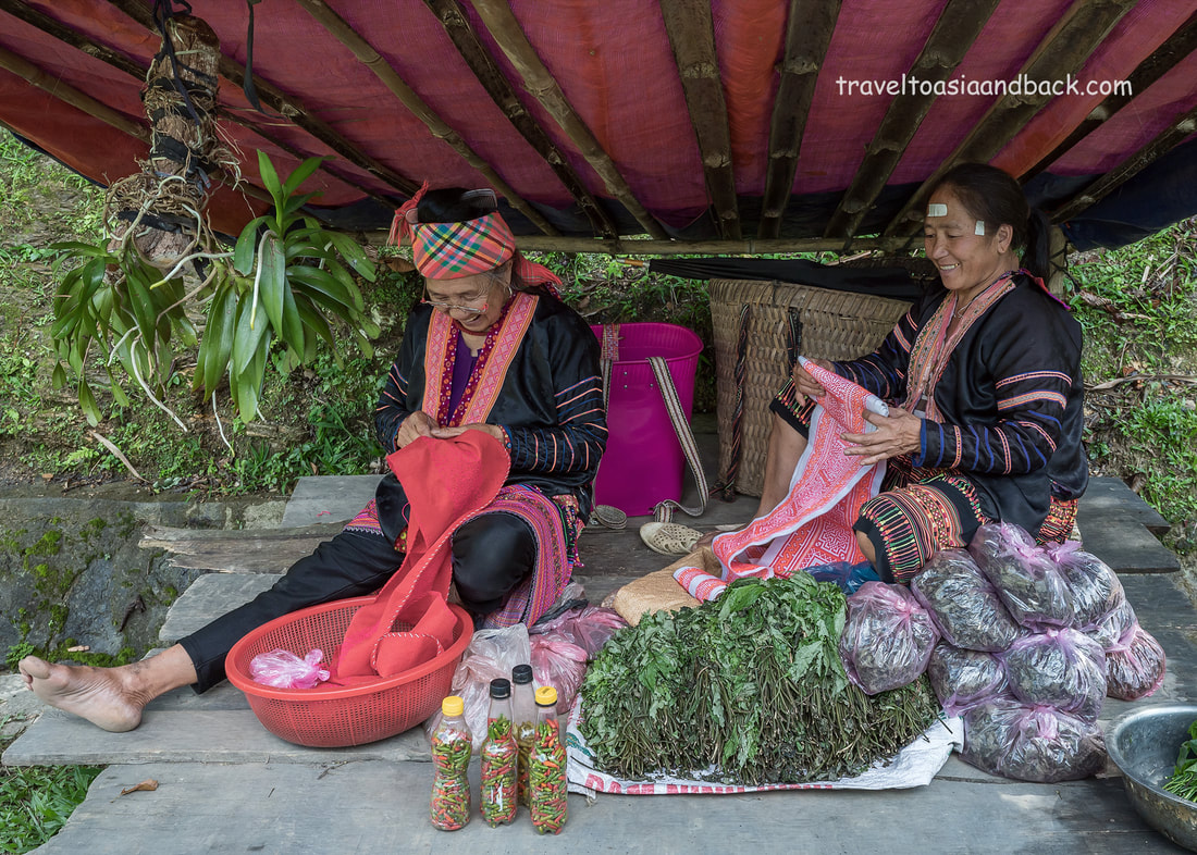
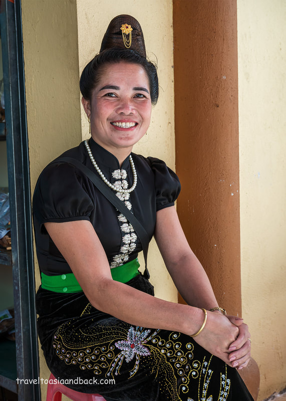
From O Que Ho Pass to Lai Chau City is an easy drive on a perfectly good stretch of sealed highway. At Lai Chau City we join DT-128, which in 2019 was under construction/repair and in a terrible state. Now that the construction has been completed and the road has been resurfaced, it is a lovely stretch of perfectly good tarmac road. Sunday is the big market day in Sin Ho, but on this particular Tuesday it was fairly busy. It is a small market, in a remote mountain town that normally sees few tourists. As is often the case, the people who trade here are the main attraction. Dressed in their finest traditional clothing, the Hmong, and the Dao, the people of the mountains, gather at these markets not only to trade but to reunite with family, friends, and neighbors, often over a meal and local rice wine. After a stroll around the market and lunch, we continued on to Dien Bien Phu via DT-128 to QL-12 at Chan Nua. This section of DT-128 was also in reasonably good condition and makes for an interesting drive through a fairly remote part of Lai Chau. We spent the night in a typical local-style hotel in Dien Bien Phu City.
On Wednesday we started the day with a visit to the artillery monument, Ban Pa Pom Hmong village, then had an early lunch at a Thai (Tai) homestay that JP was interested in staying at on his upcoming tour.
I’d been to DBP several times and had visited all the historic sites in town but I missed the sites outside of the town proper, most importantly General Giap’s Headquarters aka “Dien Bien Phu Campaign Command Headquarters”. As the name implies, this was the General’s base of operation during the decisive battle which would see the defeat of the imperialist aggressors and the liberation of North Vietnam. The headquarters, like many of the sites related to the Indo-China wars, doesn't have much to see, proper signage or knowledgeable guides, etc., but for folks who are interested in history, it is enough to stand in the footsteps of the people who made it. From the General’s headquarters, we worked our way up some fairly bumpy and remote roads up to roads QL-279 and AH-13 to Tuan Giao where we spent the night in a fairly typical city-center hotel.
I should probably mention that the weather during our trip was fantastic. There was a period last summer (2022), from roughly the second week of June until the second week of August, that was unseasonably sunny, dry, and hot. Our timing was perfect, perhaps too perfect, and I managed to get sunburned on my right arm and leg. Next time I would consider wearing long-sleeved shirts and trousers and using sunblock.
To give you an idea of how lucky, it only rained on us one time, and we were fortunate to drive through it rather quickly. I say fortunate, because it was heavy, driving rain that easily penetrated the Jeep’s canopy, particularly where it met the passenger side of the windshield. In just a few minutes I was getting wet, which is no big deal but not so great for camera and computer gear. This brings us to another issue of Jeep travel: there is limited space for luggage and no secure storage like in the trunk of a car. Your baggage is going to get dusty, dirty, and wet. You need to take the same precautions with your gear as you would on a small motorcycle; your passport, docs, and clothes need to be in plastic bags and you really should have some sort of waterproof cover for your daypack/camera bag.
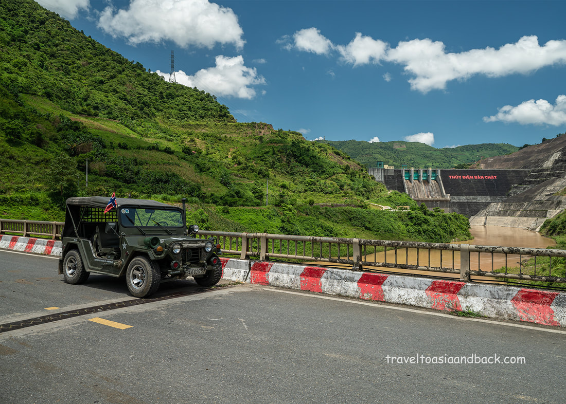
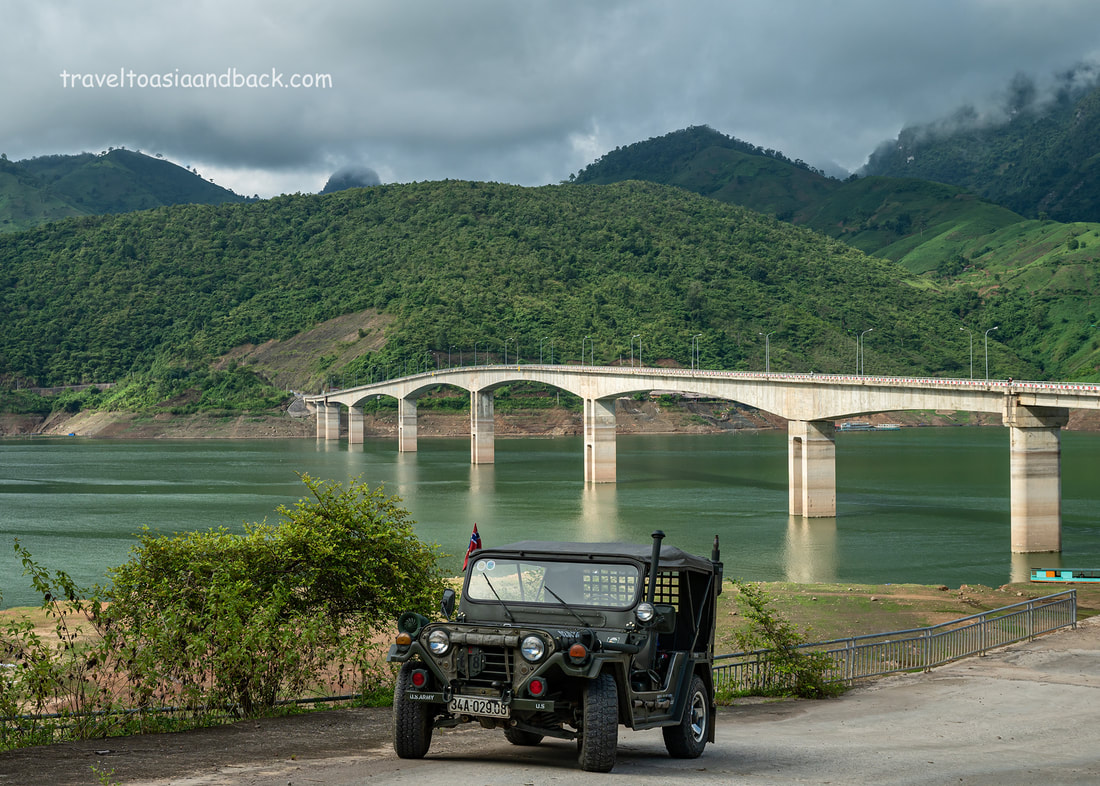
Thursday was another interesting day of driving as we took QL-279 and the Pa Uon bridge across the Da River in Son La Province. From there we continued to another long bridge at the Ban Chat hydropower plant, in Than Uyen District, Lai Chau, Province.
Continuing on road QL279 we join QL 32 and drive through Mu Cang Chai Town where we found a homestay for the night. There are many “homestays” along QL-32, most of which can be better described as guest houses than homestays. The one we chose; Homestay Hoà Thảo, was neat and clean and was a good choice. With our accommodations settled, we got back in the Jeep and did some exploring in La Pan Tan and De Su Phin communes. Then we had an early dinner so I could get up to Móng Ngựa (The Horseshoe) for sunset.
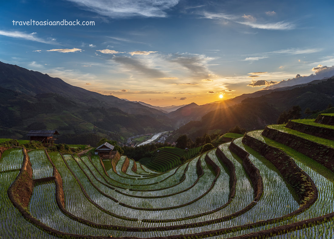
Móng Ngựa (The Horseshoe) is one of the most famous rice terraces / scenic / sunset viewpoints. The site is well-known among Vietnamese photographers: during the “golden season”, when the rice has matured and turned yellow-gold in color, it is overrun with domestic tourists. But July is too early for mass tourism as this particular terrace had been planted a few weeks earlier and I am the lone tourist viewing and photographing another spectacular sunset.
On Friday I settled up with JP and headed to Sa Pa. At the time JP could get the Jeep for 1.5 million VND per day. Currently, as the tourism situation improves in Vietnam (and the region in general), and demand increases, I doubt you can rent one for less than 2.0 million VND. Presently (April 2023) that works out to be approximately $85 USD per day. That’s kind of expensive for an ancient vehicle without air-con, power steering, or drink holders.
Gasoline cost roughly 1,000,000 VND per day which was approximately $42 USD per day. Having just completed two back-to-back self-driving road trips in Laos with late-model 4x4 pickup trucks, I used around $ 35-42 USD worth of fuel on a full day of driving. So, I think the fuel cost was pretty reasonable. There were some other expenses; a 600,000 VND charge to deliver the Jeep to the airport, and toll road fees, but these are minimal expenses that are hardly worth mentioning.
In conclusion, I think the Jeep is an excellent choice for day trips and shorter road trips, perhaps five days give or take. I intend to do another Jeep road trip in Cambodia later this year so that I can do more research on the subject. However, for longer trips, I really prefer the comfort of a four-door pickup truck or SUV. The sixteen-passenger Ford vans are also excellent and if you can put a small group together the price is quite reasonable.
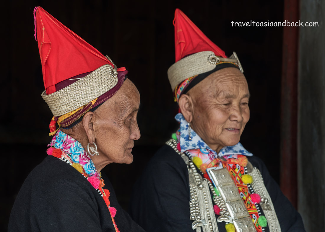
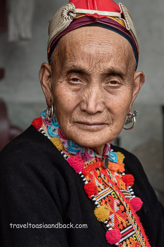
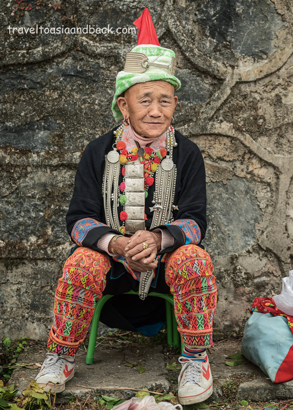
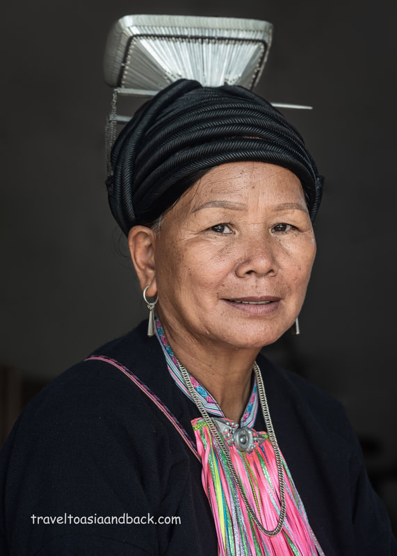
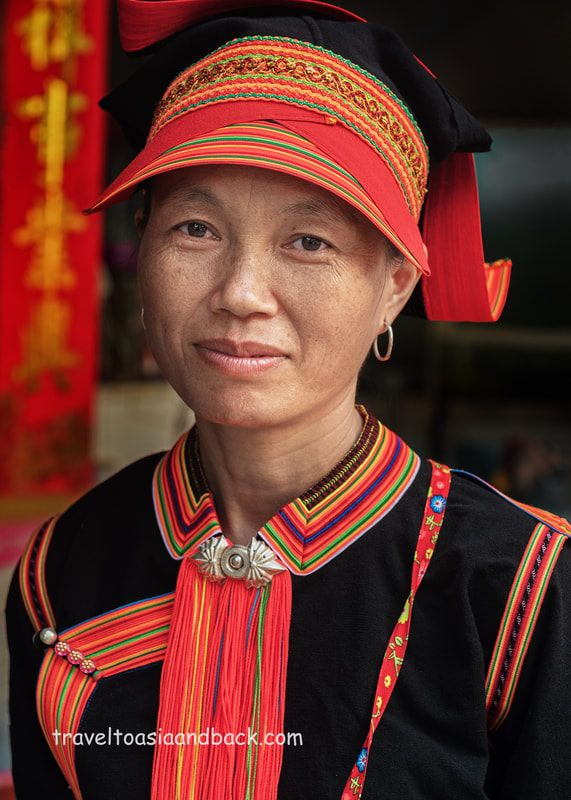
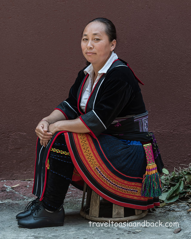
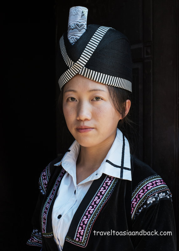
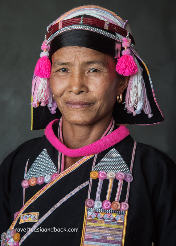
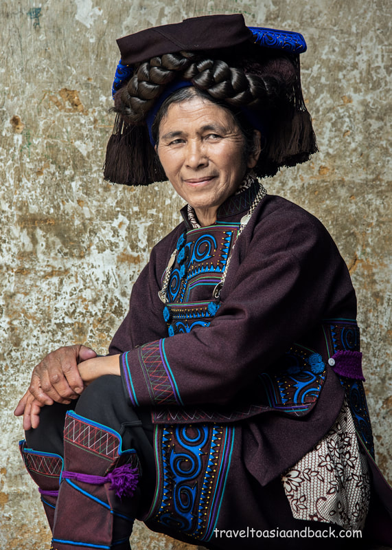
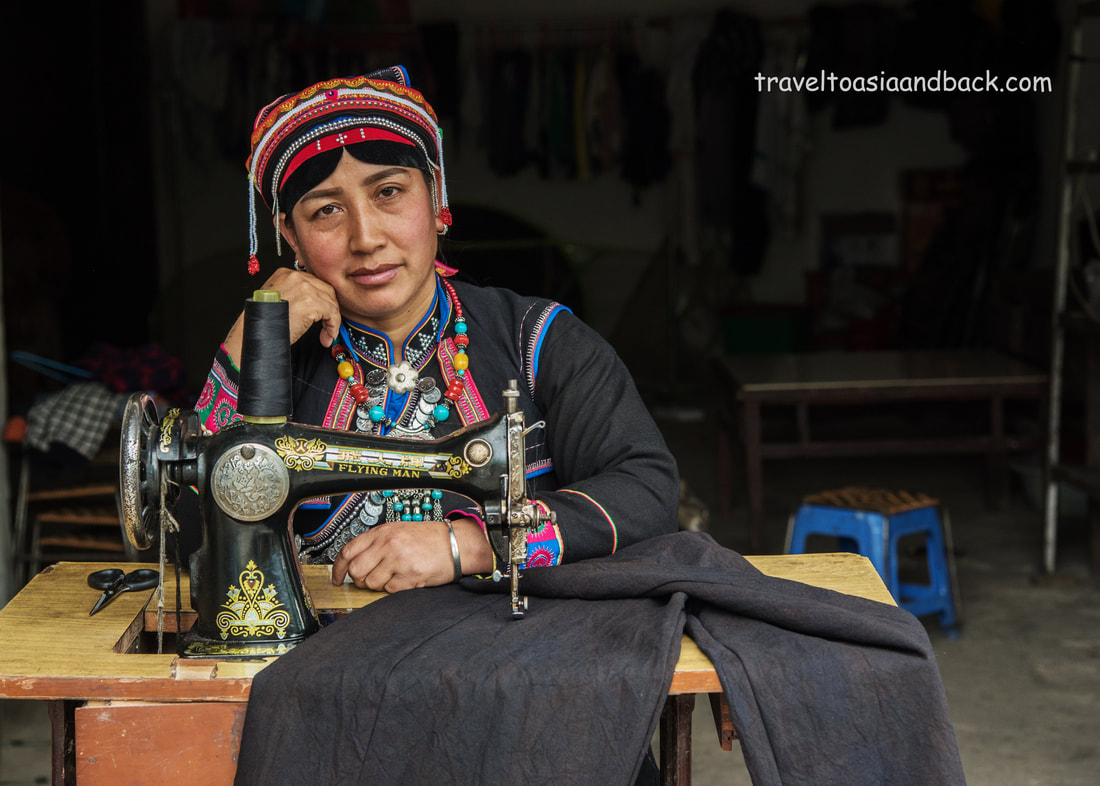
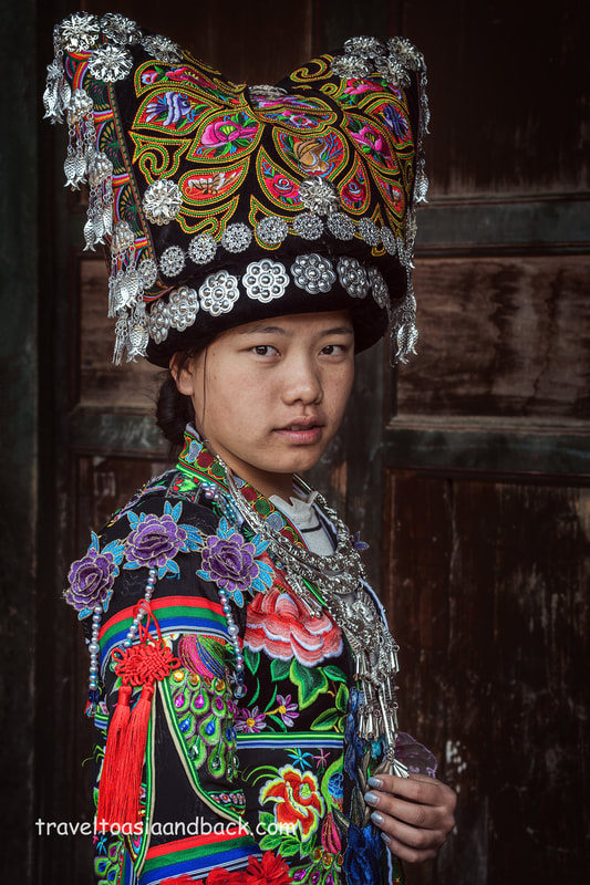
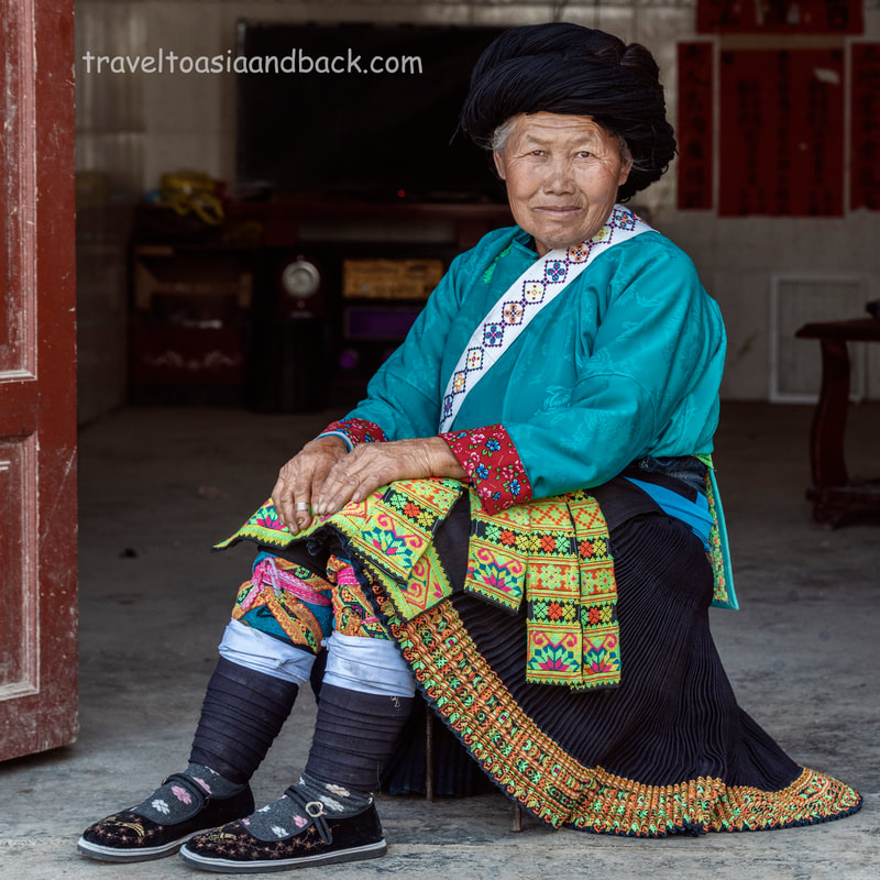
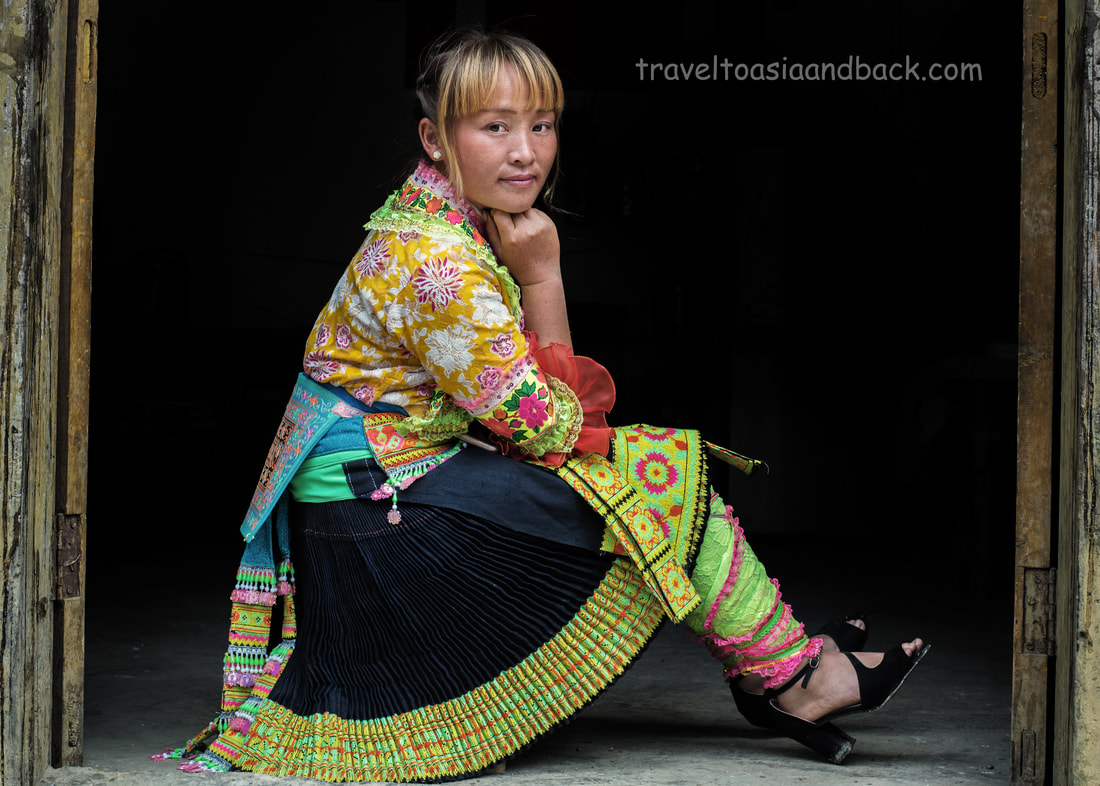
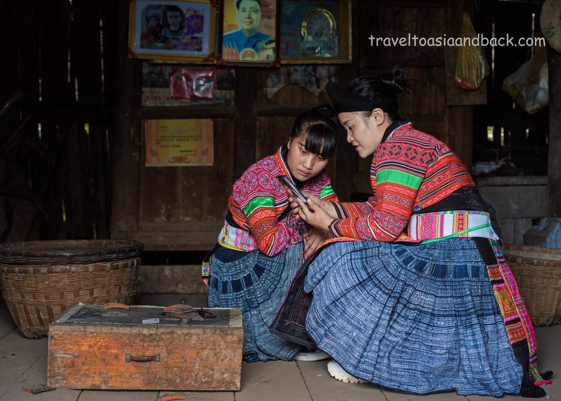
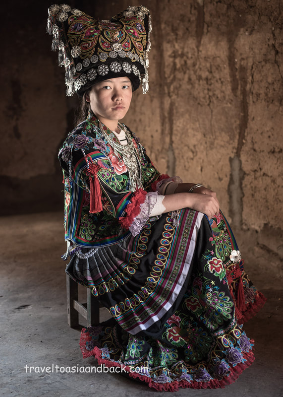
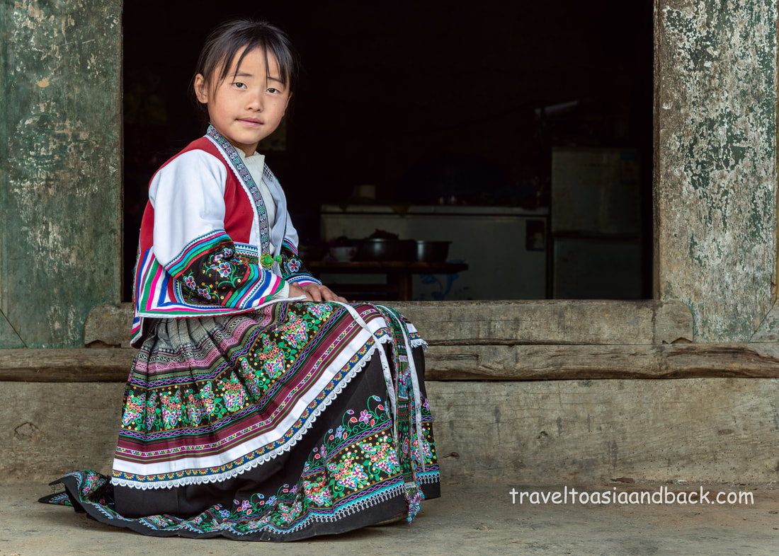
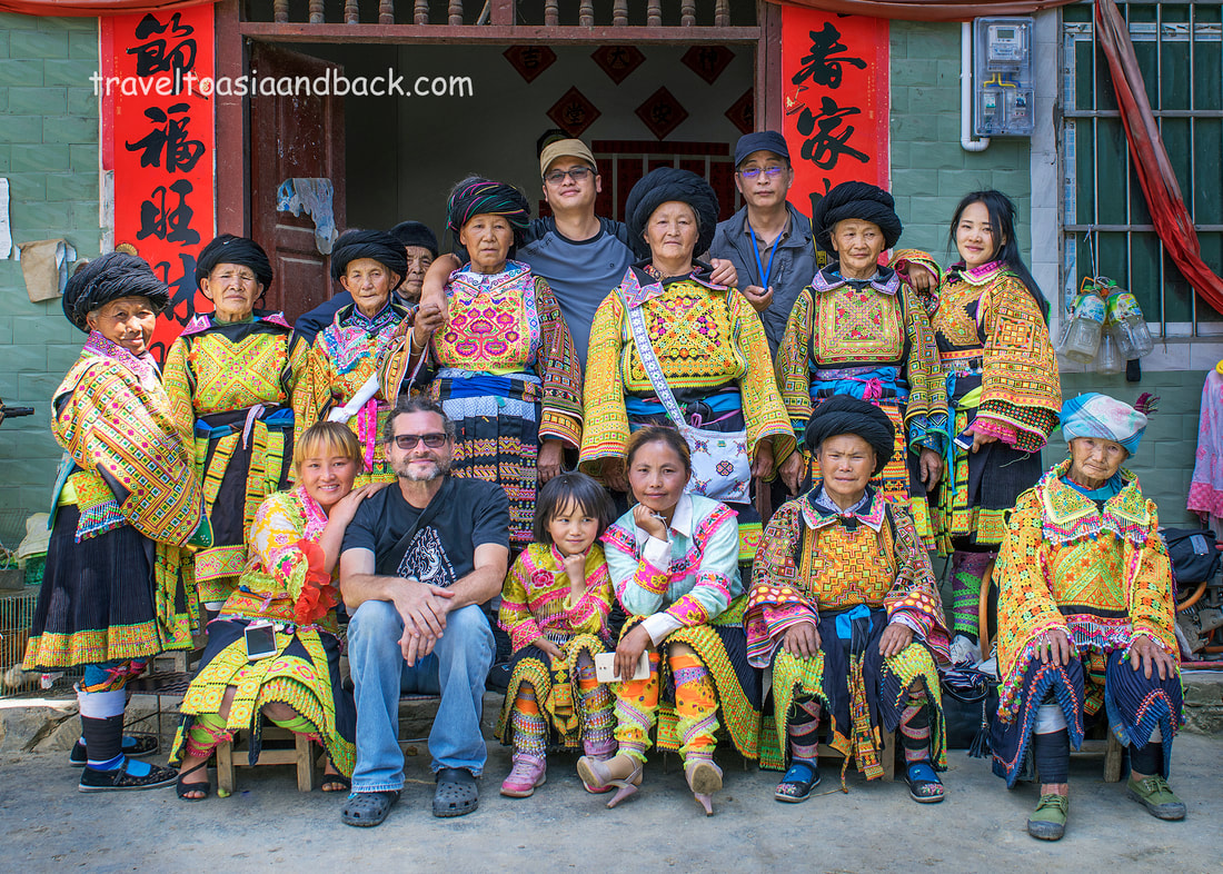
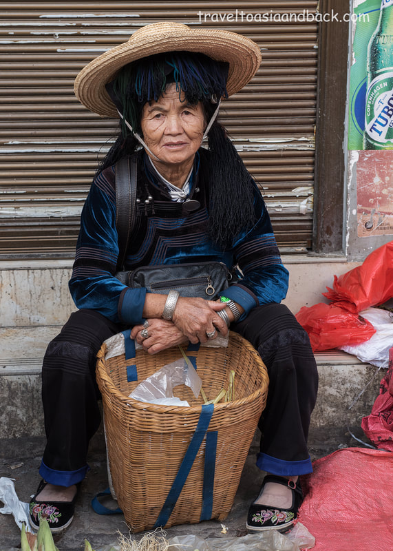
In 2019, after completing two road trips through Guangxi Province with Shanghai-based documentary photographer Hong Qui (Carl) Ye, I convinced Carl to make a trip through Jinping County in Yunnan Province. Sharing a common border with Vietnam’s Lai Chau province to the south and Yuanyang County to the north, the region is home to a number of minority ethnic people including the Dai, Hani, Lahu, Miao (Hmong), Yao (Dao), and Zhuang. One of my main interests was to meet and photograph a particularly interesting group of Yao people who live on both sides of the border in the very southernmost reaches of Yunnan Province. Known as “Red Top” or “Red Headed” Yao, the married women wear a spectacular red headdress adorned with handcrafted silver ornaments; silver is highly prized by the region’s minority people. The city of Jinping, the county’s capital, hosts a fantastic market every Sunday, where many Red Top Yao can be found wearing their best traditional costume. A large portion of the market is occupied by Yao women who sell their hand-made clothing and accessories. In August of 2019, I made another solo trip from Vietnam’s Lao Cai Province up to Yuanyang to see the spectacular terraced rice fields during the height of “green season”, when the rice plants start to flower. On the journey back to Lao Cai I returned to Jinping City to attend both the Sunday market and the remote border market in Jinshuihe, better known as Nafa. Nafa market, scheduled as per the lunar calendar, is within walking distance of a Chinese / Vietnamese border crossing point. This particular crossing point is not open to foreigners but is fairly busy with minority people such as the Yao who live on the Vietnamese side and frequent both Nafa and Jinping markets. In addition to the Red Top, there are two other groups of Yao people who attend the market; the Sha Yao (沙瑶) and the Indigo Yao who are easily recognizable as they wear a unique silver, basket-shaped headdress perched on top of a coil of black rope. Centuries ago, the Yao (Dao) and Miao (Hmong) were allies in a series of bloody rebellions against the Ming and Qing dynasties. They likely migrated, or were driven, southward into China’s most remote and mountainous provinces, and later, further into Laos and Vietnam, at roughly the same time. The Yao and Miao are often found living in close proximity to one another in what is known as a “people clusters”, where related peoples, which, for strategic purposes may be clustered together. The Miao people have a unique culture and are well-known as artisans and craftsmen. Traditionally the men work with stone, wood, bamboo, and steel to build homes and produce hand tools, knives, baskets, and various other types of farming implements. The women of the region are also skilled artisans who weave cloth, produce natural indigo dyes, and excel at batik and embroidery work. Silver, in the form of jewelry, is highly prized by both the Miao and their neighbors the Yao. Silversmiths can be found in most of the region’s towns. In addition to producing simple items, such as ring and bracelets, local craftsmen painstakingly create large intricate pieces that are worn during festivals and weddings. The Hani are another minority group that can be found on both sides of the border. Scholars believe they mostly likely migrated southward from the Qinghai-Tibetan plateau prior to the third century. In China, there are eleven primary branches (or clans) that can be further divided into a bewildering number of sub-groups, each with its own unique costume. The Hani are distant relatives to a number of minority ethnic groups found in China and mainland Southeast Asia, also known as the Southeast Asian Massif. They are members of the Lo Lo - Burmese language speaking group, a branch of the Sino-Tibetan family. Also included in this group are the Akha, Ho, Lahu and, the Lo Lo.
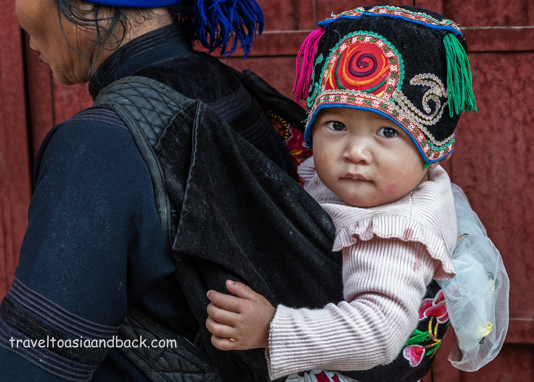
As an avid amateur travel photographer with a keen interest in the minority groups of the Southeast Asian Massif, I was extremely intrigued by the work of Shanghai-based documentary photographer Hong Qi (Carl) Ye. Carl spent four and a half years driving thirty thousand kilometers across five provinces, twelve regions, and eighty-five villages to photograph the Chinese Miao people. The Miao (苗) is one of 55 ethnicities officially recognized by the government of China as a minority group. Better known as the Hmong in Laos, Thailand, Vietnam, and the United States, the Miao primarily live in China’s mountainous southern provinces of Guizhou, Yunnan, Sichuan, Hubei, Hunan, Guangxi, Guangdong, and Hainan. The Miao people have a unique culture and are well-known as artisans and craftsmen. Traditionally the men work with stone, wood, bamboo and steel to build homes and produce hand tools, knives, baskets, and various other types of farming implements. The women of the region are also skilled artisans who weave cloth, produce natural indigo dyes and excel at batik and embroidery work. Silver, in the form of jewelry, is highly prized by both the Miao and their neighbors the Yao. Silversmiths can be found in most of the region’s towns. In addition to producing simple items, such as ring and bracelets, local craftsmen painstakingly create large intricate pieces that are worn during festivals and weddings. The decision to visit Guangxi Province came easily to me, and I started the necessary research to plan a trip along a fairly common tourist route that included well-known destinations such as Guilin and Longsheng. At the same time, I began corresponding with Carl who I had initially contacted after viewing his work on Instagram. He was very generous with his knowledge of the area. He patiently answered my questions and with his help, I made a basic travel plan and purchased plane tickets. To my great surprise, just days before I was to fly to Shanghai, Carl invited me to join him on a trip to Guangxi Province. Who would do this? Invite a complete stranger, from the other side of the globe, on a road trip? That question was answered clearly when I met Carl, a warm, friendly, and compassionate man whose enthusiasm can best be described as contagious. I had read Carl’s magazine article “In Their Own Space” and seen his striking images. But I did not have a full grasp of the depth of his project. Carl is a consummate professional whose technical knowledge and skill are superb. The ability to connect with one’s subjects is a key part of creating meaningful images and this is another area in which Carl excels. Our journey started from Nanning where we picked up a rental car and drove 453 kilometers west to De’exiang, (De’e) a small town in Longlin County. The majority of De’s residents are minority people from the Miao, Yi, Gelao, and Zhuang ethnic groups. We used De’e, a typical rural market town, as a base to visit the remote villages scattered around the county. Few foreign or domestic tourists visit De’e apart from during lunar new year when the town hosts the well-known Tiapo Festival. Tiapo (跳坡节), or Tiàopō Jié in pinyin, translates to “leaping on the hillsides” and features music and dance performances by both local Miao people and other minorities from around the province. It is estimated that up to 40 thousand people attend the annual festival. I was very fortunate to receive a second invitation to travel with Carl during Lunar New Year 2019 and attend the Tiapo Festival. Festivals and weddings are the best times to visit many of these remote regions and see people in their full costumes. Traditional clothing is time-consuming to make, or expensive to buy. In many areas’ minority people have given up on locally made clothing in favor of mass-produced, inexpensive western-style dress. In many communities, one only sees the older folks, grandmothers, and grandfathers, still wear traditional clothing, or at least bits and pieces of what was once daily attire. I fear that in another generation or two the distinctive clothing that differentiates various ethnic groups and clans from one another will only be found in museums.
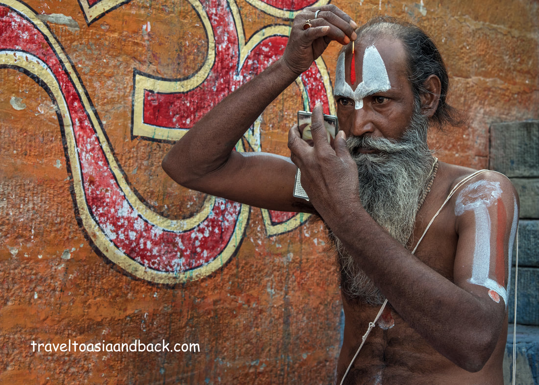
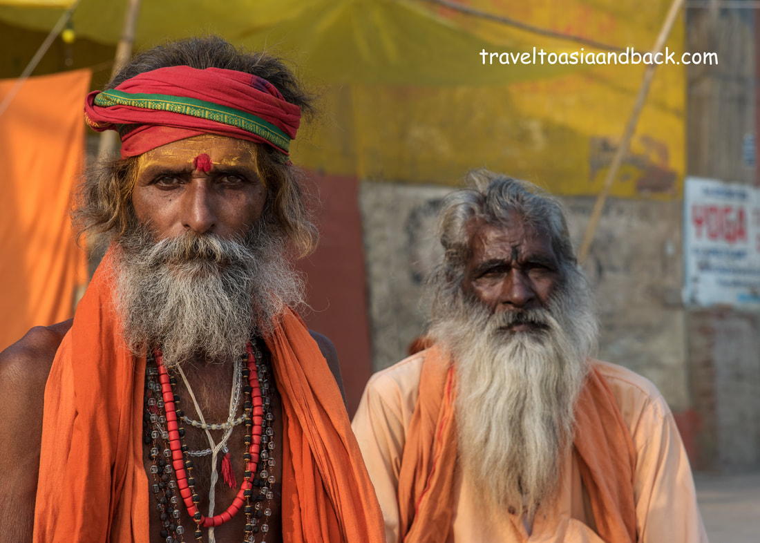
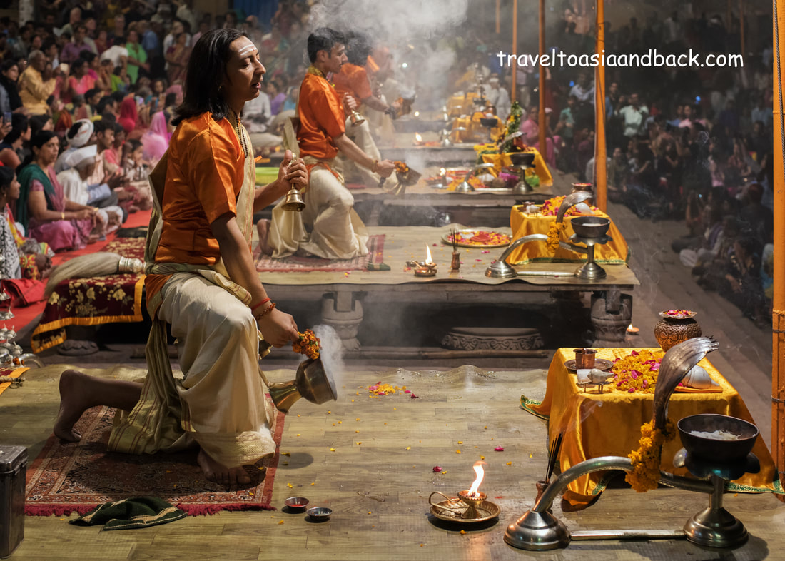
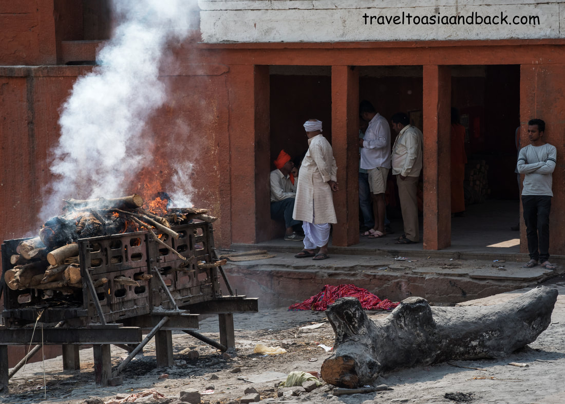
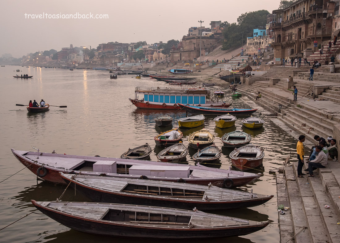
The oldest city in India, Varanasi, does not have street lights or stop signs but it does have over four million residents who squeeze their way through the dusty and dirty narrow maze of streets that city is famous for. They travel in tight packs and in any number of ways; bicycle, cyclos, auto-rickshaws, cars, and motorcycles, sharing the congested streets with cows, goats, packs of dogs and brave pedestrians. There does not appear to be any rules or regulations regarding the flow of traffic which can be best described as utter chaos. There is one thing that the local drivers take quite seriously- a motorized vehicle in Varanasi must have a horn and the driver is required to use it liberally. I imagine that if a vehicle’s horn was to malfunction, driving it would be completely out of the question until the necessary repairs could be made. This is stereotypical India and if one has any preconceived notions about the country and its people they will be verified here. Hawkers line the sides of roads, there is little in the way of sidewalks, with heavily laden carts overflowing with fruit, vegetables, and mountains of food of dubious hygienic condition. They share space with vendors selling aromatic chai masala (spiced tea with milk), cigarettes and pan or betel quids. Beggars wrapped in blankets and shawls that are little more than rags are a common sight as is the sadhu, or holy man. Dressed in bright saffron-colored garments, their faces covered in ash, yellow saffron and blood red vermillion paste, the sadus, also known as babas, are homeless ascetics who primarily worship the Hindu god Shiva. Living only from alms, they spend their time in prayer and meditation. In my mind they must be descendants of the ancient rishis, a Vedic term for mendicant monks who once roamed much of Asia and play prominent roles in Indian literary classics such as the Ramayana and Mahabharata. Bass relief carvings of rishis are a common sight at the temples of Angkor Wat in Cambodia. Interestingly, they can be found adorning the bases of the many columns supporting the main sanctuary at Angkor Wat itself. One cannot help but think that this is no accident, as Rama, the earthly incarnation of Lord Vishnu, and hero of the Ramayana said “the prayers of the rishis support the weight of the world”. Lying along the banks of “Mother Ganges”, the sacred river, Varanasi is considered by Hindus to be the holiest place on earth. It is certainly not a party place. Most restaurants, particularly near the ghats, do not serve alcohol and one must search for beer, whisky or wine. The libation of choice here is ganja or marijuana. Devotes of Lord Shiva, the principle deity worshiped here, believe that the using ganja brings them closer to god. Although smoking ganja (known as bhang in India) is illegal, eating it is not, and it is commonly used as a seasoning or consumed in beverages such as lassis and thandais. “green lassis” can be found through out the city as well as “government bhang shops” where a variety of ganja edibles can be legally purchased. Smoking marijuana may be illegal but the law does not appear to be enforced and one will often smell its pungent aroma while strolling along the ghats. In India the term ghat is used to describe steps and stairways that lead down to a river or other body of water. Primarily constructed in the 18th century, Varanasi has well over 80 ghats many of which are used for very specific purposes. For example, bathing ghats are used by Hindu devotees for entering the Ganges and conducting prayers and rituals while others are used for mundane tasks such as washing laundry. The cremation or burning ghats are of course used for the cremation of human bodies and seem to be of particular interest to many western travelers. Admittedly, I too am fascinated with the burning ghats. Not because I have a morbid or ghoulish desire to see corpses, but because it’s so interesting to see the cycle of life completed in public. Generally speaking, daily life in many parts of the world is played out in full public view. Privacy is a much different concept in the east where families prepare and eat meals, bathe, mend clothes and conduct business on the street in front of their tiny and cramped homes. While the streets of Varanasi, like most Indian cities, are noisy and chaotic the ghats offer a peaceful respite from the daily grind of urban life. In addition to the many travelers and pilgrims who pass time along the banks of the Ganges, locals too enjoy the river’s stunning views and tranquility.
Varanasi’s residents can often be heard uttering the word “Shanti”, which comes from the ancient Vedic mantra of peace “Om Shanti Shanti”. “Shanti Shanti” they say, before climbing aboard noisy auto-rickshaws, cars, and motorcycles to join the other horn- honking drivers in the city’s maddening roads.
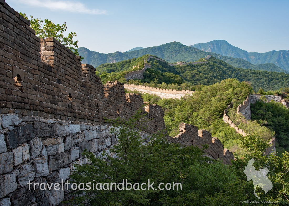
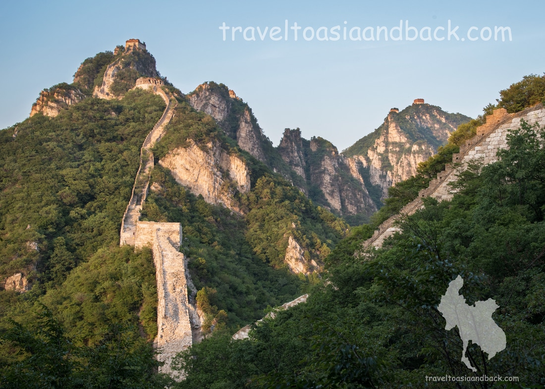
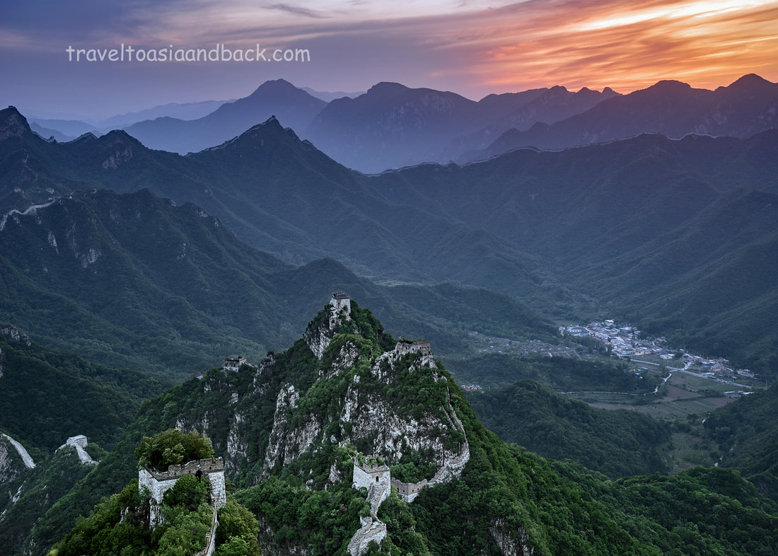
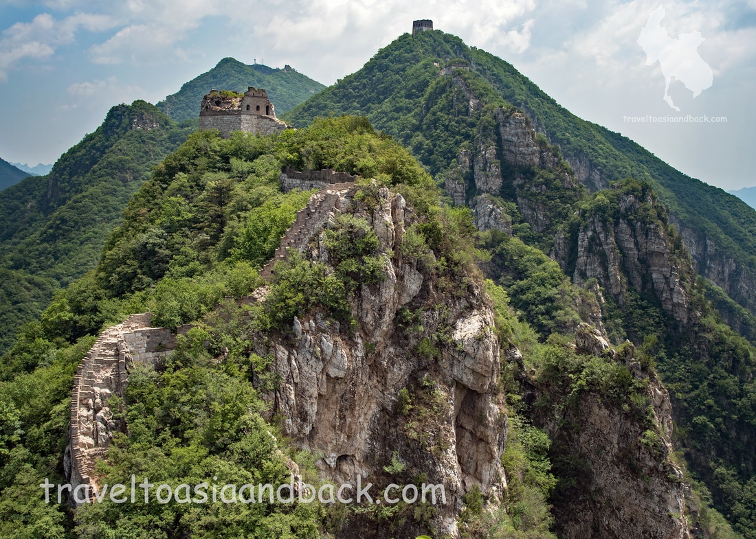
Gazing up at a near-vertical stairway that led to an ancient watchtower precariously perched atop of a steep mountain, I began to understand why exploring the Jiankou section of the Great Wall of China could be dangerous. My goal was to reach Beijingjie, Beijing Knot in English, a mountain-peak junction where the wall meets from three different directions. But the northern approach, up the stairway, looked absolutely terrifying. Built from stone blocks and bricks over five centuries ago, this particular section of the wall has never been rebuilt and is now in a very decrepit state. Besides being extremely steep, the stone steps making up the center of the stairway are mostly broken or missing. A bigger problem is that virtually all of the horizontal walkways leading to the stairway and the first five meters of stone steps have collapsed and are spilling down the mountainside like a white stone waterfall. Surely this approach is better left to experienced rock climbers. I was certain that one mistake would lead to serious injury or even death. Not wishing to tempt fate, I abandoned my lofty goal and hiked back down the mountain to the safety of Xizhazi Village.
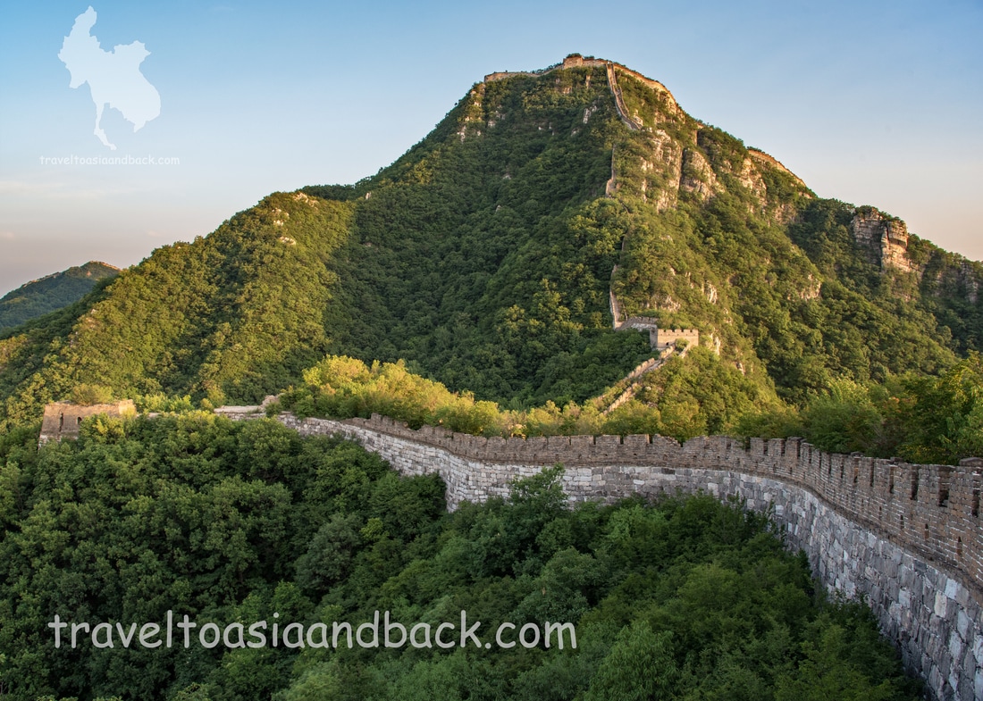
Spanning a distance of over 8000 kilometers, much of the existing 6259 kilometers of the Great Wall of China was constructed by the Ming Dynasty that ruled from 1368 to 1644 AD. Built primarily to protect China’s northern border from invasion by the Mongols, the vast system of fortified walls and towers generally runs from east to west along natural barriers such as hills, mountains and rivers. Construction of the wall continued for the entire reign of the Ming Emperors which lasted nearly three centuries.
There are over 600 kilometers of ancient Ming wall within the Beijing Municipality and it is often said that a visit to China’s capital is incomplete without seeing the famous Great Wall. A number of sections can easily be visited as a day trip from downtown Beijing. The most popular areas such as Badaling, Mutianyu and the lakeside wall Huanghuacheng, have been refurbished to a state that is probably better than when originally constructed. These sites are major tourist attractions with significant infrastructure and although there are a great number of stairs to climb, are generally suitable for visitors of all ages and physical conditioning. However, there are still sections of the Great Wall that remain virtually untouched and have not been made into tourist attractions. Many Beijing residents and international travelers who are outdoor enthusiasts, avid hikers, rock climbers and photographers or those who simply wish to get off the beaten path will head to a remote area of the Great Wall known as Jiankou.
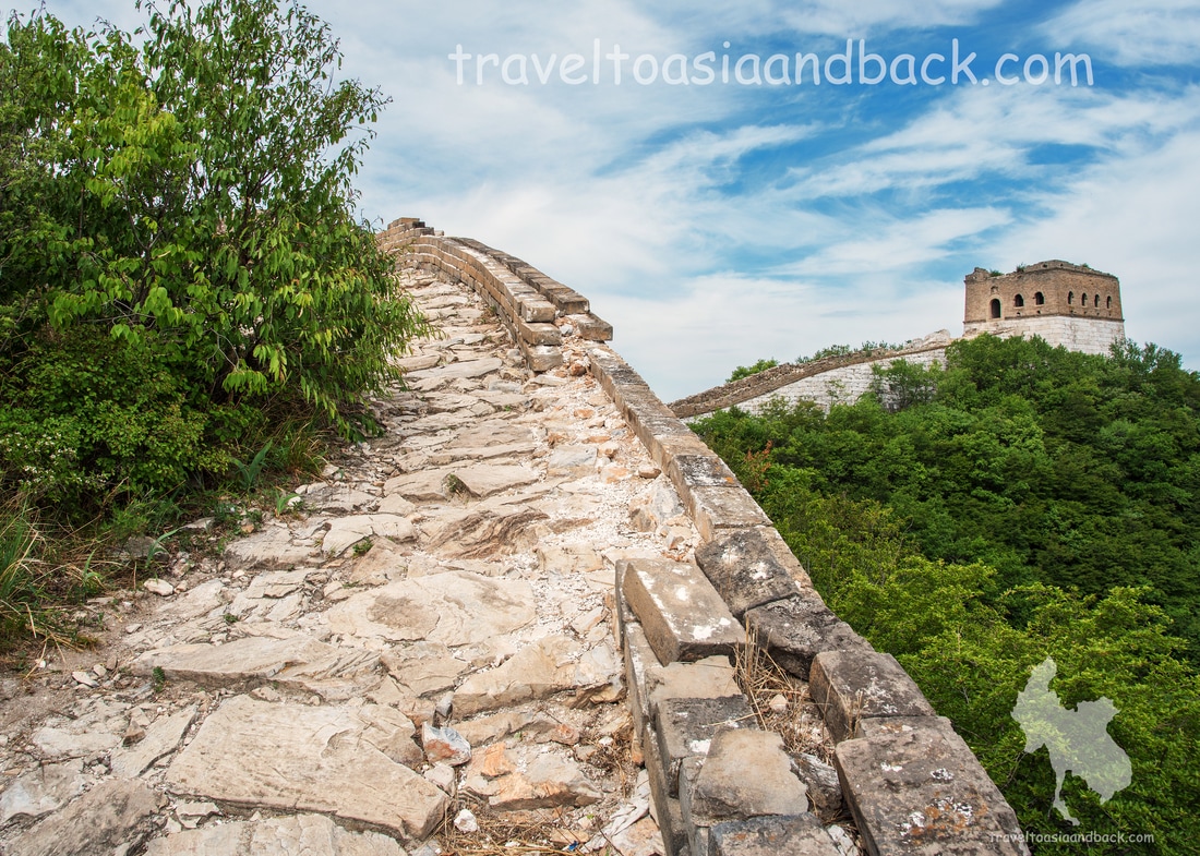
Jiankou is a pristine 20-kilometer section of the Great Wall located in the Huairou District approximately 100 (highway) kilometers north of the center of Beijing. Known as the “Wild Wall”, the mountains in this area are particularly tall and steep. The ancient sections of wall clinging to the mountainsides closely resemble roller coaster tracks. The scenery here is absolutely spectacular and is considered by many to be the best place to photograph the Great Wall. Constructed circa 1368 from brick and a locally-quarried white stone called dolomite, most of the Jiankou wall has not been restored and in many places the outer walls, walkways and towers are in severely deteriorated states. Hiking here can be very challenging and physically demanding as many of the walkways are very steep and a good amount of climbing or crawling over obstacles is required. Hiking here is often slow going and it can take many days to thoroughly explore the area.
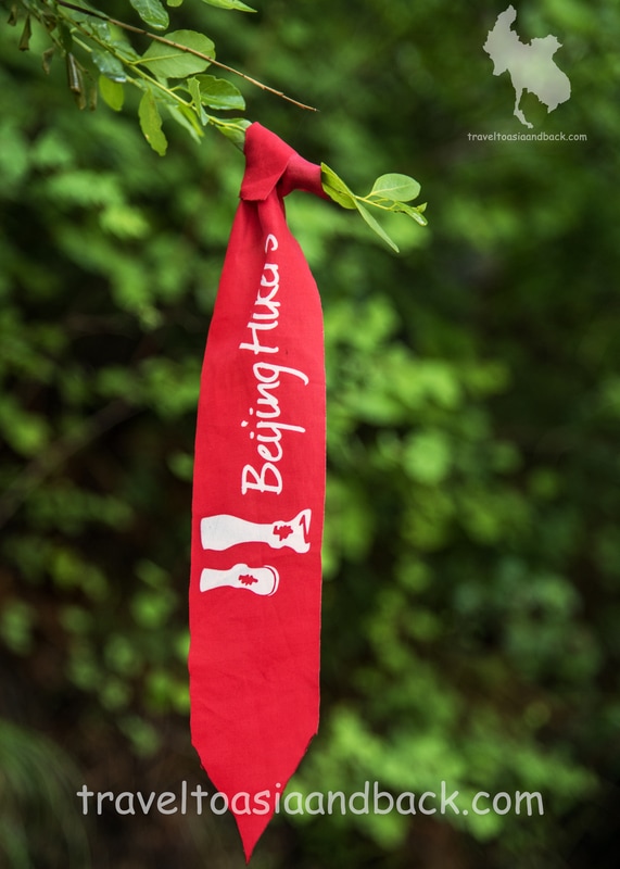
“Wild” means that you will not encounter any tour buses, guides, touts or souvenir vendors, gift shops or fast food joints. You will be lucky to find a mom and pop “convenience store” set up in the living room of a villager’s home. On the most popular stretches of the wall one is likely only to encounter a handful of fellow hikers, mostly on the weekends. Hike further afield, to the west and north of Jiankou, and it is possible to hike for days without meeting any other travelers. “Wild” also means that there are no park rangers, information booths or signage on any of these sections. You will not see any caution signs, barriers, yellow safety chains or whistle-blowing security guards. In fact, the trails leading to the wall are themselves barely marked. In some places only red or blue ribbons, hung from trees by local hikers, indicate the correct direction of travel, a turn in the trail or a bypass leading around an unsafe or impassable section of the wall. Interestingly, Jiankou is not officially open to the public and many, or perhaps all, of the trails that lead to the wall appear to be on private property. There are enormous signs posted at the beginning of each well-trodden trail reminding hikers of this fact, yet strangely, there are also similar signs posted to remind visitors not to litter (a big problem) or build open fires. Camping on the wall is not permitted either, yet many hikers do this is well. Jiankou is also considered to be the most dangerous section of the wall to hike on. This is particularly true of the stretch between Jiankou Spot and Zhengbeilou where several parts have completely collapsed and slid down the mountainside. In numerous places stone blocks and bricks continue to give way and fall from their precarious positions as the ancient mortar that once bound them disintegrates and turns to dust. Hikers will often find that walkways are overgrown with brush and trees and are nearly impassable. For the most part the horizontal parts of the wall are fairly intact, which makes walking on them relatively safe and easy. However, you can only walk on a level stretch for so long before the snake-like wall ascends (or descends) to the next peak. It is these sections, essentially near-vertical stair cases, where the danger lies. Often one must approach the steps, if there are steps remaining, as a rock climber would tackle a sheer cliff face. JiankouHiking from Zhengbeilou to Mutianyu
There is one particularly popular Jiankou hike which is relatively safe, easy, and can be done as a day trip from Beijing. Starting from Xizhazi village (number 5) or Nanjili village, travelers will hike for one to one and a half hours through dense forest following a well-trodden trail that winds its way up the mountain to Zhengbeilou Tower. This large watchtower is situated on a high peak 991 meters above the valley. The westward view from Zhengbeilou is spectacular and is a popular place for photography. From the watchtower, hikers will travel eastward on a fairly level section of the wall towards Niujiaobian (Ox Horn Edge in English). The ascent up the western leg of Niujiaobian is not very difficult, but the eastern downhill section is a different story. Constructed from smooth and very slippery pieces of rock, this walkway is very steep. Personally, I would never attempt to do this hike in the rain or snow.
The next section, between Niujiaobian and Watchtower Number 23, is a nice, easy and relatively safe hike. At Tower Number 23 the Jiankou Wild Wall ends and the beautifully reconstructed Mutianyu Great Wall begins. At this point hikers will join tourists from China and around the globe walking towards the Jiankou cable car station. It took me roughly two hours to complete this section. From the Mutianyu section of the wall, hikers can purchase a one-way cable car ticket (120 CNY) or simply continue hiking down the mountainside to the park’s main entrance. At Mutianyu, a major tourist attraction, it is very easy to arrange transportation back to Beijing. My original plan was to go for a cable car ride down to the valley for lunch, but it appears that one cannot purchase a round-trip ticket from up top on the wall. Rather than paying over 240 CNY for two one-way tickets I simply turned around walked back to Xizhazi. The return hike took exactly five hours but I stopped many times along the way to rest and admire the beautiful scenery. Smartphone Mapping Apps in China
The Google map included in this article is presented solely for informational purposes. I enjoy working with Google Maps but they simply don’t provide enough detail to navigate the Great Wall of China. Also, to use all the available features you must use a Virtual Private Network (VPN) which I find to be a nuisance.
A better choice in mapping software, often recommended by Chinese residents, is MAPS.ME. Also known as "MapsWithMe", MAPS.ME features global coverage utilizing the GPS system with maps downloaded on your device. The App is fully functional even when offline. Most importantly, the China maps on MAPS.ME provide far more detail than Google Maps. MAPS.ME works very well on and around The Great Wall. Many of the small trails leading from Xizhazi to Jiankou and the bypasses that lead around hazardous sections of the wall are clearly displayed. Xizhazi Village
The Jiankou Great Wall is most easily accessed from Xizhazi village. Xizhazi is actually a cluster of five small farming villages located in a peaceful valley on the northern side of the Great Wall. Numbered one through five, they are often referred to on maps as “teams” or “spots”. Situated to the west of the cluster is the fairly large village of Xizhazi number five. From this village hikers can reach several Great Wall sites including Beijingjie, Jiankou Spot and Zhengbeilou.
Although there are no ATM machines, supermarkets, pharmacies or any type of store in Xizhazi, accommodations are plentiful. It appears that each family in the village built a hotel, guest house or hostel in preparation for a tourism boom that never materialized. There are more beds here than will ever be filled, prices range from 100-200 CNY. Most, if not all, offer home-cooked meals and beverages. Budget travelers will appreciate that Xizhazi can be reached very inexpensively by public bus. Travel to Xizhazi Village
To reach Xizhazi by bus travelers will have to first reach the Yujiayuan section of Huairou District. A number of busses travel between the stops and stations scattered around Beijing’s Dongzhimen subway station and Yujiayuan.
To visit Jiankou as a day trip from Beijing the fastest and most practical way is to take the number 916 express bus from the bus stop at Dongzhimen subway exit B. This bus will reach Huairou in just over one hour and costs 12 CNY. From Huairou a taxi or min-bus to Xizhazi should cost no more than 150 CNY and take 45 minutes. On my recent trip I took the number 867 bus from Dongzhimen Outer Bus Station. The bus departed at 07:00 AM, costs 12 CNY and took approximately two hours. It should be noted that this bus is a typical local public bus with no designated space for luggage. The bus can also be quite crowded so carrying large baggage is a bit inconvenient. Upon arrival in Huairou one will meet a number of taxi and mini-van drivers who will tout rides up to Xizhazi. The fare price is around 50 CNY for the trip but a far cheaper option is to catch the H-25 bus from Yujiayuan north bus stop. This leg of the journey costs a mere 8 CNY and takes approximately an hour and a half. The H-25 bus makes its final stop in the center of Xizhazi village five. Beijingjie (The Beijing Knot)
Having spent the last four hours exploring the dense woods to the west of Xizhazi village my clothes are filthy and I am soaked in perspiration. I am searching for a safe and easy trail up to Beijingjie but it eludes me. I have explored many of the paths and trails that run along this section of the wall but only a Mongol invader or rock climber would have the skill and courage to scale the sheer sides of the Great Wall.
Finally I decide to investigate the end of a bypass that is clearly visible on MAPS.ME. Located roughly 200 meters southwest of Beijingjie tower, the east end of the bypass is situated at a particularly low spot on the wall. From this point I am able to easily and safely get on the wall and hike up towards Beijingjie. This section turns out to be in very bad condition but several bypasses lead around the worst of the obstructions and soon I am standing on top of the ruins of Beijingjie’s ancient watchtower. Mike Polllock
Note: To make things easier for travelers headed to this fascinating region I have used the simplified locally used names of towns and villages. For example; the town of Xinjiezhen is sometimes referred to as Old Yuanyang, but locals, bus and taxi drivers, know it as Xinjie.
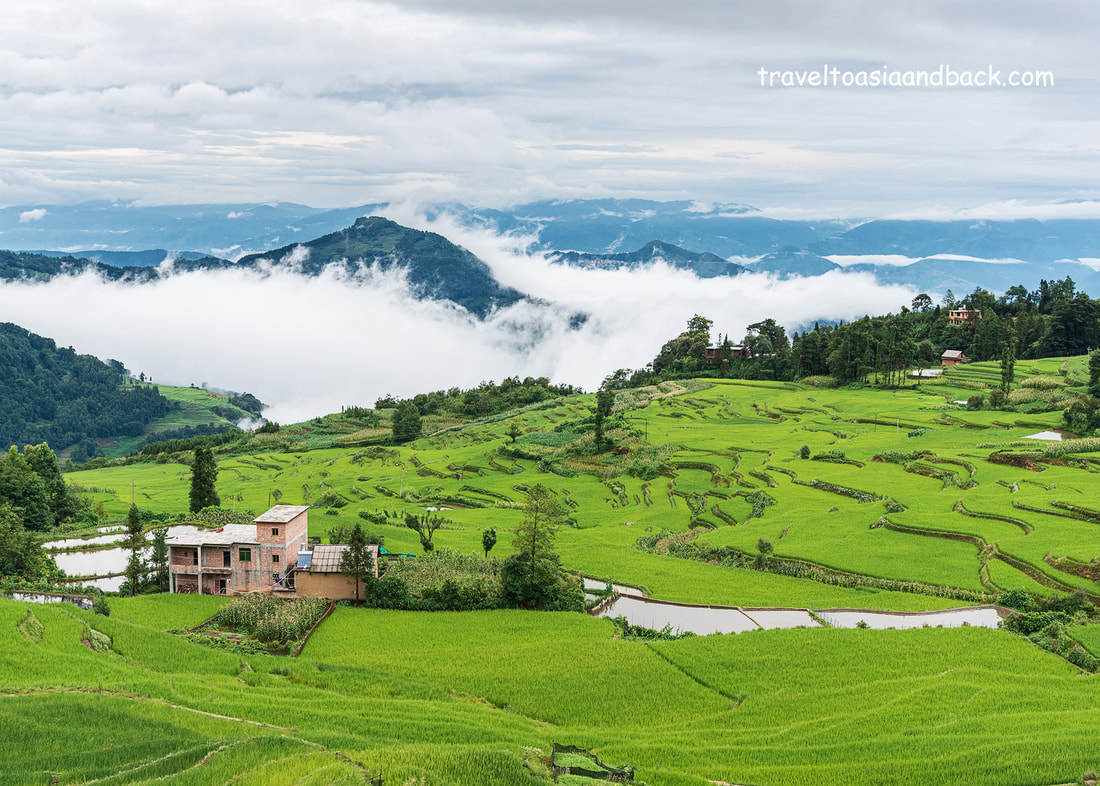
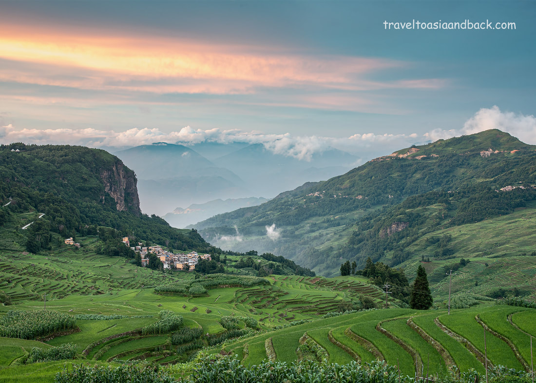
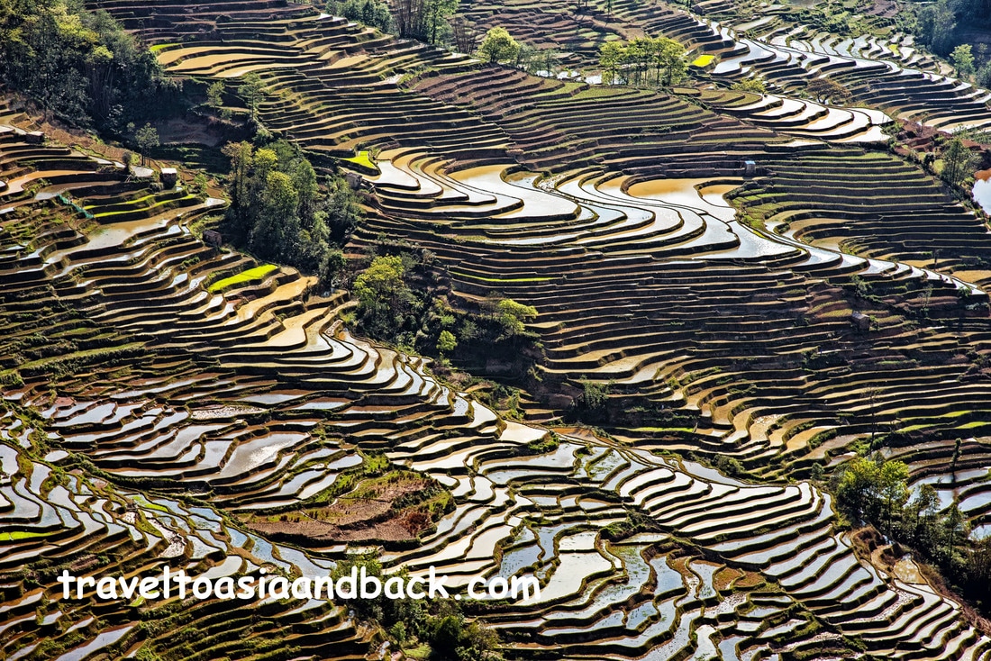
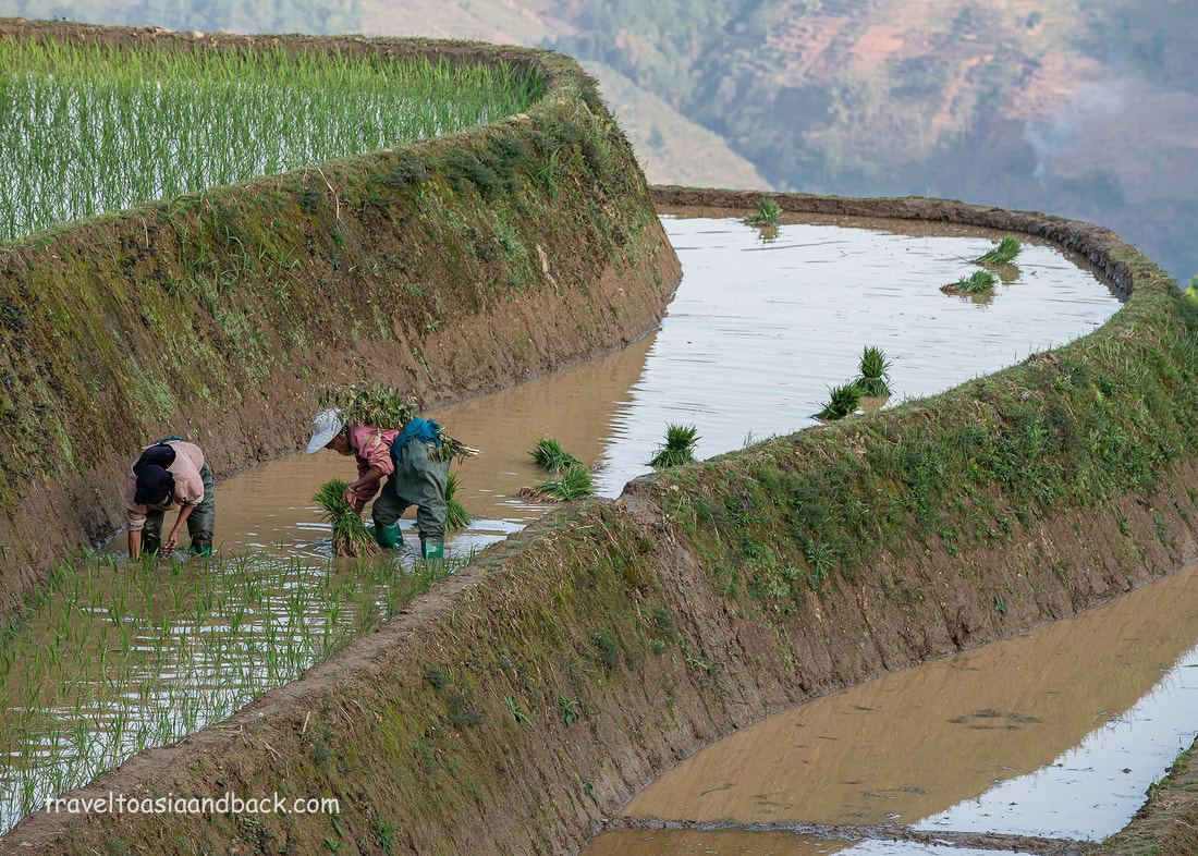
Well over 1000 years ago the Hani and Yi peoples of Southwestern China began clearing dense forests and carving plots of farmland from the steep hills and rugged mountains of what is now known as Yunnan Province. Using only simple handmade tools and beasts of burden such as the strong and gentle water buffalo, the hard working people of this region have toiled for centuries creating and maintaining their fields. Rice is the world’s most important food crop and China is its largest producer and consumer. Rice farming requires vast amounts of land and water. To successfully grow rice in the Ailao Mountains at 1600 meters above sea level, the Hani and Yi people crafted a seemingly endless number of rice terraces. Cascading down the steep faces of the mountains like giant steps, the local people built an incredibly complex and effective irrigation system to move water from the heavily forested mountaintops down to the terraced fields. In addition to growing rice, plots of land are dedicated to growing other staple food crops such as soya, corn, and cabbage. Livestock including buffalo, chicken, cows, ducks, and pigs are raised here as well; essentially integrated into the vast system of terraces.
In this part of the world, only one rice crop is produced per year. Planting coincides with the start of the rainy season which begins around May and is harvested in September. Around November, after the rice is harvested, the farmers flood the terraces with water to keep the soil moist and prevent collapse. Much of this water evaporates, forming clouds which drift up the valleys and above the mountains returning the water to earth as rain. Over the course of 1300 years, the Hani and Yi people have created a unique and self-sustaining ecosystem. The Cultural Landscape of Honghe Hani Rice Terraces
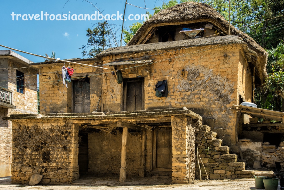
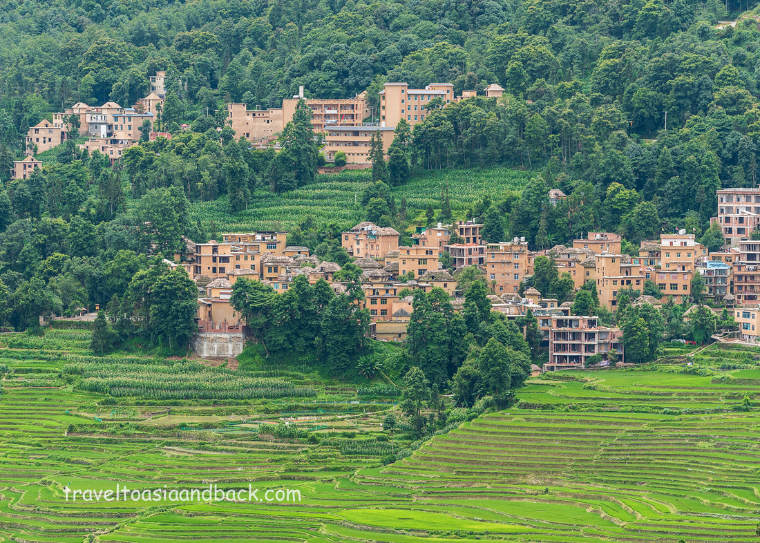
In 2013 over 1000 square kilometers of Yuanyang County was declared a UNESCO World Heritage Site. Officially known as the “Cultural Landscape of Honghe Hani Rice Terraces”, the site includes 82 villages many of which have old traditional houses built of earth and brick. These “mushroom houses” are three-storied structures with thatched roofs. Easily identified by a UNESCO place card, livestock live on the ground floor; the villagers on the second with the third floor dedicated to the storage of rice and corn. Three of the principle areas of rice terraces and Hani / Yi villages are known as Bada, Laohuzui and Duoyishu.
Duoyishu
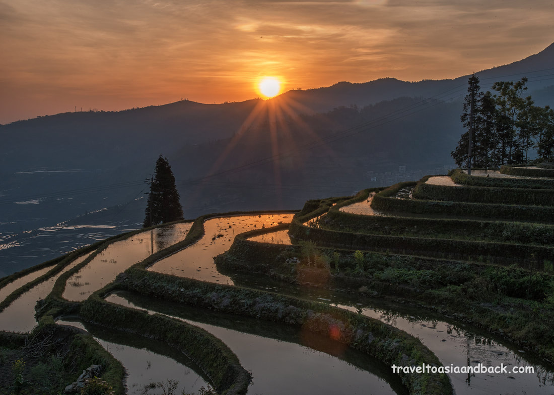
Located 23 km (50 min.) from the town of Xinjie, the enormous swath of steep rice terraces found here is well known as the best place to view and photograph sunrise. There is a large viewing platform situated on the main road which towers above the many villages nestled among the terraces. Lying between high mountains, the terraces take on a dreamlike quality as the sun rises and clouds ascend up the valley filling in the gap between the cliff to the west and the mountains to the east. When the conditions are just right, the sun’s rays reflect off of the clouds and water filled terraces often producing spectacular colors. Duoyishu is one of the more popular travelers’ destinations and a number of hotels and hostels can be found here.
Pugao Lao Village
Just to the south of the Duoyishu viewing platform is the village of Pugao Lao. This tiny Hani village is situated approximately 500 meters downhill from the main road which connects Duoyishu to Xinjie. Surrounded by lush farmers' fields, the village sits atop of the Duoyishu terraces and its “town square” makes a perfect place to view and photograph the terraces. There are a handful of hostels situated in and just above the village.
Bada
Bada is a deep valley blanketed with rice terraces and surrounded by high mountains. A number of villages and viewing platforms are perched on the mountainside. On the main road one can easily find the “Bada Scenic Area” which provides access to multiple viewing platforms and the villages. This area is better photographed late in the afternoon as the sun descends and is hidden from view by the mountains.
Laohuzui
Also known as the “Tiger’s Mouth” this area of very steep terraces and villages is considered to be the best area to view and photograph sunset. Two viewing platforms can be found here, the highest one giving visitors a panoramic view over the valley, while the lower position allows photographers the opportunity to get tighter shots of the terraces.
It should be noted that there is an admission fee charged to use the scenic viewpoints in the area. A two-days pass, which allows unlimited access to all of the platforms, costs 100 CNY (RMB) or just under $15 USD. Trekking in the Hani Rice Terraces of Yuanyang County China
Trekking between the various villages scattered among the rice terraces and lush farmers' fields is the most popular activity with visitors to this quiet and peaceful area. Most of the villages and towns are interconnected by a system of well-paved roads and paths. The roads are relatively easy to walk on, even uphill, as the grade is fairly low. A guide really isn’t necessary, which is good, as it can be difficult to arrange English speaking guides. A good map or mapping software on a smartphone is extremely useful.
Travelers who wish to explore Yuanyang with a guide should consider contacting a local Hani woman named Belinda. Belinda speaks fluent English and owns a small hotel in Xinjie and a hostel in Duoyishu. She is an excellent trekking and tour guide and a pleasure to be around. She also has a good mini-van which is suitable for families and small groups. Belinda can be reached by phone at (+ 86) 159 8737 4367.
Smartphone Mapping Apps in China
I have to admit that I am addicted to Google Maps and use the app constantly. Google Maps does work in China, however to use all the available features you must use a Virtual Private Network (VPN). Even with a VPN, Google Maps lacks a bit of detail and is a bit inaccurate in rural China.
A better choice in mapping software, often recommended by Chinese residents, is maps.me. Also known as "Maps With Me", MAPS.ME features global coverage utilizing the GPS system with maps down loaded on your device. The App is fully functional even when offline. Most importantly; the China maps on MAPS.ME provide far more detail than Google Maps. Travel to the Hani Rice Terraces of Yuanyang China
As there is no airport or railway station in Yuanyang County it is only accessible by private vehicle or bus. Bus travel in China is reasonably inexpensive, safe and comfortable. Busses play an important role in rural China transporting not only passengers but cargo. Operating very much like Fed Ex or UPS, local residents routinely call bus companies to pick up and deliver boxes small packages. Even some of the smallest towns have at least one modern and efficient bus station. The Hani Rice Terrraces can be reached by bus from a number of popular traveler’s destinations including Hekou (5 hrs), Jianshui (4 hrs), Jinghong (8 hrs) and Kunming (7 hrs).
However, before reaching the terraces you will first have to stop in either the towns of Xinjie or Nansha and then take a mini-bus or shared taxi to your final destination. Nansha
Nansha is a small town located 310 kilometers south of Kunming which serves as a local bus transportation hub. If you are traveling from Hekou or some other parts of southern Yunnan Province you very well may pass through or stop here. Although Nansha is labeled “Yuanyang” on Google Maps and referred to as “New Yuanyang” in guide books it is a solid two hour drive from the famous rice terraces.
Xinjie
This small town located 25 kilometers from Duoyishu is the last bus transportation hub before reaching the terraces. If you are traveling from Kunming or Hekou this will be your destination and gateway to the Yuanyang Terraces. The town has numerous hotels, guesthouses and restaurants and can be used as a base to explore the area. Countless mini-buses and taxis travel the roads between Xinjie and the small towns and villages scattered among the principle areas of terraces.
Several times a week the town hosts a lively local market that attracts many minority people from the surrounding villages. The stalls closest to the town center cater mostly to the ladies, particularly the Hani and Yi. This area provides visitors an excellent opportunity to view and purchase typical ethnic clothing and accessories. Shengcun
Situated 20 km, or 40 minutes from Xinjie town, Shengcun is the largest town between Bada and Duoyishu. This normally sleepy little town comes to life a few times a week when it hosts a lively and colorful market. Although most of the participants are Hani and Yi other ethnic groups are likely to attend this busy market.
Both of these markets are scheduled based on the Chinese zodiac calendar. For example; Xinjie market is held on rat, dragon and monkey days whereas Shengcun market is held on rabbit, sheep and pig days. Fortunately, for those of us who are not intimately familiar with the Chinese zodiac calendar, the Yunnan Explorer website has a great calendar and interactive map listing all the markets and festivals held in Yunnan Province. Mike Pollock
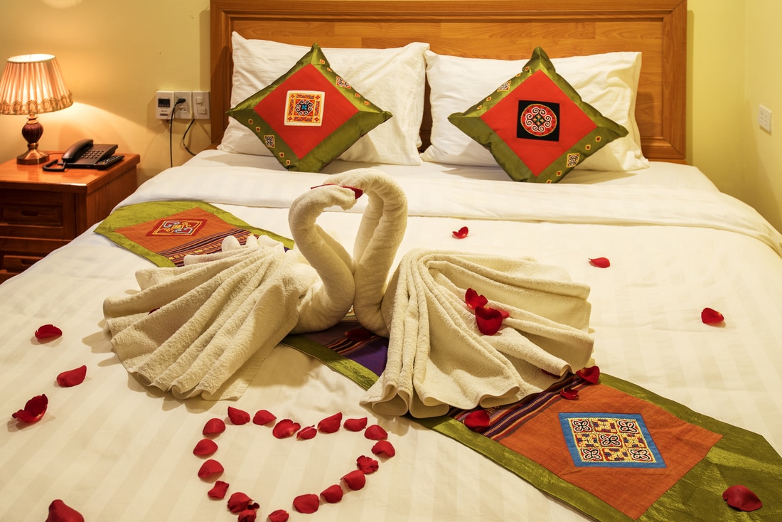
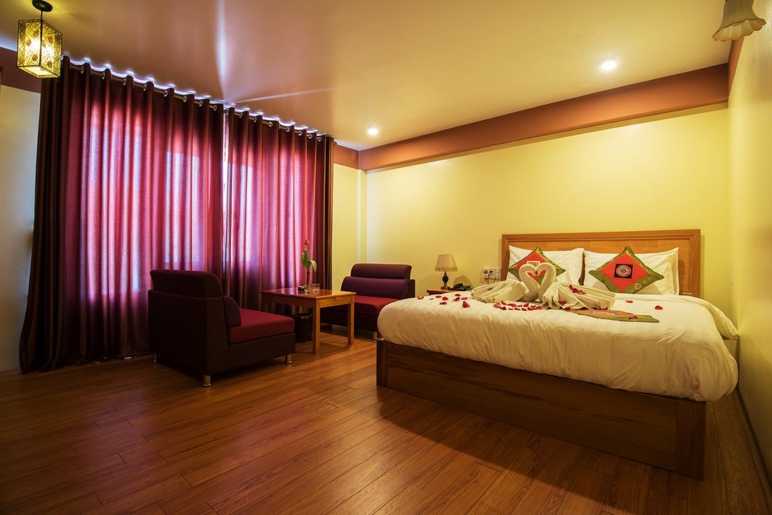
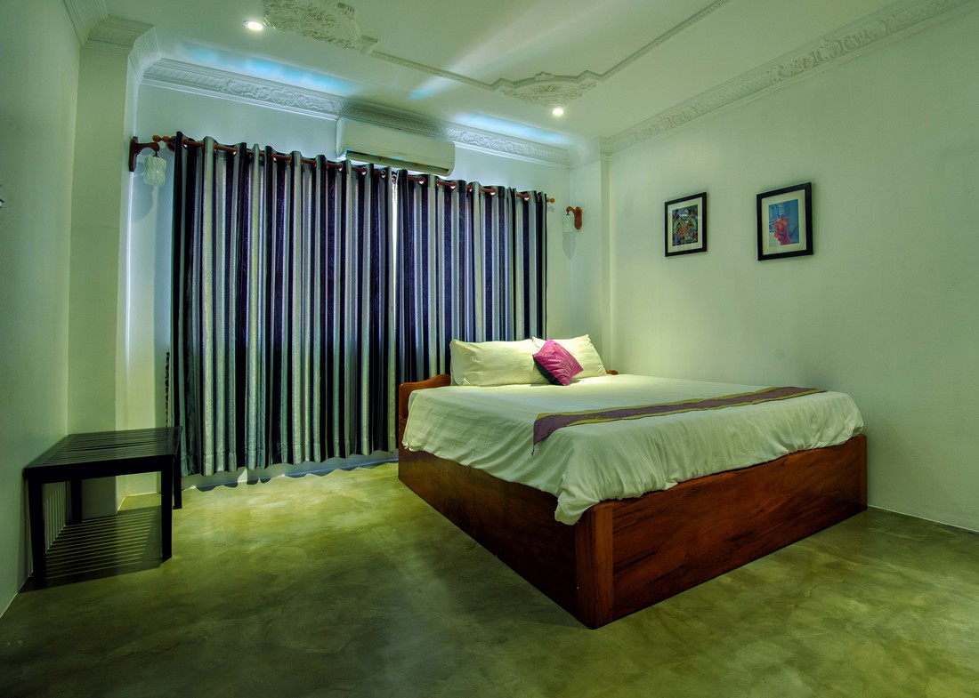
With the exception of Myanmar, mainland Southeast Asia is saturated with inexpensive hotels, guest houses and hostels. The ability to easily find cheap accommodations makes Southeast Asia particularly attractive to backpackers and budget travelers. In many places a bed in a dormitory-style hostel can be had for as little as $5 USD. As for myself, I prefer a bit more comfort (air-conditioning) and privacy, choosing to stay mostly in two to three-star hotels and guest houses. Outside of the big cities like Bangkok I rarely pay more than $20 USD per night.
Many budget travelers and backpackers will arrive in a city or town without pre-booking any accommodations. Armed with an outdated guide book they wander the streets with their heavy backpacks searching for cheap hotels or hostels. I usually run into most of these fellow travelers early in the morning, just as they have arrived in town on an overnight bus or train. There is some logic behind this strategy; generally in Southeast Asia you can walk into a hotel, guest house or hostel and get a room a little cheaper than booking ahead on-line. Personally I almost always book a hotel room in advance, usually on-line, particularly in cities or towns where I have not previously visited. First of all, I like the peace of mind that comes with knowing that I definitely have a place to lay my head. More importantly, I like to have a plan for organizing transportation from the airport, bus or train station. Knowing the transportation options and the distance and route to your hotel will save you money and may prevent ripoffs by unscrupulous taxi drivers. When I travel to new places, with planned stays of more than three days, I will often only book the first few nights. This gives me an opportunity to check out my chosen hotel and look around for other options. How to find budget accommodations in Southeast Asia
Guide books are very useful for choosing the general area of a town or even a particular city neighborhood to stay in; but usually only list a very small sample of accommodation options, particularly in big cities. Much of the information may be outdated, especially prices. Once I decide which part of town that I want to stay in, I put the guide book away and study the area with Google Maps. Using Google Maps, travelers can easily locate hotels, see prices, reviews, ratings and determine the proximity to restaurants and points of interest.
Once I find a few potential hotels on Google Maps I turn to Trip Advisor and read the reviews posted by fellow travelers. One has to take these reviews with a grain of salt and read between the lines, but if the majority of the posters have something positive to say about an establishment the hotel usually turns out to be acceptable. Travelers who plan on staying in budget accommodations in tropical Southeast Asia should keep a few things in mind:
1. An occasional gecko or insect may show up for a visit. In my experience they are all harmless with the exception of mosquitoes.
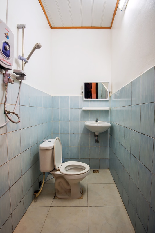
2. Most budget hotels and guest houses will have wet bathrooms (no shower stalls). Move the toilet paper away from the stream of water. 3. Breakfast is often pretty average if the establishment does not cater to Westerners. 4. The rooms are usually rather simple and have minimal furnishings. 5. You can save as much as $4 USD per day by choosing a “fan room”. Many hotels have circuit breaker panels behind the front desk which allow them to control the power supply to air-conditioning units. A simple flip of a switch converts a fan room to air-conditioned room and vice versa. Booking budget accommodations in Southeast Asia
I’ve had mixed results contacting hotels directly through their websites and generally prefer to make reservations through the big on-line hotel booking sites like Agoda or Booking.com. These two are my current favorites and I use them for the majority of my reservations.
Many small family-run hotels only use booking.com, which requires you to pay the bill at the hotel. These places often only accept cash in local currency. The credit card details that you provide at the time of booking appear to be only a formality. I use Agoda when I want to use my credit card to pay for the room and collect the reward points. I have never had a problem with either of these companies. Budget accommodations in rural Southeast Asia
Even some of the smallest rural towns with virtually no tourism will have more hotel rooms than they will ever fill. I often think that many families just build hotels as long-term investments rather than putting their cash into banks. These hotels generally cater to local business people and do not make on-line bookings or have web pages. I have stayed at a number of small family-run hotels where none of the staff are able to speak English. In these cases I usually have an English-speaking local call the owners and make a reservation over the phone. Otherwise, I just simply walk in and ask for a room.
TripAdvisor reviews
One of my current projects is to review all the Asian hotels that I have stayed on TripAdvisor. So far I have written over 40 reviews which you can findhere through my TripAdvisor profile.
Safe travels, Mike Pollock
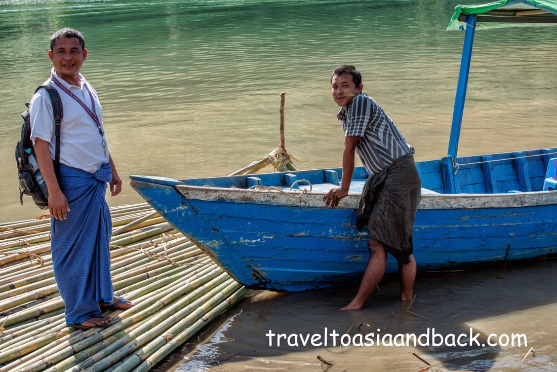
Our handcrafted wooden boat, not much bigger than a canoe, struggled against the current as we made our way up the Lemro River in western Myanmar. Lush green vegetation and farmers’ fields blanketed both sides of the Lemro. The fresh water river is vital to the people who live on its shores. Not only does it provide water and fish, it serves as a major transportation route for both people and goods. As our craft meandered up the winding waterway we passed many other boats engaged in fishing, collecting river rock and towing huge bundles of bamboo destined for Bangladesh.
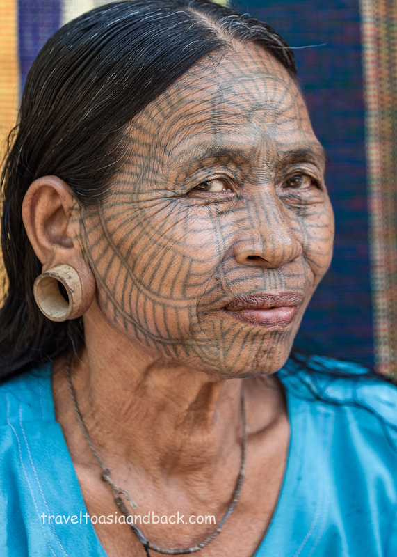
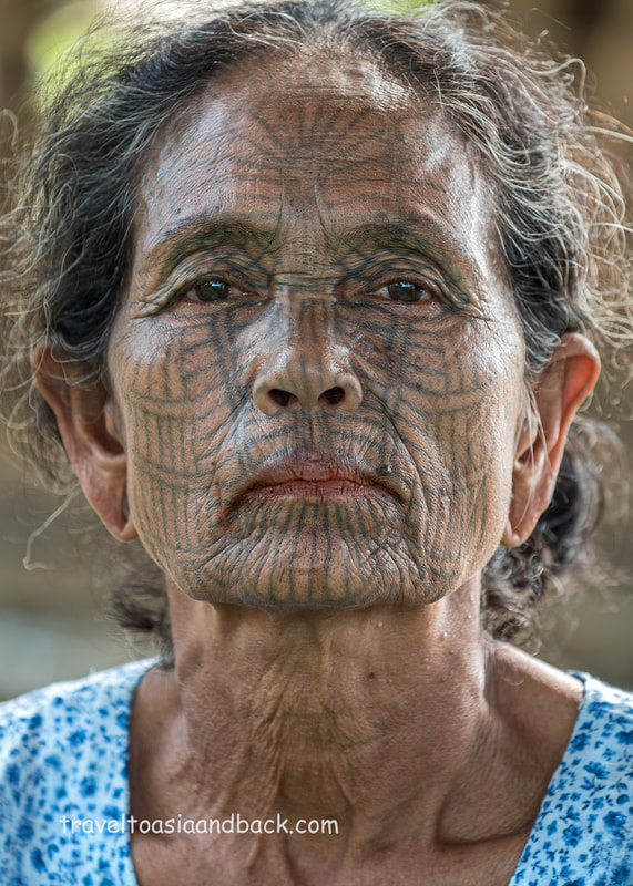
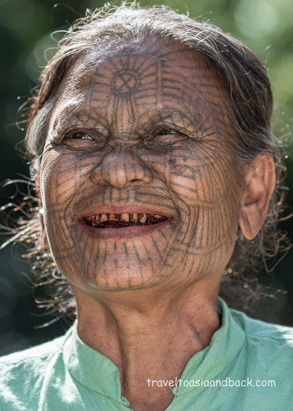
The vessel was essentially a smaller version of a long-tail boat commonly seen on Bangkok’s Chao Phraya River. Powered by a tiny two-stroke engine, the boat was not built for speed and it took the better part of two hours to reach our first destination; a cluster of tiny villages in Chin State, home to a remarkable group of women known as the Tattooed Ladies.
Sharing borders with Rakhine State and Bangladesh, Chin State in western Myanmar is a remote and largely undeveloped region. Covering an area of over 13,000 square miles (36,000 km²), it has the highest poverty rate of any state in the country. Many of its mountainside villages are essentially isolated due to a lack of infrastructure. Most of the state’s 780,000 people are known as the Chin. They are one of Myanmar’s “major ethnic groups”. The Chin people are further subdivided into numerous tribes.
Visiting ethnic villages in neighboring Chin State is a popular activity with the few travelers that make the journey to Mrauk-U in Rakhine State. The highlight of the trip is meeting and interacting with the famous tattooed ladies. Generations ago the young girls of these villages had their faces covered in tattoos. Applied with plant thorns, intricate patterns were painfully applied using soot from burned tree bark mixed with leaves and water as ink.
There are several possible explanations for this unusual custom. One theory is that the women were marked to make them unattractive and therefore less likely to be kidnapped by rival ethnic groups. Others think that the markings were done as a way to differentiate people from various clans or villages. As time passed the tradition became an accepted cultural norm and the tattoos were considered to be beautiful. Since the practice was outlawed in the 1960s, the remaining tattooed women are all in their seventies. They are the last generation that can offer us a glimpse into these unique peoples’ past.
Like many independent travelers I rarely use guides or participate in organized tours. However, I correctly surmised that a trip to these villages requires a guide particularly if your goal is to meet and photograph the tattooed ladies. Taking a tip from TripAdvisor, I contacted Nay Chay, an Mrauk-U resident who has been guiding guests to these villages for many years. He is a charming, energetic and friendly man who seems to be constantly laughing and smiling. His good humor and enthusiasm is infectious and one can’t help but enjoy his company.
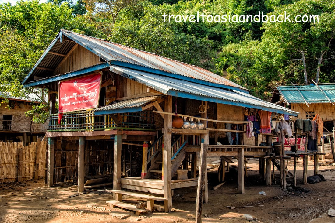
Eventually our vessel pushed up on the river’s west bank - our first stop. Nay Chay informed me that the first three villages we were to visit, (I have some doubts as to their correct names), are not regularly visited by tourists, and would not have any “souvenir shops”. Sure enough, there were only a few locals and their livestock to greet us. I have been to many impoverished rural villages in southeast Asia but I have never seen one so neat, clean and organized as this one. Despite living in tiny bamboo houses without water or electricity they are obviously proud people who take great care of the few things that they do have. These people appeared pretty apathetic to my presence and didn’t ask me for a thing. While trekking through the villages we met three shy, diminutive tattooed women, who, with some coaxing, agreed to pose for some pictures.
After a few hours we got back in the boat and headed up and across the river to Pan Paung, a village on the river’s east bank. I am told that this spot is frequented by as many as 10 tour groups per day and has many “gift shops”. Chin ladies are well known for weaving and in this area produce “towels”, which they sell to tourists. In reality the “gift shops” do not exist. The towels, more accurately described as scarves, are simply draped over the bamboo fences that guard each home from intrusive pigs.
In this village I met several very enthusiastic tattooed ladies who greeted us with a gift of small bananas. I believe that in the Caribbean we called them apple bananas. Anyway, I am quite certain that if we had stuck around, a sales pitch would have been forthcoming. Seeing that the women already had a group of four other tourists to entertain, we continued on our trek through the village. It is worth noting that during my four-hour stay in Chin State, I only ran into six other travelers
Nay Chay can be reached by phone at 09250126742.
Mike Pollock
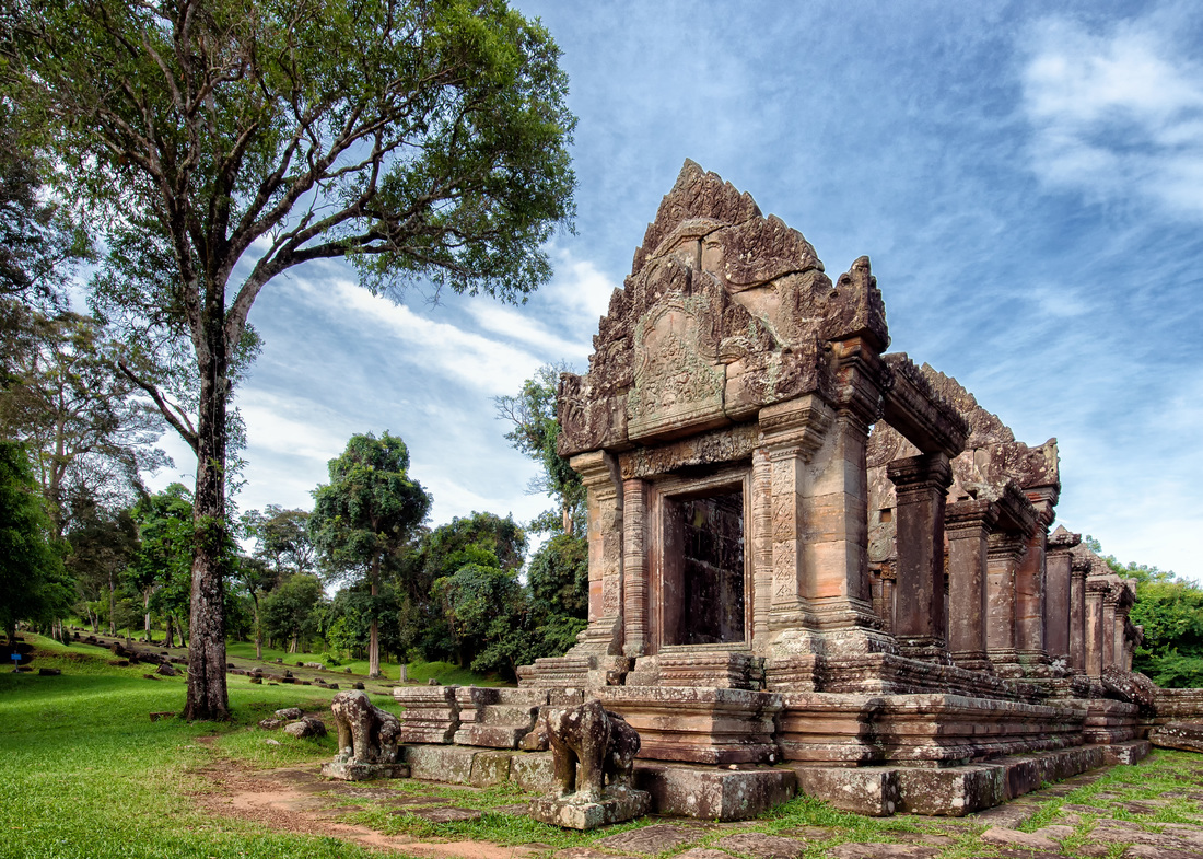
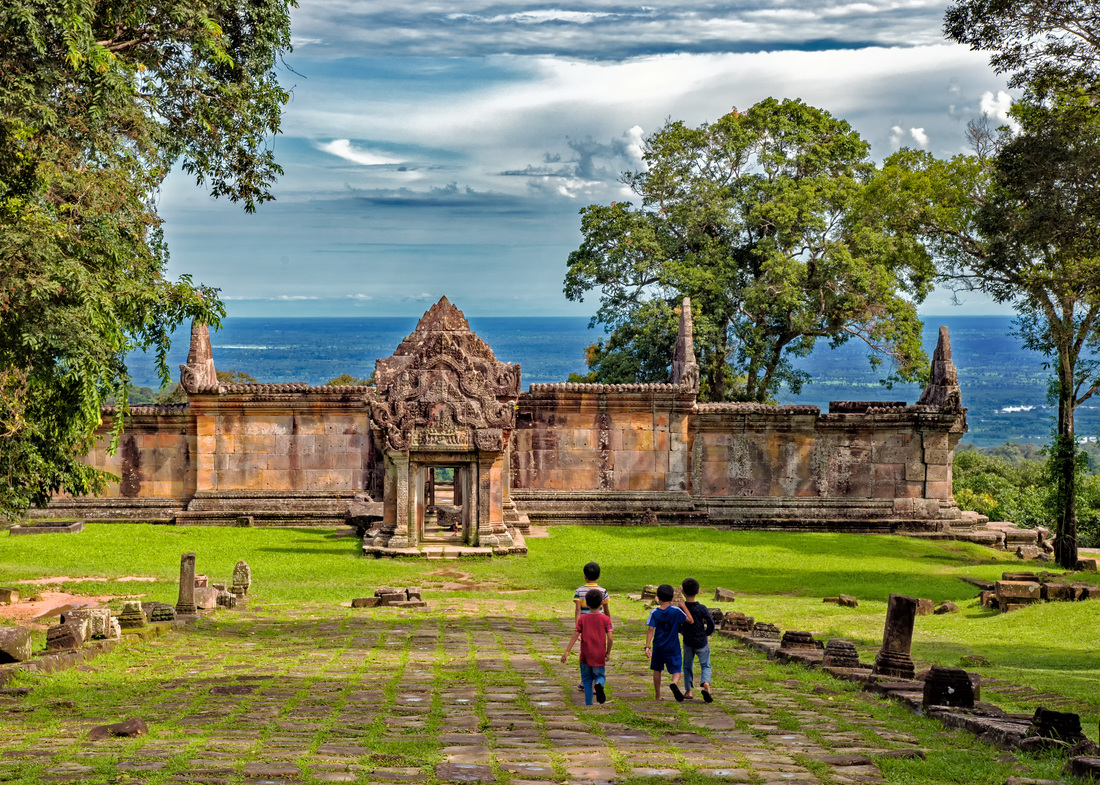
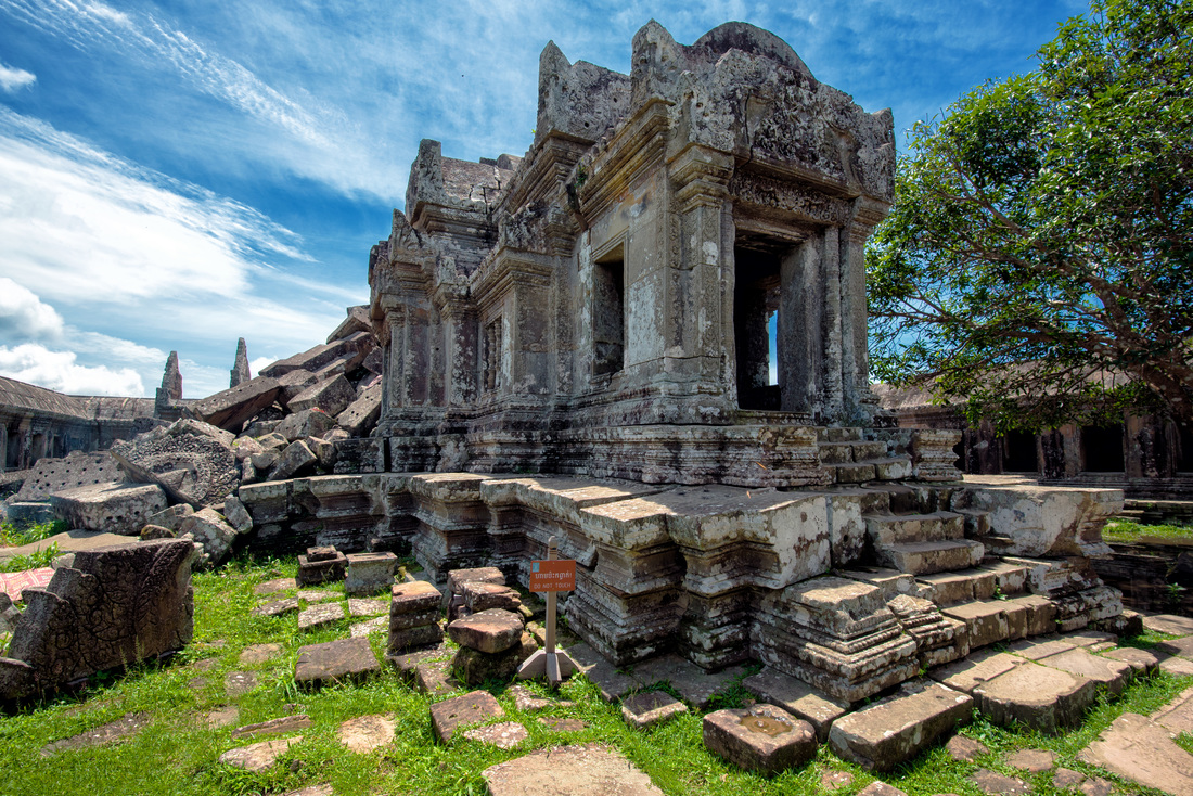
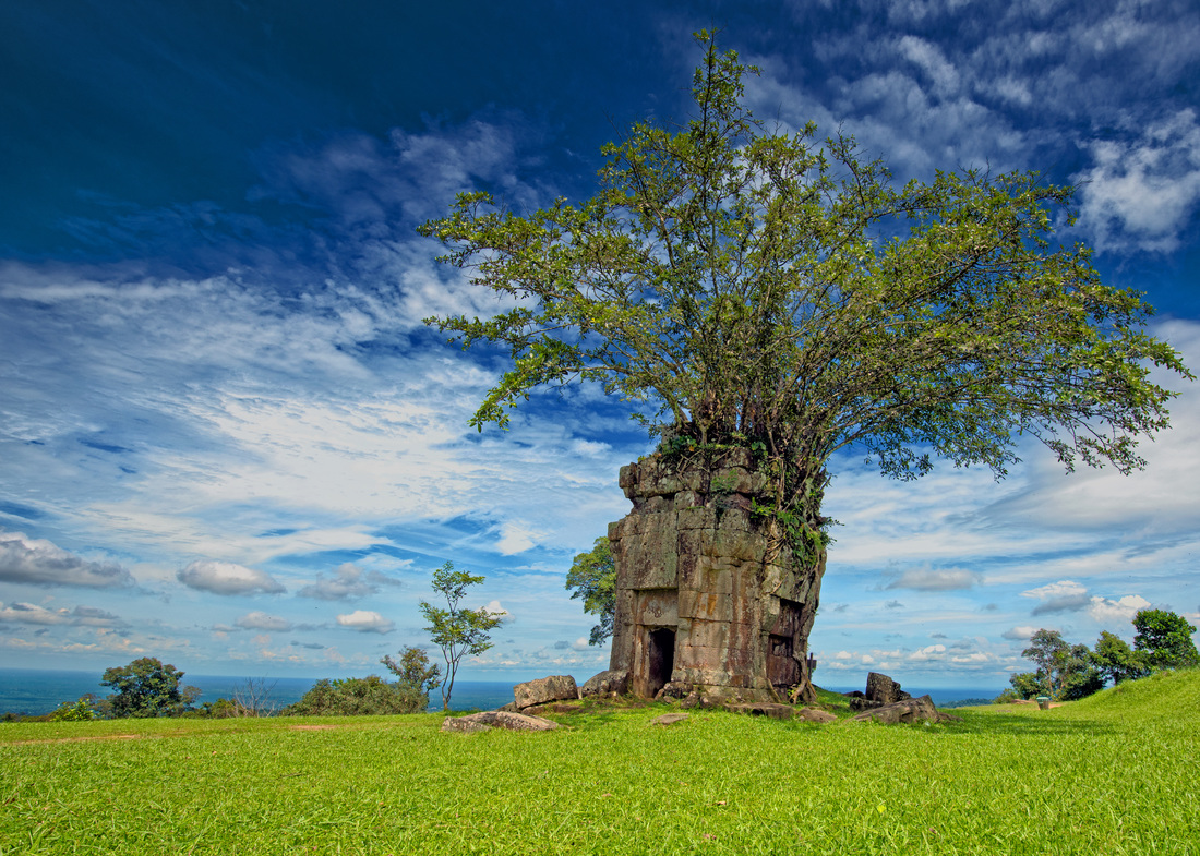
After my March visit to the UNESCO World Heritage site Prasat Preah Vihear I was quite determined to return to this fascinating site before the end of the rainy season. I wanted to see the ancient temple, perched on top of a cliff 625 meters (2,051 ft) above Cambodia’s plains, before the dry season’s unmerciful sun baked the grass and shrubbery to a golden brown.
Located on Cambodia’s northern border with Thailand, in the Dângrêk Mountain range, the site has been used as a place of worship by both Hindus and Buddhists since the 9th century. Dedicated to the Hindu god Shiva, the remaining ruins were constructed in the 10th to 11th centuries during the reigns of the Khmer kings Suryavarman I and Suryavarman II.
The site is unique due to its remote location, spectacular mountain view and troubled modern geopolitical history. For over one hundred years the Thais and Cambodians have disputed, often violently, ownership claims to Preah Vihear. In 1954, well after the last French troops left Cambodia, the Thai military occupied the temple. It was not until 1962 that the International Court of Justice ruled that the temple was “situated in territory under the sovereignty of Cambodia.”
In July of 2008 tensions rose again as soldiers from both sides of the conflict began occupying various temples and monuments along the border. By October the standoff became violent when troops engaged each other in firefights with small arms, RPGs and mortars. These sporadic clashes intensified and by early 2011 long range artillery and multiple launch rocket systems were used by both sides. Luckily civilian casualties were relatively low due to the sparse population on either side of the border. Presently the site is peaceful and perfectly safe for travelers to visit. However, new bunker complexes have been built on both sides of the border and the presence of the Cambodian military is proof that things could change. We recommend visiting this unique site now before conflict resumes or the area is invaded by tour buses.
The closest town to Prasat Preah Vihear is Sra’aem, a dusty little settlement that straddles the junction of Highways 62 and 2648. Located less than 30 km from the temple’s main entrance, the town is commonly used as a base to visit the area as there are a number of surprisingly good guest houses on either side of the roundabout that serves as the town center.
Please note that the roads from the Preah Vihear ticket and transportation office up to the temple do not appear on Google maps.
My last trip to Sra’aem did not go smoothly; I mistakenly booked a bus that traveled to a town well to the south of my intended destination. I was required to transfer buses and retrace 20 km of my original route, extending the three-hour journey by nearly four additional hours. Upon reaching Sra’aem I learned that there was a direct mini-bus to the town from Siem Reap, which would have saved a great deal of travel time. I was looking forward to utilizing this service on future trips to the temple.
As luck would have it, when I returned to Siem Reap in September, I was told that the mini-bus had stopped running due to a lack of passengers. Inquiries with several travel agencies and bus companies in Siem Reap town yielded similar replies. I walked a good ways from the town center down Highway 6, stopping and making inquiries with other bus companies yielding the same results. Eventually I gave up on walking under the midday sun and took a tuk-tuk to Siem Reap’s main bus station located five km from the city center. At the bus station I easily purchased a $7 USD ticket for a mini-bus bound for Preah Vihear City for the following morning. Travelers to this area should be aware that Preah Vihear is the name of a province, city and temple. To avoid confusion when speaking about the temple, it should be referred to as Prasat Preah Vihear. Preah Vihear city is a small town 53 miles (86 km) south of Sra’aem where I intended to find a bus, mini-van or share taxi to complete the journey.
When the 08:30 mini-bus, operated by the “777” company arrived at the station at 09:10, it already had five passengers on board suggesting that the bus’s route must have originated somewhere closer to the town center. Since the bus only carried six passengers there was plenty of room to stretch out allowing for a reasonably comfortable ride. One does not need to travel far from Siem Reap city to experience rural Cambodia. As the bus sped along the province’s newly paved roads we passed through dozens of small villages separated by vast expanses of rice fields. An hour into our journey we were on Highway 64 and the mountain known as Phnom Koulen came into view. I had traveled this same route several weeks ago on my way to the fascinating site of Peung Kom Nuo and now recognized much of the scenery.
Reaching the junction of Highway 62, we stopped at a roadside restaurant for a lunch break. It occurred to me that this might be a good place to catch a bus north to Sra’aem. I mentioned Sra’aem to the driver and he quickly pointed out a patron of the restaurant who would be more than happy to drive me the remaining 62 km to my destination. The fifty-minute ride cost me $5 USD and saved a minimum of 40 minutes of travel time. Upon arrival in Sra’aem I checked into the Heng Sok Chamreun Guest House, which I would call a two-star hotel. I had stayed here during my previous visit and found that the owners were very friendly and helpful. A large, clean, air-conditioned room is $18 USD dollars per night.
The hotel owners organized a motorcycle taxi for the following morning at a price of $11 USD. The 18 mile (30 km) trip to the temple took around 30 minutes; we arrived before the ticket office opened at 07:45 AM. The entrance fee is $10 USD. After purchasing the ticket, you go to a second window to arrange transportation up to the temple. The mountain road is very steep. Private vehicles are not allowed to carry tourists from the ticket booth to the temple. There are three options to complete the journey; walk, which will take an hour, motorcycle for $5 USD or in pick-up trucks which will charge either $25 USD per person, or upon filling the truck with travelers, around $4 USD.
Regardless which transportation option is chosen to make the final ascent, visitors are dropped off at a checkpoint at the base of the temple. Adjacent to the entrance is a large area containing food stalls. This is a good place to buy water as the remaining hike to the top of the cliff is hot and tiring. Prasat Preah Vihear is well off the beaten path for most tourists venturing to Cambodia. One is unlikely to encounter more than a couple of Westerners at the site; most of the visitors are locals. The Khmer-era ruins scattered around the country are active places of worship for the Buddhist majority of Cambodia. It is very common to see worshipers bringing offerings of incense, candles, flowers and food to the temple’s inner sanctuary.Most people will spend an hour our two touring the 1.5 km² site, but with its fresh mountain air, spectacular views and intriguing ruins I can easily spend the better part of the day exploring the ancient temple. I never formulated a clear plan for my return trip to Siem Reap. After discussing transportation options with the locals in Sra’aem, it appeared that my best option was to catch a mini-bus back to Preah Vihear City. There was also a possibility that a taxi could be arranged to Siem Reap for a reasonable price. Luckily the owner of my guest house offered to make the three hour and fifteen minute drive for $7 USD. I can’t imagine where he came up with that price, but I certainly didn’t refuse the offer. Mike Pollock
Located roughly 40 kilometers (25 mi) from Siem Reap, Cambodia and the world famous Angkor Wat is Phnom Kulen, or in English, Kulen Mountain. Although its highest point is a mere 487 meters (1600 ft) above sea level, when the mountain comes into my view I am immediately impressed. This part of Cambodia is extremely flat; the landscape alternating between plains and farmer’s fields. Kulen breaks up the visual monotony. Not long after our departure from Siem Reap it started raining, not heavily but consistently, and now the mountains’ peak is covered in low clouds and mist, creating the illusion that Kulen is much taller and more formidable than it actually is.
The ancient inhabitants of this area, the Hindus and Buddhists who founded the Khmer Empire and built Angkor, considered this mountain to be sacred. Once known as Mahendraparvata (Mountain of Great Indra), it is believed that the empire started here and was perhaps the first royal capital. Today, archaeologists consider Kulen to be of great historical significance. In recent years, after clearing land mines and other types of UXO (unexploded ordinance), over 17 sites on the mountain have been excavated as part of an on-going program to learn more about the origins of the empire. Many Cambodians still regard the mountain as sacred and often visit sites on its west side. This area, closest to Siem Reap, is well known for its rivers, waterfalls and the large reclining Buddha statue at Wat Ang Thom. Both Western tourists and locals enjoy taking in the sights, swimming in the river and picnicking on its bank.
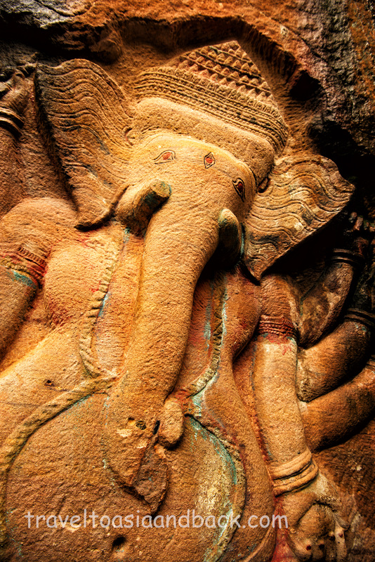
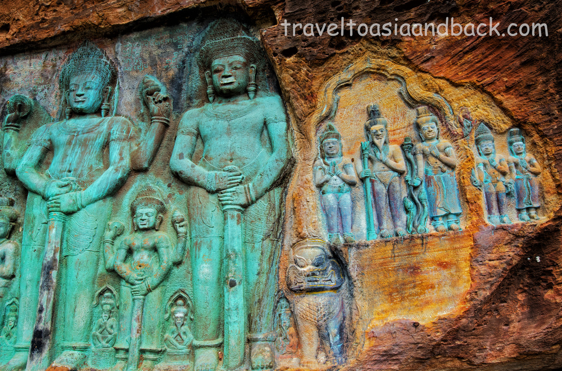
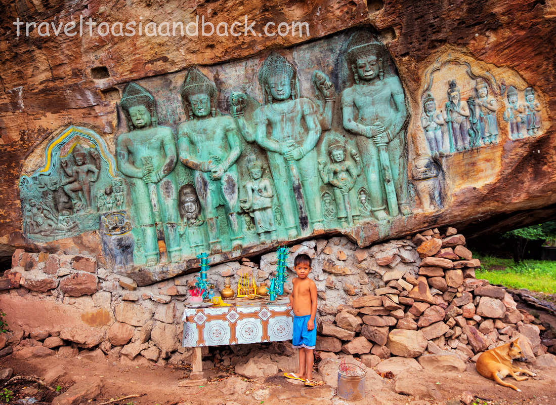
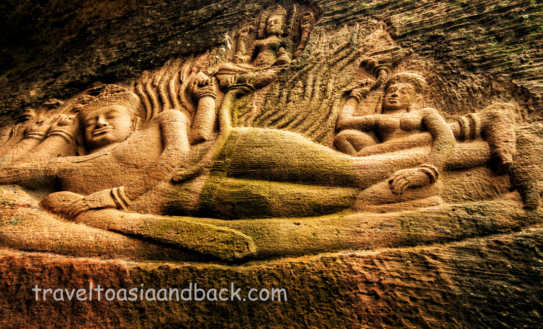
Today, I’m headed to the mountain’s less-visited east side to see a site known as Peung Kom Nou. Sometimes known as the Caves of Komnou, this site consists of a field of enormous boulders some of which lean against one another forming cave-like shelters. Other solitary rocks have jagged outcroppings protruding from their tops which form natural stone awnings. At least four of these rocks are adorned with beautiful bas-relief carvings that depict Vishnu reclining on Ananda, Vishnu and Garuda, an eight-armed Ganesh and a fantastic piece with Vishnu, Shiva and a host of other divas and followers. My internet research indicates that the carvings were produced by “hermits” circa 1000 AD. In my opinion, these artists were probably Rishis (or Ruesi in Khmer), Hindu ascetic holy men or sages, who lived alone or in very small groups, spending most of their time in prayer and meditation.
I was particularly intrigued by this site because many local Cambodian people have never heard of it. There are several blog pieces and articles on the web which describe the carvings and include photographs, but no exact location of the caves. One blogger noted the position as being about four kilometers north of Svay Leu village. At the time I was unable to find the site on Google Maps, but it turned out that I was looking in the wrong area. The site is clearly on the map, however the road that leads there is not.
I hired a taxi to make the hour-and-a-half trip from Siem Reap and when a large Lexus SUV showed up at my hotel I was greatly encouraged. Unfortunately, the driver did not know the exact location of the caves either. Off we went to sleepy Svay Leu with a vague plan to inquire with the locals as to the whereabouts of my destination.
Upon arriving in Svay Leu and receiving directions from the locals we turned left from the main road and proceeded to drive up a very wide and well-maintained dirt road. The first one-kilometer stretch was quite good but as we continued, it soon narrowed and became very bumpy to say the least. I was curious to see how far the driver would continue on what was becoming a partially flooded trail before giving up. At a point approximately three and a half kilometers from the main road the driver could no longer continue.
I left the driver and the Lexus and continued on by foot following what was soon to become a trail only passable by motorcycles. Although the path tended to branch out towards different directions, I stuck to the most well-traveled sections following recently-made motorcycle tracks and the occasional piece of trash. I had not (and still have not) confirmed if this area has been completely cleared of landmines. Landmines are still an enormous problem in northwestern Cambodia and it is a good idea to stay on well-trod paths. After traveling for one kilometer I reached the boulder-strewn area that makes up Peung Kom Nuo. There are a few small houses located about 200 meters from the caves, from which two small boys came out to greet me and show me the carvings. We were soon joined by their father, uncle and grandmother who remained with me for the duration of my visit. The uncle spoke a few words of English; the remainder of the family spoke only Khmer, which tends to confirm my suspicions that few foreigners visit this unique site. After spending a couple of hours touring and photographing the carvings I returned to the car on the same path, this time encountering a small boy on foot and a couple of local guys on motorcycles. On our journey from Svey Leu to the caves and back I never saw any signs of tourists or tourism, which to me, makes Peung Kom Nuo a truly unique site. Mike Pollock |



 RSS Feed
